
Lizard Rock Trail From Lizard Rock to Wildwood Canyon at Wildwood Park Thousand Oaks
/This is one in a series of posts about trails in the 1,765 acre Wildwood Park in Thousand Oaks.
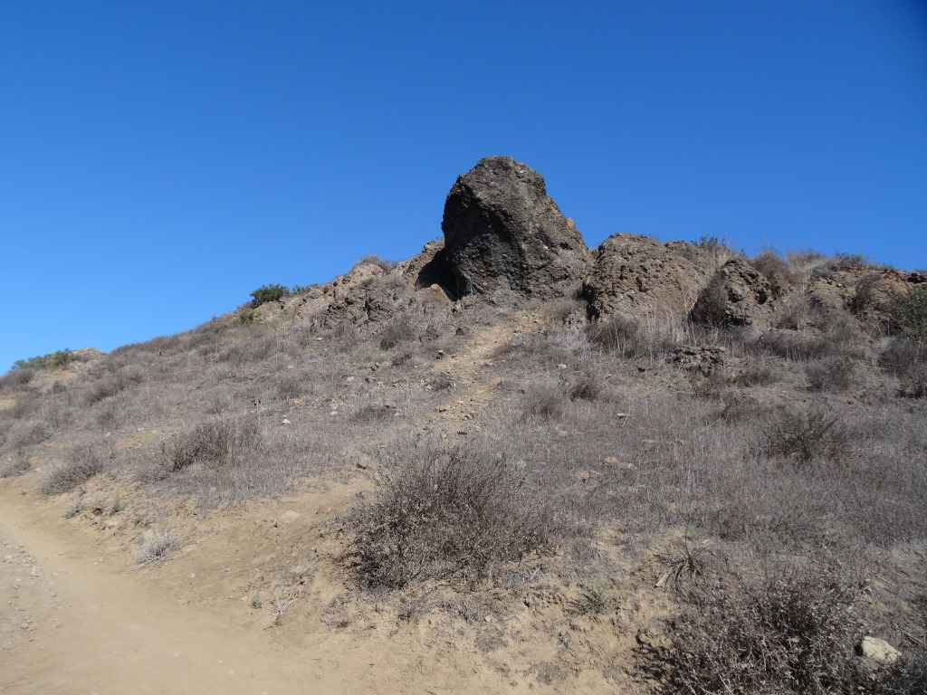
Lizard Rock at Wildwood Park
Lizard Rock is a popular 2 mile round trip destination for hikers from the main parking area in Wildwood Park, mostly on the Mesa Trail. It is a moderate hike with an elevation gain of about 300 feet to its peak at 931 feet.

Sign just south of Lizard Rock indication direction of Lizard Rock Trail towards Wildwood Canyon
After reaching Lizard Rock, some folks (hikers and bikers) venture further south on the Lizard Rock Trail about .8 mile of downhill that takes you past the City of Thousand Oaks Hill Canyon Water Treatment Facility to the Wildwood Canyon area, a drop of about 600 feet in elevation.

View of Hill Canyon Waste Treatment Plan from near Lizard Rock
The descent down the Lizard Rock Trail provides nice views into the Santa Rosa Valley as it zigs and zags towards the bottom. You can see Hill Canyon from Lizard Rock but as you move down the hill you will get a much clearer view of this high tech facility that converts wastewater into a reusable water source. You will indeed catch some whiffs of smells that aren't particularly pleasing down there but having been down there myself a number of times, it ain't that bad.

The descent down Lizard Rock Trail
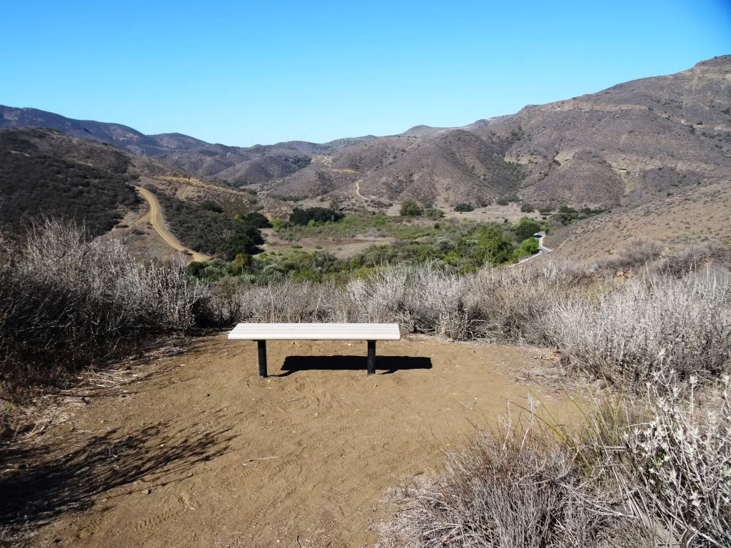
Before you reach the bottom, there are several overlook benches available to take a break as you look towards the Arroyo Conejo, Santa Rosa Valley and beyond.

The first of two overlook benches facing west on the Lizard Rock Trail

A view of the same bench looking back up (north) towards Lizard Rock (yes, that's the lizard head poking out of the hill on the right).
And here's the 2nd bench, further down the Lizard Rock Trail. Is that actual green I see up ahead in late September!? Yes it is. Must be drought-tolerant native shrubs!

Hill Canyon comes into closer view

As you can see, the Lizard Rock Trail starts heading back east as it traverses the Hill Canyon Treatment Plant. Amazing facility. I wouldn't want to go swimming in the green liquid however.

At the very bottom of the trail, after you have completely passed the water treatment plant, you see this sign that indicates you are on your way towards Lower Wildwood Canyon.
So you've reached the bottom of Wildwood Canyon and other than heading back up that steep Lizard Rock Trail to where you just came from, you can take the more interesting loop route following the Wildwood Canyon Trail to Wildwood Canyon. There are restrooms, drinking fountain and picnic tables in there.
From Wildwood Canyon, either continue onward up the Wildwood Canyon Trail about a third of a mile to Paradise Falls, or the Tepee Trail (yes, this is what it is called on the map), which largely parallels the Wildwood Canyon Trail, up towards, yes, the Tee Pee. Then follow the signs back
There is a great map that covers this Lizard Rock to Paradise Falls to Two Springs (formerly Indian Creek) Trail loop, about 4 1/2 miles in total, on the Conejo Open Space Foundation website at www.cosf.org/website/html/lizard-waterfall-creek.html.
Since we're down at the bottom of the canyon, you will see a sign for "Skunk Hollow." This is a tree-lined area adjacent to the creek with a picnic bench. Kind of nice little area, just around the corner from the waste treatment plant, albeit not within view of the plant.
And in that area, you will see a sign indicating Eagle Point Trail. Eagle Point Trail is a hilly little 1/3 of a mile alternate route that gets you into Wildwood Canyon. The first section has dozens of steps. The remainder has a few steep sections. Just a small side attraction to check out.

