The Carpinteria Tar Pits are One of Five Natural Asphalt Lake Areas in the World

The Carpinteria Tar Pits at Carpinteria State Beach are located in a designated area called Tar Pits Park. The Carpinteria Tar Pits are one of five natural asphalt lake areas in the world, 2nd in size to and older than the La Brea Tar Pits in Los Angeles.

These tar pits date back to the Pleistocene Age (Ice Epoch), which 2.6 million to 11,700 years ago. Evidence of imperial elephants, the giant sloth, bison, wolf, tusked mastodons and camels have been discovered in t

Read More

Compilation of Public Beaches Spanning From Oxnard to Hueneme to Malibu

In a separate post, we highlighted beaches ranging from Carpinteria down south to the beaches at the Ventura Harbor. This is the 2nd installment of local area beaches that stretch from McGrath State Beach on down to the beaches gracing Malibu. We hope these compilations prove useful in guiding you to all the oceanfront fun Ventura County and adjacent areas have to offer!

Additionally, here's a compilation of beaches in the Santa Barbara area (excluding Carpinteria).

McGrath State Beach is currently open for day use and trails, but there are no facilities or parking available. Camping is not open as of June 2021. Visit parks.ca.gov/?page_id=607 or call 805.968.1033 for more information.  McGrath has 2 1/2 miles of beach available. Swimming, surfing, and water sports are discouraged because of rip currents. McGrath is 5 miles south of Ventura off the 101 freeway via Harbor Boulevard.

Mandalay Beach Park is 94 acres of undeveloped beachfront land located south of Reliant Energy's Mandalay Generating Station. The natural sand dunes and the wetlands ecosystem are recognized for their important natural value and houses several threatened bird species. This is a passive, natural open space park with no support facilities. The sandy ocean beach and adjacent coastal dunes are available for public day use only. The beach is managed by the County of Ventura on behalf of the California State Parks Department. Located at the corner of Harbor Boulevard and 5th Street in Oxnard. Visit www.parks.ca.gov/?page_id=609. No dogs allowed.

Oxnard Beach Park has one of the best kids play areas around town, restrooms, lots of grass, and easy access to miles and miles of beach. The sand dunes are really large in Oxnard. The park is located at 1601 S. Harbor Boulevard. For more information, contact the Oxnard Recreation & Community Services Department at www.oxnardrec.org/17/3/960.

Oxnard Beach Park looking towards the beach.

Oxnard Beach Park looking towards the beach.

Hollywood Beach is a great spot for swimming, sunning and viewing the Channel Islands. Free public beach volleyball courts, public restrooms on the north end of the beach, on-street parking and lifeguards on duty between Memorial Day and Labor Day. Located right next to Channel Islands Harbor off of Harbor Boulevard. Dogs are allowed at Hollywood Beach on leash before 9am and after 5pm. West-facing beach means it’s great for catching the sunset!

Hollywood Beach

Hollywood Beach

Silver Strand Beach is a 1 mile long beach near Channel Islands Harbor, about 150 yards in width. It is capped by north and south jetties, both of which have small parking lots; one next to San Nicholas Avenue (at Ocean Drive), the other next to Sawtelle Avenue. Free parking from sunrise to sunset with limited restroom facilities. This is a sandy bottom beach break which may have rip tides and an undertow, so be careful. Dogs on leash allowed before 9am and after 5pm. Lifeguards on duty daily during summer months. Accessed via S. Victoria Avenue. Visit visitoxnard.com/things-to-do/beaches/silver-strand-beach for more information.

There's a Kiddie Beach Park off of S. Victoria Avenue at Sunset Drive with available parking, restrooms and benches. It is a small sliver of sand that fronts the south end of Channel Islands Harbor and thus does not face ocean waves.

Hueneme Beach Park is 50 acres with picnic tables, barbecue pits, walking paths, a fishing pier, sand volleyball courts, Surfside Seafood snack bar, lifeguards and restrooms. Beach parking lots and Surfside Drive parking available for a fee. No dogs allowed! Visit www.ci.port-hueneme.ca.us/index.aspx?NID=926 for more information. Located at 550 E. Surfside Drive, Port Hueneme

Ormond Beach is 1,500 acres composed of agriculture, industry and wetlands. A two mile long beach extends from Port Hueneme on the north to Naval Base Ventura County on the south. This is one of the few areas in southern California with an intact dune transition zone marsh system, hosting over 200 migratory bird species. The California Coastal Conservancy is restoring these wetlands. A bit off the beaten path, it is probably more geared towards bird watchers and hikers. Get there via Hueneme Road, going south on either Perkins Road on the north and Arnold Road on the south.

Naval Base Ventura County occupies roughly 6 miles of oceanfront space between Ormond Beach on the north and Point Mugu State Park on the south. This space is not accessible by the general public. However, there are periodic opportunities for civilians to catch a glimpse of the Pacific Ocean from NBVC during organized events open to the public.

Mugu Beach is the first publicly accessible beach area south of Naval Base Ventura County off of PCH, located adjacent to the prominent Mugu Rock. For the most part this is the most quickly accessible beach to Camarillo and Conejo Valley residents. There is paid parking ($12 last time I was there) as well as parking available on PCH. Popular with fisherman. One thing to be aware of here is that there is a significant undertow. If you bring the little ones, best to stay out of the water or just be extra careful.

South of Mugu Rock there is also some beach that is accessible with plenty of parking on PCH. No facilities and not a lot of beach, but beautiful views and a quick place to explore.

ThornhillBroome.JPG

Thornhill Broome Campground and Beach is also part of Point Mugu State Park, located a mile or two south of Mugu Beach. This is a campground right on the beach with a capacity for about 60 or so RVs. But of course you can visit for the day for a parking fee. Plenty of parking also available on PCH. Porta-potties available. Dogs are allowed around here as long as they are on a leash (and paleeeze...pick up after them).

Across the street on PCH is a gigantic, steep sand dune that I've always found to be interesting. Learn more about that sand dune here.

Unusually large sand dune on the east side of PCH across from Thornhill Broome Campground

Unusually large sand dune on the east side of PCH across from Thornhill Broome Campground

Sycamore Cove is at the southernmost beachfront portion of Point Mugu State Park. Point Mugu State Park features 3.6 miles of ocean shoreline (Sycamore Cove to Mugu Beach), with rocky bluffs, beaches, sand dunes, rugged hills and uplands, two major river canyons and wide grassy valleys dotted native trees.

Sycamore Canyon Campground across PCH from Sycamore Cove has 58 campsites. For a challenge, ride or hike down through Sycamore Canyon from Rancho Sierra Vista/Satwiwa in Newbury Park. You'll most likely have to pay to park here (most recently $12 for day use) as there are not many spots on PCH available on the south side...watch out...there are no parking signs all over the place.

SycamoreCove_sign.JPG

Sycamore Cove Beach has a number of picnic benches shaded by trees and is thus a popular spot on summer weekends for the BBQ crowd as well as with the campers from the campground on the other side of PCH. Located at 9000 Pacific Coast Highway. Visit www.parks.ca.gov/?page_id=630.

Trees shade the picnic tables at Sycamore Cove Beach

Trees shade the picnic tables at Sycamore Cove Beach

In the 3.3 mile stretch of PCH between Sycamore Cove Beach and County Line Beach (below) there are three or four places where you can park on PCH and access the beach.

One of these beaches I refer to as Call Box 1-35 Beach, about a mile southeast of Sycamore Cove Beach. This is not the official name of this beach in the unincorporated section of Ventura County northwest of Malibu city limits. But since the dilapidated staircase leading down to the beach is next to this call box, it seems appropriate. The address is approximately 9649 Pacific Coast Highway, Malibu (yes, technically not Malibu, yet in Google maps the address says Malibu).

About half a mile southeast of Call Box 1-35 is Call Box 1-27 Beach, which I also refer to as 26 Steps Beach. 26 Steps Beach is approximately 1.9 miles northeast of County Line Beach (see below) and 1.5 miles southwest of Sycamore Cove Beach (see above), at approximately 9999 PCH, just west of Deer Creek Road. I made up the name 26 Steps Beach because there is a well-worn, tagged up staircase that leads you from your parked car on PCH near the 1-27 Call Box sign to the beach. This is not a bad little section of beach that rarely has many people. No restrooms. Parking is free on PCH.

County Line Beach is located across the street from the iconic Neptune's Net, 3 miles south of Sycamore Cove at 42505 Pacific Coast Highway, Malibu. Lots of surfers and places to explore. Park on PCH. Watch out for bikers...there can be hundreds of them hanging out here on many a weekend. There are outer reefs for scuba diving that have an abundance of sea life. Activities include diving, surfing, and tide pools. No lifeguards on duty. There are a few porta-johns here. Technically, County Line Beach is located in Solromar, an unincorporated community in Ventura County - but they use the Malibu zip code so hey, it’s ok to say it is in Malibu.

NeptunesNet.JPG

Leo Carrillo State Park has 1 1/2 miles of beach for swimming, surfing, windsurfing, surf fishing and beach combing; one of our favorites for exploring sea caves, rocks and tidepools. Leo Carrillo is about 1 1/2 miles south of Neptune's Net at 35000 West PCH, Malibu. On the other side of PCH, Leo Carrillo has 135 campsites, with over 2,500 acres of land. Visit www.parks.ca.gov/?page_id=616 or call 805.488.1827. Dogs on a leash are allowed in day use areas, campground and north beach (north of lifeguard tower 3). Dogs are not allowed on back country trails or south beach (south of lifeguard tower 3). Park on PCH or in the State lot ($12) and take the tunnel under PCH to the beach. More details on how to get to Leo Carrillo from the 101 freeway at this link.

Before the main Leo Carrillo Beach area while heading south on PCH is the Leo Carrillo State Park Staircase Beach area. There’s a California State Parks parking lot at approximately 40000 PCH Room for I’m gonna guesstimate 50 cars. There’s a moderately narrow trail that takes you down to the beach, which is also fairly narrow. You can also walk to this beach from the main Leo Carrillo Beach. Dogs allowed on leash.

Leo Carrillo State Park Staircase Beach parking lot.

Leo Carrillo State Park Staircase Beach parking lot.

NicholasCanyon.JPG

Nicholas Canyon County Beach is 1 mile east of Leo Carrillo at 33850 Pacific Coast Highway. Great beach where you can hang out, fish, picnic, surf and more in about 25 acres. About 150 parking spaces available. Generally $10 to park on summer weekends, or park on PCH. More info at beaches.lacounty.gov/nicholas-canyon-beach. Restrooms available.

A view of Nicholas Canyon County Beach, just a mile east of Leo Carrillo.

A view of Nicholas Canyon County Beach, just a mile east of Leo Carrillo.

Located between Leo Carrillo and Point Dume State Beaches, Robert H. Meyer Memorial State Beach is made up of a number of cove or cliff-foot strands known as "pocket beaches" along the west end of Malibu, including El Pescador, La Piedra and El Matadorwww.parks.ca.gov/?page_id=633 Dogs are not allowed on state beaches.

El Pescador State Beach is 1.4 miles east of Nicholas Canyon at 32900 Pacific Coast Highway, Malibu. Steep, uneven stairs lead to about 10 acres of narrow, sandy beach. It is just east of Decker Canyon, the curvy, steep road that takes you up to Hidden Valley/Westlake Village. Dogs are not allowed on state beaches. Limited parking is available (fees vary) or park on PCH. Small, secluded beach. When the tide is not too high, you can trek you way east towards La Piedra Beach and back.

Porta-potty available. www.parks.ca.gov/?page_id=633.

Sign on PCH east of Decker Canyon Road, prior to El Pescador State Beach to the west of it.

Sign on PCH east of Decker Canyon Road, prior to El Pescador State Beach to the west of it.

La Piedra State Beach is .3 miles east of El Pescador at 32700 Pacific Coast Highway. A fairly long hiking path (may be a bit challenging for those lugging a lot of stuff) leads to 9 acres of narrow, sandy beach. Dogs are not allowed on state beaches. Limited parking available for a fee (which vary) or park on PCH. Porta potty available. www.parks.ca.gov/?page_id=633.

El Matador State Beach is .3 miles east of La Piedra at 32350 Pacific Coast Highway, just east of where Encinal Canyon Road intersects with PCH. A dirt path, then dozens of stairs, leads to 18 acres of narrow, sandy beach with stunning, rock formations and caves.

Dogs are not allowed on state beaches.  There is a parking lot with room for 25 or so cars where you can pay $3/hour or $10 for all day (as of July 2023).  You can also park on PCH, but on the north side...for whatever reason parking is prohibited on the south side of PCH. This means you have to cross PCH, which can be a challenge. There are porta-potties available. www.parks.ca.gov/?page_id=633

Stunning rock formations at El Matador State Beach.

Stunning rock formations at El Matador State Beach.

Lechuza Beach in Malibu, a mile east of El Matador State Beach, is maintained by the Mountains Recreation and Conservation Authority. It is a small, sandy beach with beautiful rock formations and views up the coast. Accessible via the northeast end of Broad Beach Road.  More information and specific access points at mrca.ca.gov/parks/park-listing/lechuza-beach. Dogs not allowed on the beach.

Zuma Beach is located at 30000 Pacific Coast Highway about 3.5 miles east of El Matador. At 4 miles long, Zuma is one of the largest and most popular beaches in Los Angeles County, Zuma is known for its long, wide sands and excellent surf. Plenty of facilities, including several food stands, restrooms, showers, volleyball, etc. Plenty of street parking on PCH and over 2,000 parking spaces (currently $8 weekdays and $10 weekends). Visit beaches.lacounty.gov/zuma-beach for more information. Zuma is known for riptides, so do be careful out there.

NOTE: Fires, including BBQs, are not allowed on any beach in Malibu; the exception is that fires may be allowed in designated spots at some state beaches. Dogs not allowed on the beach also.

Zuma Beach

Zuma Beach

Point Dume State Beach is a 63 acre promontory that juts out into the Pacific and features headlands, cliffs, rocky coves and vast beach access for swimming, surfing, scuba diving and fishing. Westward Beach borders Zuma Beach at Zuma's south side. There is plenty of parking on Westward Beach Road, which parallels Westward Beach. To the southeast of Westward Beach is a small 300 foot or so beachfront area called Pirate's Cove Beach (which due to its seclusion was once used as a nude beach).

PointDumeSign.jpg

At the end of Westward Beach Road (WBR), access to the protected 34-acre Point Dume Natural Preserve begins from the cul-de-sac. A gradual ascending trail leads to an ancient coastal bluff sand dune with spectacular views...we've seen whales, seals and dolphins over here. A stairway from the east side of the bluff-top preserve allows access to a more isolated beach and tidepools (look but don't touch). Location/Directions: Take Kanan south to PCH and turn right. WBR is over the rise, at the foot of the hill. Park free on WBR or pay a fee at Westward Beach lot. No restrooms at the Preserve but some can be found on WBR. Call 310.457.8143 or visit www.parks.ca.gov/?page_id=623 for more information.

NOTE: Dogs are not allowed on trails in the Point Dume Natural Preserve or on the beach.

Looking down on the beach at Point Dume

Looking down on the beach at Point Dume

Paradise Cove Beach is located at 28128 Pacific Coast Highway, accessed via Paradise Cove Road. Parking (as of June 2023) is $10 ($15 weekends/holidays) for if you spend up to 4 hours at the Paradise Cove Beach Cafe (and spend at least $30 there) or $45/$65/day (weekdays/weekends) if you park there just for the beach. Or, you can park on PCH and walk there. There are restrooms, cabanas, lounge chairs and chairs for rent, and a small pier. Visit www.paradisecovemalibu.com.

Escondido Beach is a short, narrow strip of beach accessible just west of Geoffrey's Malibu via a long stairway at 27420 PCH or near the corner of Escondido Beach Road and Malibu Cove Colony Drive. Look for access signs. No dogs allowed. No facilities.

Dan Blocker Beach is located at 26000 Pacific Coast Highway (between Solstice Canyon and Corral Canyon Roads. A sandy, narrow beach that draws surfers and scuba divers. Limited free roadside parking. Restrooms are available. Corral Canyon (trail map HERE) is located across the street at 25623 PCH. The trailhead is on the north side of PCH next to Malibu Seafood restaurant. The beach can be accessed from via a seasonal trail under PCH. 310.305.9546

On June 14, 2016, a new beach stairway access was completed at 24038 Malibu Road. Very little parking available there and no facilities at the beach. Read more at THIS LINK.

Malibu Beach is a 167 acre beach at 23050 and 23200 Pacific Coast Highway that includes Malibu Lagoon, Malibu Lagoon Museum and the Malibu Pier. Malibu Surfrider Beach next to the pier is quite popular with local surfers. Parking available for a fee, or park on streets surrounding Malibu Country Mart and walk across PCH at the signaled crosswalk at Cross Creek Road.

Malibu Surfrider Beach viewed from the Malibu Sportfishing Pier

Malibu Surfrider Beach viewed from the Malibu Sportfishing Pier

Perhaps the most expensive strip of beach in the world is Carbon Beach, which stretches about a mile and a half between the Malibu Pier and just east of Carbon Canyon Road. This wide beach is a beautiful strip of sand, but public access points can be challenging to find and parking can be a challenge. Learn specifics at THIS LINK but specifically, the public accessway points are at 22670 PCH, 22466 PCH and 22126 PCH. No restrooms and no dogs allowed at this beach.

Las Tunas Beach is located at 19444 Pacific Coast Highway, about 4 1/2 miles east of the Malibu Pier. It is a narrow beach beneath the bluffs that holds a special attraction to surf casters. Free parking lot. Located between Tuna Canyon and Las Flores Canyon Roads.

CoastalAccess2.JPG

And there's more...the California Coastal Commission Shoreline Public Access Program helps maximize public access to the beach along the California coast. When you see one of those "Coastal Access" signs, that means you can get to the beach. More on the program at www.coastal.ca.gov/access/accndx.html. The L.A. County Dept of Beaches and Harbors has published Malibu beach accessways at file.lacounty.gov/dbh/cms1_151453.jpg, including 11 accessways on PCH, Malibu Road and Broad Beach Road. But if you do check them out, be mindful of those who live there!

Alaska Airlines Flight 261 Sundial Memorial at Hueneme Beach in Port Hueneme

Just 25 miles west of Thousand Oaks is Hueneme Beach Park, a beautiful 50 acre park on the beach with a fishing pier, bike/walking paths, volleyball, picnic tables, BBQ pits, the Surfside Seafood snack bar and more.

24 hour fishing pier at Hueneme Beach Park

24 hour fishing pier at Hueneme Beach Park

One other feature at Hueneme Beach is the Alaska Airlines Flight 261 Sundial Memorial that commemorates the 88 passengers and crew who lost their lives aboard Alaska Airlines Flight 261 near Anacapa Island on January 31, 2000. The flight was en route from Puerto Vallarta, Mexico to San Francisco and Seattle.

The Memorial features a 36-foot diameter concrete plaza with a curving sand wall and seating area and a raised sundial in the center.

The Memorial features a 36-foot diameter concrete plaza with a curving sand wall and seating area and a raised sundial in the center.

The Memorial features a 36-foot diameter concrete plaza with a curving sand wall and seating area and a raised sundial in the center. The monument was designed by by well known Santa Barbara sculptor James “Bud” Bottoms. The sundial’s bronze dolphins and triangular blade (gnomon) cast a shadow on the 20-foot diameter dial face oriented to Pacific Standard Time. Names of each of the victims are inscribed on individual bronze plates mounted on the perimeter of the dial.

AlaskaAirMemorialHueneme.jpg

The crash site is located between the mainland at Port Hueneme and Anacapa Island, one of the smallest islands in the Channel Islands chain, 14 miles offshore. Families of the lost passengers and crew dedicated the sundial as both a memorial to their loved ones and a work of public art in gratitude to the residents of Port Hueneme for their compassion and tireless assistance in the recovery effort. This is a touching and lasting tribute to those who lost their lives on this flight.

Access the Sundial Memorial from Hueneme Beach parking lot B off Surfside Drive near the gazebo. More details at www.ci.port-hueneme.ca.us/index.aspx?nid=930.

BEACHES SPANNING FROM CARPINTERIA TO MALIBU

Life's a Beach! Public Beaches Spanning From Carpinteria to the Ventura Harbor

Beach_Klotz.jpg

The beaches of Ventura County have something for everyone, be it the sand, the ocean breezes, surfing, volleyball, sunning, picnicking or just chilling out to the sound of the waves. Here we have compiled a listing of beaches just north of Ventura County in Carpinteria down the coast to the Ventura Harbor. Separately we highlight beaches stretching further down the coast through Oxnard, Channel Islands Harbor, Point Mugu and Malibu as well as up the coast in and around Santa Barbara.

The Santa Claus Lane Beach Area in Carpinteria is a south facing beach area popular with surfers, boogie boarders and sunbathers. Get there from the 101 by taking the Padaro Lane exit towards Santa Claus Lane, then taking a left on Santa Claus Lane. You can park in a small dirt area (there's room for maybe 10 cars there) on the ocean side or find street parking, which is plentiful. This is not an "official" beach to my knowledge, as in city or county-run. Just a private beach. No restrooms to my knowledge. Oh yes, you'll have to cross the railroad tracks...so be careful! Down the street is Padaro Beach Village, where you can grab a bite to eat and do a little shopping.

On a separate note, you may be wondering why it is called Santa Claus Lane. Well the old-timers among you (including me) know that a gigantic roadside Santa used to reside here that now greets us off the 101 freeway in the Nyeland Acres section of Oxnard. Learn more about the history at this link.

Surfers, boogie boarders, body surfers and frolickers at the Santa Claus Lane area beach.

Surfers, boogie boarders, body surfers and frolickers at the Santa Claus Lane area beach.

Just down the street is the quaint Padaro Beach Village, where you can grab a coffee, breakfast, lunch, do a little shopping, etc. Very relaxing little area.

Just down the street is the quaint Padaro Beach Village, where you can grab a coffee, breakfast, lunch, do a little shopping, etc. Very relaxing little area.

Carpinteria State Beach is a mile long beach for swimming, surf fishing, tidepool exploring and camping. Dogs are allowed only at the picnic area. The park originally opened in February 1932. There are four campground areas with 216 family campsites and seven group campsites available. Seals and sea lions can be seen in the area December through May, as well as an occasional gray whale. Tidepools contain starfish, sea anemones, crabs, snails, octopi and sea urchins. Exit the 101 at Casitas Pass Road, go west to Carpinteria Avenue, make a right at the signal; then turn left on Palm.  The beach is at the end of Palm Avenue near 4th Street. Call 805.968.1033 or visit www.parks.ca.gov/?page_id=599.

Note: Campfires are only allowed in the campground in fire rings provided. No fires are allowed on the beach.

CarpStateBeach_sign.JPG

Tar Pits Park in Carpinteria provides hiking and biking trails and a few benches, but no other park amenities.  Access to the park is very remote and it is suggested that you enter from the Carpinteria State Beach campgrounds or beach area.  Here you will see tar oozing out of the hills...so watch where you step! The Carpinteria Tar Pits is one of five natural asphalt lake areas in the world! Visit carpinteria.ca.us/parks-and-recreation/park-system for more information. The Carpinteria Harbor Seal Rookery can be reached by following trails east of the park.

Beach view from Tar Pits Park in Carpinteria.

Beach view from Tar Pits Park in Carpinteria.

Carpinteria Bluffs Nature Preserve is 53 acres of open space situated overlooking the Pacific Ocean is a series of walkways, trails and open space for ocean views, whale watching and fresh air. There are restrooms and I believe parking is free. This is not a beach for hanging out on the sand. Visit www.carpinteria.ca.us/parks_rec/park_system.shtml for more information. Take the 101 Freeway to Ballard Avenue and turn towards the ocean.

Rincon Beach Park is near the Ventura/Santa Barbara County line just a few miles east of Carpinteria. Just take the Bates Avenue offramp off the 101 Freeway to the ocean and on the right you'll find plenty of free parking and easy beach access, with picnic tables and restrooms. Just steps to the south of Rincon Beach Park is Rincon Point, known as one of the best surfing spots in the world.

Great photo opps here at Rincon Beach Park :)

Great photo opps here at Rincon Beach Park :)

South of Rincon Beach Park is a newer (premiered September 2014) Class I bike path that takes you through the La Conchita Beach area to Mussel Shoals. La Conchita Beach is low key, with several access points from the La Conchita Bike Path area. You can park at Rincon Point and bike or walk to one of several access points from the path. You can also drive into La Conchita, find a parking spot and take the newer undercrossing that'll get you to the beach by walking under Highway 101.  No restrooms or other facilities to my knowledge at the beach. It’s several miles of beauty, directly adjacent to the 101.

La Conchita Beach

La Conchita Beach

Mussel Shoals is a small beach community in Ventura with around 50 homes. There are about a dozen public parking spots along Old Pacific Coast Highway, paralleling the 101 near the Cliff House Inn. No restrooms. If you go there, perhaps have lunch at the Cliff House Inn and take in the peaceful views, while also checking out man-made Rincon Island.

Mussel Shoals

Mussel Shoals

The beach between Mussel Shoals on the northwest and Seacliff on the southeast is referred to Oil Piers Beach. There used to be piers here until they were taken down in 1998. You get here either via the La Conchita Bike Path or by taking the Seacliff Exit (#78) from Highway 101, then take Pacific Coast Highway northbound to Mobil Pier Road, where you will drive under the 101 to find parking (and if there's no spots available, go back to PCH and you'll find some). No facilities to my knowledge at this beach.

Oil Piers Beach Ventura

Hobson Beach Park is located north of Faria Beach Park and the Rincon Parkway, at 5210 W. Pacific Coast Highway, Ventura. It is managed by the County of Ventura. Day use parking is free but limited. Restrooms available. Limited beach space. Camping and RV spaces are available on a first come, first served basis. CLICK HERE for more info or call 805.654.3951.

Rincon Parkway is located between Faria Beach Park and Hobson Beach Park on Highway 1 off the Ventura Freeway at 5275 Pacific Coast Highway, Ventura. 127 parallel parking spaces are available for RV use only; no camping. All RV's must be fully self-contained units as there are no hookups, utilities, etc. Minimal beach, mostly rocks. Next to a train track. But nonetheless fun to stop by from time to time. No day use parking. CLICK HERE for more info.

Faria Beach Park is located south of Hobson Beach Park is another popular RV/camping spot at 4350 W. Pacific Coast Highway, Ventura. Also managed by the County of Ventura with spots available first come, first served. There are restrooms. No dogs on beach but they are allowed in camping areas. CLICK HERE for more info or call 805.654.3951.

South of Faria Park and north of Solimar Beach is an area referred to as Mondos Beach. We recently rode bikes from the Ventura Pier past this area and saw plenty of families enjoying the sand and the water. There is parallel parking available on the old highway. I believe there are also some porta-johns available.

Mondos Beach area in Ventura, south of Faria, north of Solimar.

Mondos Beach area in Ventura, south of Faria, north of Solimar.

There's a strip of beach along Old Highway 1 between Mondos Beach and Solimar Beach that has parallel parking available, with large rocks separate the street from the beach. I don't know the name of this beach, but it is there, open to the public. There's not a specific street address but it is in the proximity of 3456 Pacific Coast Highway.

Solimar Beach is a strip of beach between Faria and Emma Wood known for surfing, swimming and fishing. Park along Old Highway 1. No facilities. There are about 60 homes along this beach.

Emma Wood State Beach is popular for swimming, surfing and fishing.  The Ventura River estuary is at the mouth of the Ventura River at the southeast end of the park.  It attracts a variety of wildlife including raccoons, songbirds and great blue herons. Dolphins are occasionally seen just offshore. The park also features the crumbling ruins of a World War II coastal artillery site. Emma Wood offers family camping for self-contained vehicles only and group camping is available at Ventura River Group Camp. There are 90 campsites. There is a day use area in the park and beach access is available.  A bike path connects the park to Ventura and to the coast highway to the north. Parking is currently $10. Call 805.968.1033 or visit www.parks.ca.gov/?page_id=604. Directions at this link. Campfires not allowed on the beach.

We noticed a new sign at Emma Wood in the summer of 2015

We noticed a new sign at Emma Wood in the summer of 2015

The Downtown Ventura Promenade beachfront area stretches from Surfers' Point and Promenade Park at Figueroa Street and Shoreline Drive on the north, down the Promenade bike/walk path to the Ventura Pier. This is a popular area with lots of surfers, a cool kids' playground area just north of the pier and plenty of beach with lots of interesting looking rocks. There are several restrooms in the area. Great place to go bike riding with the family. Plenty of parking in the area on the north end. On the south side by the pier you may need to pay for parking at the Crowne Plaza on Harbor Blvd east of California Street or at San Buenaventura State Beach further east.

SurfersPointSign.JPG
VenturaPromenadeRocks.JPG

San Buenaventura State Beach stretches from the Ventura Pier down south past the homes of the Ventura Keys to Marina Park. This beach features swimming, surfing and picnicking. There are two miles of sandy beach, sand dunes, picnic sites, a parking lot and the Jolly Oyster. Bike trails connect to other nearby beaches. The 1,700-foot pier has a snack bar, Beach House Fish restaurant and bait shop. Wheel Fun Rentals is right near the pier if you need a bike. Visit www.parks.ca.gov/?page_id=600 or call 805.585.1850. Campfires not allowed at this beach.

Marina Cove Beach is a very popular family spot located at Marina Park, with a newer, small playground area, lots of parking (though weekends can get pretty packed), restrooms and a nice family-friendly beach.. Walk from Marina Park south to Soter Point for picnic areas, mermaid statue and more.

SanBuenaventuraSB.JPG
Fun stone jetty to navigate at the beach adjacent to Marina Park in Ventura.

Fun stone jetty to navigate at the beach adjacent to Marina Park in Ventura.

Harbor Cove Beach is located at the west end of Spinnaker Drive near Ventura Harbor Village and across from the Channel Islands National Park Visitor Center. It is a "still water" beach protected by jetties that is considered one of the safest family friendly beaches in the area (and also referred to as "Mother's Beach"). Restrooms and showers are available and across the street, next to the Visitor Center, is the Harbor Cove Cafe.

Harbor Cove Beach Lifeguard Station

Harbor Cove Beach Lifeguard Station

Surfer's Knoll Beach is located in Ventura adjacent from Ventura Harbor Village and as its name implies, is geared towards surfers, as well as others looking to relax and explore. Riptides are common here so be careful if you're a novice swimmer. There are restrooms and showers but no lifeguards on hand. Free parking!

And there you have it! Let's take a break for now but as mentioned above, beaches stretching further down the coast through Oxnard, Channel Islands Harbor, Point Mugu and Malibu are covered in this separate post!

But wait! Here's a compilation of beaches in the City of Santa Barbara and surrounding areas!

Public Beaches In and Around Santa Barbara

We've compiled highlights of public beaches ranging from Malibu to Carpinteria so how about if we stretch the boundaries of that list further west a bit to include some of the popular beaches of Santa Barbara.

The City of Santa Barbara maintains four miles of beaches, including East Beach, West Beach, Leadbetter Beach, Shoreline Park and the Mesa neighborhood. The city offers a number of parking lots along the waterfront. Dogs not allowed on city beaches from East Beach to Leadbetter.

East Beach stretches from Stearns Wharf on the west to roughly across the street from the Santa Barbara Zoo. There are over a dozen volleyball courts, a play area, the full service East Beach Grill and picnic facilities. The Cabrillo Pavilion Bathhouse at 1118 East Cabrillo Boulevard is open M-F from 8am to 5pm and has showers, lockers, a weight room, beach wheelchairs and volleyball rental.

West side of East Beach looking towards Stearns Wharf.

West side of East Beach looking towards Stearns Wharf.

There's a also a fun bike path stretching from here to West Beach and Leadbetter. Bring your bikes or rent them across the street on Cabrillo Boulevard near State Street. And on Sundays year-round is the Santa Barbara Arts & Crafts Show.

West Beach is located on the west side of Stearns Wharf to the Santa Barbara Harbor. Good for sunbathing, swimming, picnics, kayaking, volleyball and other fun. West Beach is easily accessible and family-friendly, with a wide walkway/bike path. There's also a wading pool, playground and the Los Baños Pool nearby. The beach is adjacent to the Santa Barbara Harbor, where among other things you'll find the Santa Barbara Maritime Museum.

SBHarbor.JPG
It definitely doesn't suck to be at the beach next to the Santa Barbara Harbor at sunset!

It definitely doesn't suck to be at the beach next to the Santa Barbara Harbor at sunset!

Leadbetter Beach and park is between the Santa Barbara Harbor and Shoreline Park, across from Santa Barbara City College. The area has reservable picnic and barbecue sites, outdoor showers, restrooms and a grassy lawn. Popular for beginning surfers and sailboats, as well as sunbathers and fitness enthusiasts.

LeadbetterBeachpark.JPG

Shoreline Park is a 14.6-acre coastal bluff park west of Leadbetter Beach that has a playground, restrooms, picnic tables, barbeques, a group picnic area, benches and beach access stairs.  The park has sweeping views of the coastline, city, and Santa Ynez Mountains. The Torii Gate at the center of the park takes you to a staircase down the bluff to the beach below, where you'll find a narrow and rocky beach area.

View from Shoreline Park looking east towards Leadbetter Beach.

View from Shoreline Park looking east towards Leadbetter Beach.

ShorelineParkSign.JPG

The Mesa beach area between Shoreline Park on the west and Arroyo Burro Beach is accessible via the Mesa Lane Steps near the corner of Mesa Lane and Edgewater Way. This is a residential area where primarily locals access the relatively narrow and rocky beach area below. About a mile away on the east is another beach access point at the eastern end of Camino Al Mar.

Arroyo Burro Beach is a beach park managed by the County of Santa Barbara. It is also referred to as Hendry's Beach, as the Boathouse at Hendry's Beach is located here at 2981 Cliff Drive. Decent sized parking lot with restaurant serving up moderately priced meals and drinks indoors/outdoors, seven days a week from 7:30am to 9:30pm. Arroyo Burro Beach is a sandy beach, good for surfing, boogie boarding and fishing, with an adjoining park with grassy areas and picnic tables. Restrooms available. From the 101 take Las Positas Road south to Cliff Drive. Turn right and travel 1/2 mile to the park entrance.

Arroyo Burro Beach also welcomes dogs! Dogs must be leashed but the Douglas Family Preserve next door allows dogs to be off leash.

Arroyo Burro Beach

Arroyo Burro Beach

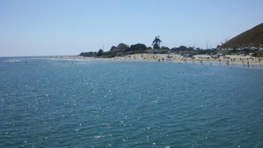
Goleta Beach Park is a 29 acre Santa Barbara County park known for its 1,500 foot fishing pier and sunbathing beaches. Great destination for bicyclists on the area's paved trail system. There are also BBQ picnic areas, volleyball, horseshoes and children's playgrounds as well as the Beachside Bar Cafe. Find your way to Sandspit Road and you're there. Learn more at www.countyofsb.org/parks/parks02.aspx?id=7682.

For beachside parks in Isla Vista, including beach access points at Camino Pescadero Park, El Embarcadero, Camino Corto, Escondido Pass and Camino Majorca, visit www.ivparks.org/parks/descriptions.

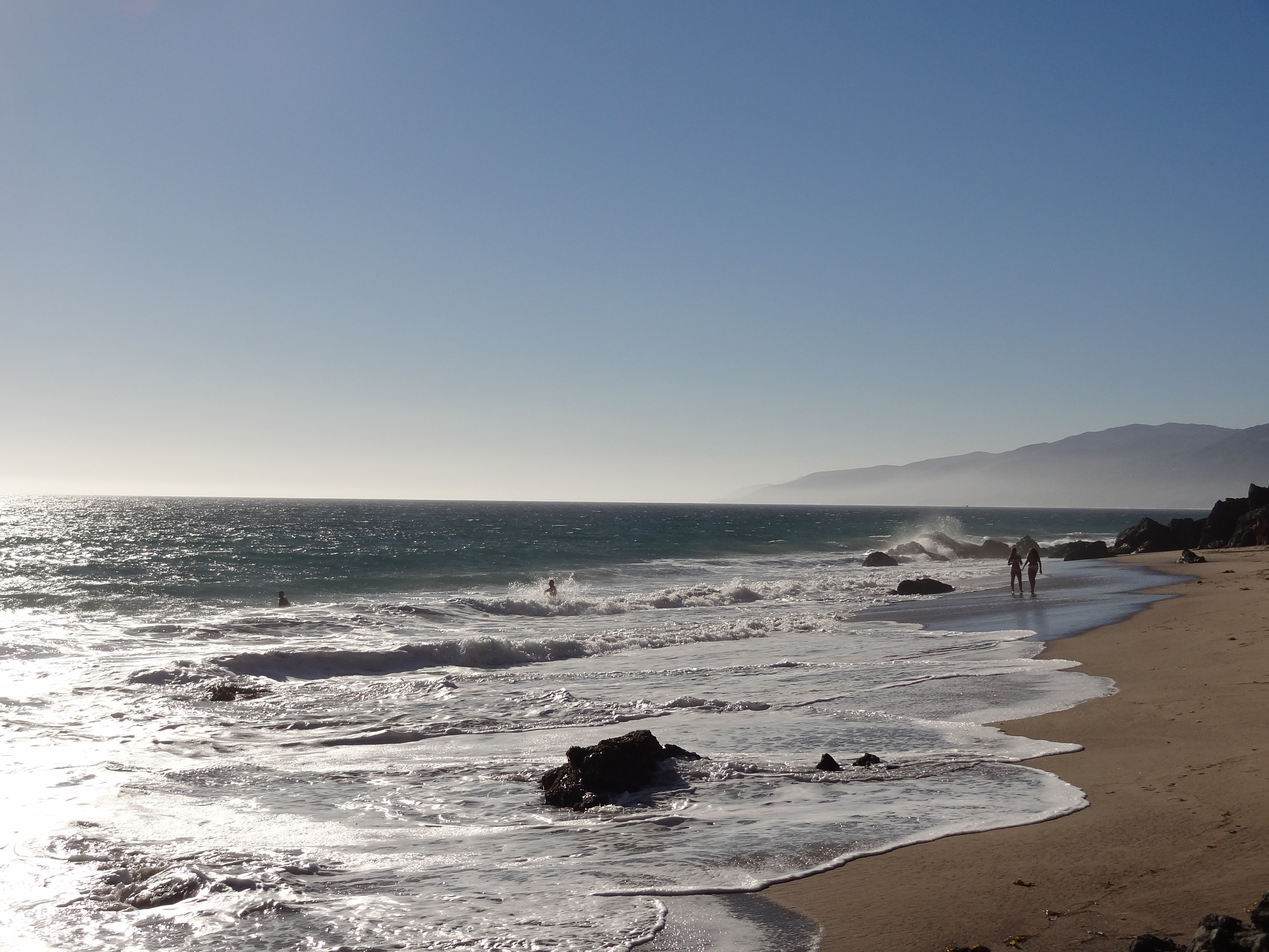
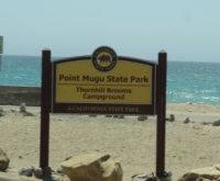
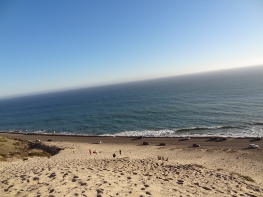
El Capitan State Beach is located in Goleta, 17 miles west of Santa Barbara, Exit 117 off of Highway 101. south and you'll see the entrance to the park. A great place for camping, hiking, surfing, picnicking and beach walking. There are rocky tidepools and fun hikes galore here. There's also a 132 site campground open year-round with easy walking access to the beach. Restrooms and showers are nearby. For those into "glamping" (e.g. luxury camping), nearby El Capitan Canyon offers awesome cabins decked out with bedding, kitchenettes and bathrooms as well as deluxe canvas tents and yurts. Visit www.elcapitancanyon.com for more information. Learn more about El Capitan State Beach at www.parks.ca.gov/?page_id=601.

El Capitan State Beach at sundown.

El Capitan State Beach at sundown.

Tree lined trails in El Capitan State Beach Park.

Tree lined trails in El Capitan State Beach Park.

Refugio State Beach is located at 10 Refugio Beach Road in Goleta, about 2 1/2 miles west of El Capitan State Beach. Refugio offers great fishing,  trails and picnic sites. Palm trees planted near Refugio Creek give a distinctive look to the beach and camping area. There are 61 campsites available. Visit www.parks.ca.gov/?page_id=603 for more information.

Jalama Beach County Park is an hour drive from Santa Barbara and a 45-minute drive from Lompoc at 9999 Jalama Road.  It is maintained by the County of Santa Barbara. Have fun at the beach with surfing, whale watching, fishing, horseshoes, picnic areas and more. There's also a popular camping area with over 100 sites as well as seven cabins available. Visit www.countyofsb.org/parks/parks06.aspx?id=9186 or call 805.736.6316.

Butterfly Beach is on the east side of town in Montecito, accessible off of Channel Drive near, of course, Butterfly Lane, across from the Four Seasons Biltmore. No amenities but nice sand, a few benches and dog access. You'll most likely have to find a parking spot on the street. Mainly geared towards locals. You can catch a beautiful sunset from here.

Butterfly Beach in Montecito

Butterfly Beach in Montecito

Lookout Park is a County of Santa Barbara managed park located on four acres on the cliffs of Summerland. Take the Summerland exit off Highway 101 and turn south into the park. Dogs are allowed on leash at this park. There access to a decent strip of beach, Summerland Beach. Also a small playground, restrooms, picnic areas, BBQ grills and more. Visit www.countyofsb.org/parks/parks02.aspx?id=7946 for more info.

Carpinteria area beaches, including Carpinteria State Beach, Tar Pits Park, Carpinteria Bluffs Nature Preserve and Rincon Beach Park, are highlighted at this link.

The Giant Sand Dune on PCH Across From Thornhill Broome Beach in Point Mugu

One of the many unique things to see in Ventura County is the gigantic sand dune located on the east end of Thornhill Broome Beach in Point Mugu.

ThornhillSandDune.JPG

Driving north up PCH, you'll see the sand dune on the east side after passing by Sycamore Canyon/Sycamore Cove Beach and before reaching the entrance to the Thornhill Broome Campground. 

ThornhillBroomeDune1.JPG

Park on the shoulder off of PCH. There's plenty of room, though you may be partially parked in the sand. You can also park on the beach side of PCH but rather than taking your life in your hands jaywalking across PCH, you're better off parking on the mountain side of the highway.

The mysteriously large sand dune is the result of "Aeolian transport," or the wind's movement of particles, in this case, sand. Quite steep this hill is, but your effort will be rewarded with some beautiful views of the Pacific Ocean. Plus, you get a nice bird's eye view of Mugu Rock.

ThornhillBroomeDune3.JPG

We noticed that the southern-most portion of the sand dune seems to have more large rocks in the sand from erosion of the mountains above. The northern hill, at least the several times we've now been there since originally posting this, has somewhat less rocks, leaving the sand smoother and more comfortable to walk on.

Going down the hill is certainly a lot easier than coming up!

Over 40 Things to Do in Malibu

This "27 Miles of Scenic Beauty" sign was swapped out for "21 Miles of Scenic Beauty" sign in April 2017 in order to correct the actual length of City of Malibu coastline.

This "27 Miles of Scenic Beauty" sign was swapped out for "21 Miles of Scenic Beauty" sign in April 2017 in order to correct the actual length of City of Malibu coastline.

The new sign updated in 2017.

The new sign updated in 2017.

Malibu was incorporated as a separate city in Los Angeles County on March 28, 1991, with 84% of Malibu voters supporting incorporation in a 1990 election.

The Conejo Valley lies just 8 to 10 miles away from the Malibu beachfront, making Malibu a natural choice to beat the heat and enjoy to its south-facing beaches. Here's a compilation of over 40 things to do in and around Malibu.

Beaches (East to West)

Surfrider Beach from the Malibu Pier

Surfrider Beach from the Malibu Pier

Adamson House

Adamson House