Koi Ponds In and Around Ventura County and Surrounding Areas

On a recent visit to The Commons at Calabasas we were treated to a beautiful pond full of koi and turtles cohabitating. Koi comes from the Japanese word nishikigoi, which means "brocaded carp." Koi is basically domesticated, ornamental carp. In Japanese, the word koi sounds like another word that mean affection or love.

Where to find koi in Ventura County and surrounding areas? Here's what we know:

There is a koi pond at The Promenade at Westlake, next to Marmalade Cafe.

Friendly looking koi looking for handouts at The Lakes at Thousand Oaks.

Friendly looking koi looking for handouts at The Lakes at Thousand Oaks.

The bottom level pond at The Lakes at Thousand Oaks has lots of koi, frolicking around with the ducks, even during the winter when the Holiday Ice Rink is in use.

Green Thumb Nursery on Victoria Avenue in Ventura has a small koi pond container in the back that is fun to observe with the kids.

The pristine Gardens of the World on Thousand Oaks Boulevard has a Japanese Garden that contains a beautiful koi pond.

Koi pond at The Gardens of the World in Thousand Oaks

Koi pond at The Gardens of the World in Thousand Oaks

The Santa Barbara Zoo has a large koi pond area with some very healthy looking koi, swimming among the lily pads.

Last I checked there were a lot of koi amongst the hundreds of ducks at Conejo Creek Park in Thousand Oaks.

The Simi Valley Town Center has a koi pond on the west side of the mall where you can get up close and personal with them.

Koi pond at west end near Studio Movie Grill.

Koi pond at west end near Studio Movie Grill.

As noted at the beginning of the article The Commons at Calabasas has quite a lovely koi and turtle pond.

The turtles are quite prominent at The Commons at Calabasas. Don't touch them!

The turtles are quite prominent at The Commons at Calabasas. Don't touch them!

When in Santa Barbara, be sure to stop by Alice Keck Park Memorial Gardens, a beautiful botanic garden with over 75 tree and plant species, a large koi pond also home to ducks and turtles, picnic areas and more. Quite a serene place.

Only 25 miles from the Conejo Valley is the Lake Shrine Meditation Gardens in Pacific Palisades. This 10 acre spiritual sanctuary hosts a spring-fed lake lined with gardens and home to koi, ducks and beautiful swans.

Things to Do With the Kids in Ventura County When It's Wet Outside

iStock_RainyDay.jpg

It doesn't rain nearly often enough here in Ventura County, but when it does, that's a great excuse for staying inside. You are in the right place as we have compiled this extensive list of well over 200 indoor activities from Agoura to Simi Valley to Ventura and everywhere in between!

Over 25 Things to Do in Agoura Hills

Agoura Hills Sign.JPG

The City of Agoura Hills incorporated in 1982 and is part of Los Angeles County. But we consider Agoura to be part of our family, consisting of Thousand Oaks, Newbury Park, Westlake Village, Oak Park and other communities that form the Conejo Valley.

Agoura Hills has an area of 7.86 square miles, with a population of approximately 20,000. It became the 83rd city in Los Angeles County when residents voted to incorporate, just one year after neighboring city Westlake Village incorporated.

Here is a compilation of things to do in the City of Agoura Hills.

Trails and Hiking

  • Malibu Creek State Park is an 8,000 acre wonderland of trails, hiking, camping and other outdoor activities. The Hike to the Rock Pool at Malibu Creek State Park is extremely popular. Equally if not more popular is the hike to the M*A*S*H television show set.

  • Cheeseboro/Palo Comado Canyons include 4,000 acres of terrain with dozens of miles of trails to explore in the northernmost section of the Santa Monica Mountain range. Popular with cyclists, runners and hikers.

  • Paramount Ranch, maintained by the National Park Service on Cornell Road in Agoura Hills, was used by Paramount Pictures for over 80 years of film and television production. Sadly, the Woolsey Fire in November 2018 destroyed the historic structures at the park. However, four new structures will be constructed by the fall of 2024.

  • The 64 acre Peter Strauss Ranch in Agoura Hills is also managed by the National Park Service and features hiking and an outdoor amphitheater area.

A "must do" in the Agoura Hills area is the hike to the old M*A*S*H TV series set in Malibu Creek State Park.

A "must do" in the Agoura Hills area is the hike to the old M*A*S*H TV series set in Malibu Creek State Park.

Kids

Fitness Related

  • The Agoura Hills/Calabasas Community Center is a 30,000 square foot facility with basketball courts, fitness studio, 35 foot rock climbing wall, dance/exercise studio, kids' programs and more. (Currently closed as of June 2023 as renovations will be made to the facility.)

  • Looking for some fresh air on the golf course but don't golf? That's ok, try FootGolf at the Lake Lindero Country Club in Agoura Hills. Quite fun and no experience necessary.

  • Other fitness and sports activities in Agoura Hills compiled at THIS LINK.

Ah yes, comic relief courtesy of Caltrans signmakers in 2013 when a new Agoura Hills sign on the 101 was put up filled with typos. It was subsequently corrected.

Ah yes, comic relief courtesy of Caltrans signmakers in 2013 when a new Agoura Hills sign on the 101 was put up filled with typos. It was subsequently corrected.

Other Entertainment, Things to Do and Annual Events

The old Agoura sign on Agoura Road at Lewis Road.

The old Agoura sign on Agoura Road at Lewis Road.

Closed: Troutdale was a local fishing pond for those looking for the experience of fishing but without the hassle of driving far! Located just off of Kanan Road, near Triunfo Canyon. It appears to be closed as of summer 2018.

Compilation of Public Beaches Spanning From Oxnard to Hueneme to Malibu

In a separate post, we highlighted beaches ranging from Carpinteria down south to the beaches at the Ventura Harbor. This is the 2nd installment of local area beaches that stretch from McGrath State Beach on down to the beaches gracing Malibu. We hope these compilations prove useful in guiding you to all the oceanfront fun Ventura County and adjacent areas have to offer!

Additionally, here's a compilation of beaches in the Santa Barbara area (excluding Carpinteria).

McGrath State Beach is currently open for day use and trails, but there are no facilities or parking available. Camping is not open as of June 2021. Visit parks.ca.gov/?page_id=607 or call 805.968.1033 for more information.  McGrath has 2 1/2 miles of beach available. Swimming, surfing, and water sports are discouraged because of rip currents. McGrath is 5 miles south of Ventura off the 101 freeway via Harbor Boulevard.

Mandalay Beach Park is 94 acres of undeveloped beachfront land located south of Reliant Energy's Mandalay Generating Station. The natural sand dunes and the wetlands ecosystem are recognized for their important natural value and houses several threatened bird species. This is a passive, natural open space park with no support facilities. The sandy ocean beach and adjacent coastal dunes are available for public day use only. The beach is managed by the County of Ventura on behalf of the California State Parks Department. Located at the corner of Harbor Boulevard and 5th Street in Oxnard. Visit www.parks.ca.gov/?page_id=609. No dogs allowed.

Oxnard Beach Park has one of the best kids play areas around town, restrooms, lots of grass, and easy access to miles and miles of beach. The sand dunes are really large in Oxnard. The park is located at 1601 S. Harbor Boulevard. For more information, contact the Oxnard Recreation & Community Services Department at www.oxnardrec.org/17/3/960.

Oxnard Beach Park looking towards the beach.

Oxnard Beach Park looking towards the beach.

Hollywood Beach is a great spot for swimming, sunning and viewing the Channel Islands. Free public beach volleyball courts, public restrooms on the north end of the beach, on-street parking and lifeguards on duty between Memorial Day and Labor Day. Located right next to Channel Islands Harbor off of Harbor Boulevard. Dogs are allowed at Hollywood Beach on leash before 9am and after 5pm. West-facing beach means it’s great for catching the sunset!

Hollywood Beach

Hollywood Beach

Silver Strand Beach is a 1 mile long beach near Channel Islands Harbor, about 150 yards in width. It is capped by north and south jetties, both of which have small parking lots; one next to San Nicholas Avenue (at Ocean Drive), the other next to Sawtelle Avenue. Free parking from sunrise to sunset with limited restroom facilities. This is a sandy bottom beach break which may have rip tides and an undertow, so be careful. Dogs on leash allowed before 9am and after 5pm. Lifeguards on duty daily during summer months. Accessed via S. Victoria Avenue. Visit visitoxnard.com/things-to-do/beaches/silver-strand-beach for more information.

There's a Kiddie Beach Park off of S. Victoria Avenue at Sunset Drive with available parking, restrooms and benches. It is a small sliver of sand that fronts the south end of Channel Islands Harbor and thus does not face ocean waves.

Hueneme Beach Park is 50 acres with picnic tables, barbecue pits, walking paths, a fishing pier, sand volleyball courts, Surfside Seafood snack bar, lifeguards and restrooms. Beach parking lots and Surfside Drive parking available for a fee. No dogs allowed! Visit www.ci.port-hueneme.ca.us/index.aspx?NID=926 for more information. Located at 550 E. Surfside Drive, Port Hueneme

Ormond Beach is 1,500 acres composed of agriculture, industry and wetlands. A two mile long beach extends from Port Hueneme on the north to Naval Base Ventura County on the south. This is one of the few areas in southern California with an intact dune transition zone marsh system, hosting over 200 migratory bird species. The California Coastal Conservancy is restoring these wetlands. A bit off the beaten path, it is probably more geared towards bird watchers and hikers. Get there via Hueneme Road, going south on either Perkins Road on the north and Arnold Road on the south.

Naval Base Ventura County occupies roughly 6 miles of oceanfront space between Ormond Beach on the north and Point Mugu State Park on the south. This space is not accessible by the general public. However, there are periodic opportunities for civilians to catch a glimpse of the Pacific Ocean from NBVC during organized events open to the public.

Mugu Beach is the first publicly accessible beach area south of Naval Base Ventura County off of PCH, located adjacent to the prominent Mugu Rock. For the most part this is the most quickly accessible beach to Camarillo and Conejo Valley residents. There is paid parking ($12 last time I was there) as well as parking available on PCH. Popular with fisherman. One thing to be aware of here is that there is a significant undertow. If you bring the little ones, best to stay out of the water or just be extra careful.

South of Mugu Rock there is also some beach that is accessible with plenty of parking on PCH. No facilities and not a lot of beach, but beautiful views and a quick place to explore.

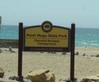
ThornhillBroome.JPG

Thornhill Broome Campground and Beach is also part of Point Mugu State Park, located a mile or two south of Mugu Beach. This is a campground right on the beach with a capacity for about 60 or so RVs. But of course you can visit for the day for a parking fee. Plenty of parking also available on PCH. Porta-potties available. Dogs are allowed around here as long as they are on a leash (and paleeeze...pick up after them).

Across the street on PCH is a gigantic, steep sand dune that I've always found to be interesting. Learn more about that sand dune here.

Unusually large sand dune on the east side of PCH across from Thornhill Broome Campground

Unusually large sand dune on the east side of PCH across from Thornhill Broome Campground

Sycamore Cove is at the southernmost beachfront portion of Point Mugu State Park. Point Mugu State Park features 3.6 miles of ocean shoreline (Sycamore Cove to Mugu Beach), with rocky bluffs, beaches, sand dunes, rugged hills and uplands, two major river canyons and wide grassy valleys dotted native trees.

Sycamore Canyon Campground across PCH from Sycamore Cove has 58 campsites. For a challenge, ride or hike down through Sycamore Canyon from Rancho Sierra Vista/Satwiwa in Newbury Park. You'll most likely have to pay to park here (most recently $12 for day use) as there are not many spots on PCH available on the south side...watch out...there are no parking signs all over the place.

SycamoreCove_sign.JPG

Sycamore Cove Beach has a number of picnic benches shaded by trees and is thus a popular spot on summer weekends for the BBQ crowd as well as with the campers from the campground on the other side of PCH. Located at 9000 Pacific Coast Highway. Visit www.parks.ca.gov/?page_id=630.

Trees shade the picnic tables at Sycamore Cove Beach

Trees shade the picnic tables at Sycamore Cove Beach

In the 3.3 mile stretch of PCH between Sycamore Cove Beach and County Line Beach (below) there are three or four places where you can park on PCH and access the beach.

One of these beaches I refer to as Call Box 1-35 Beach, about a mile southeast of Sycamore Cove Beach. This is not the official name of this beach in the unincorporated section of Ventura County northwest of Malibu city limits. But since the dilapidated staircase leading down to the beach is next to this call box, it seems appropriate. The address is approximately 9649 Pacific Coast Highway, Malibu (yes, technically not Malibu, yet in Google maps the address says Malibu).

About half a mile southeast of Call Box 1-35 is Call Box 1-27 Beach, which I also refer to as 26 Steps Beach. 26 Steps Beach is approximately 1.9 miles northeast of County Line Beach (see below) and 1.5 miles southwest of Sycamore Cove Beach (see above), at approximately 9999 PCH, just west of Deer Creek Road. I made up the name 26 Steps Beach because there is a well-worn, tagged up staircase that leads you from your parked car on PCH near the 1-27 Call Box sign to the beach. This is not a bad little section of beach that rarely has many people. No restrooms. Parking is free on PCH.

County Line Beach is located across the street from the iconic Neptune's Net, 3 miles south of Sycamore Cove at 42505 Pacific Coast Highway, Malibu. Lots of surfers and places to explore. Park on PCH. Watch out for bikers...there can be hundreds of them hanging out here on many a weekend. There are outer reefs for scuba diving that have an abundance of sea life. Activities include diving, surfing, and tide pools. No lifeguards on duty. There are a few porta-johns here. Technically, County Line Beach is located in Solromar, an unincorporated community in Ventura County - but they use the Malibu zip code so hey, it’s ok to say it is in Malibu.

NeptunesNet.JPG

Leo Carrillo State Park has 1 1/2 miles of beach for swimming, surfing, windsurfing, surf fishing and beach combing; one of our favorites for exploring sea caves, rocks and tidepools. Leo Carrillo is about 1 1/2 miles south of Neptune's Net at 35000 West PCH, Malibu. On the other side of PCH, Leo Carrillo has 135 campsites, with over 2,500 acres of land. Visit www.parks.ca.gov/?page_id=616 or call 805.488.1827. Dogs on a leash are allowed in day use areas, campground and north beach (north of lifeguard tower 3). Dogs are not allowed on back country trails or south beach (south of lifeguard tower 3). Park on PCH or in the State lot ($12) and take the tunnel under PCH to the beach. More details on how to get to Leo Carrillo from the 101 freeway at this link.

Before the main Leo Carrillo Beach area while heading south on PCH is the Leo Carrillo State Park Staircase Beach area. There’s a California State Parks parking lot at approximately 40000 PCH Room for I’m gonna guesstimate 50 cars. There’s a moderately narrow trail that takes you down to the beach, which is also fairly narrow. You can also walk to this beach from the main Leo Carrillo Beach. Dogs allowed on leash.

Leo Carrillo State Park Staircase Beach parking lot.

Leo Carrillo State Park Staircase Beach parking lot.

NicholasCanyon.JPG

Nicholas Canyon County Beach is 1 mile east of Leo Carrillo at 33850 Pacific Coast Highway. Great beach where you can hang out, fish, picnic, surf and more in about 25 acres. About 150 parking spaces available. Generally $10 to park on summer weekends, or park on PCH. More info at beaches.lacounty.gov/nicholas-canyon-beach. Restrooms available.

A view of Nicholas Canyon County Beach, just a mile east of Leo Carrillo.

A view of Nicholas Canyon County Beach, just a mile east of Leo Carrillo.

Located between Leo Carrillo and Point Dume State Beaches, Robert H. Meyer Memorial State Beach is made up of a number of cove or cliff-foot strands known as "pocket beaches" along the west end of Malibu, including El Pescador, La Piedra and El Matadorwww.parks.ca.gov/?page_id=633 Dogs are not allowed on state beaches.

El Pescador State Beach is 1.4 miles east of Nicholas Canyon at 32900 Pacific Coast Highway, Malibu. Steep, uneven stairs lead to about 10 acres of narrow, sandy beach. It is just east of Decker Canyon, the curvy, steep road that takes you up to Hidden Valley/Westlake Village. Dogs are not allowed on state beaches. Limited parking is available (fees vary) or park on PCH. Small, secluded beach. When the tide is not too high, you can trek you way east towards La Piedra Beach and back.

Porta-potty available. www.parks.ca.gov/?page_id=633.

Sign on PCH east of Decker Canyon Road, prior to El Pescador State Beach to the west of it.

Sign on PCH east of Decker Canyon Road, prior to El Pescador State Beach to the west of it.

La Piedra State Beach is .3 miles east of El Pescador at 32700 Pacific Coast Highway. A fairly long hiking path (may be a bit challenging for those lugging a lot of stuff) leads to 9 acres of narrow, sandy beach. Dogs are not allowed on state beaches. Limited parking available for a fee (which vary) or park on PCH. Porta potty available. www.parks.ca.gov/?page_id=633.

El Matador State Beach is .3 miles east of La Piedra at 32350 Pacific Coast Highway, just east of where Encinal Canyon Road intersects with PCH. A dirt path, then dozens of stairs, leads to 18 acres of narrow, sandy beach with stunning, rock formations and caves.

Dogs are not allowed on state beaches.  There is a parking lot with room for 25 or so cars where you can pay $3/hour or $10 for all day (as of July 2023).  You can also park on PCH, but on the north side...for whatever reason parking is prohibited on the south side of PCH. This means you have to cross PCH, which can be a challenge. There are porta-potties available. www.parks.ca.gov/?page_id=633

Stunning rock formations at El Matador State Beach.

Stunning rock formations at El Matador State Beach.

Lechuza Beach in Malibu, a mile east of El Matador State Beach, is maintained by the Mountains Recreation and Conservation Authority. It is a small, sandy beach with beautiful rock formations and views up the coast. Accessible via the northeast end of Broad Beach Road.  More information and specific access points at mrca.ca.gov/parks/park-listing/lechuza-beach. Dogs not allowed on the beach.

Zuma Beach is located at 30000 Pacific Coast Highway about 3.5 miles east of El Matador. At 4 miles long, Zuma is one of the largest and most popular beaches in Los Angeles County, Zuma is known for its long, wide sands and excellent surf. Plenty of facilities, including several food stands, restrooms, showers, volleyball, etc. Plenty of street parking on PCH and over 2,000 parking spaces (currently $8 weekdays and $10 weekends). Visit beaches.lacounty.gov/zuma-beach for more information. Zuma is known for riptides, so do be careful out there.

NOTE: Fires, including BBQs, are not allowed on any beach in Malibu; the exception is that fires may be allowed in designated spots at some state beaches. Dogs not allowed on the beach also.

Zuma Beach

Zuma Beach

Point Dume State Beach is a 63 acre promontory that juts out into the Pacific and features headlands, cliffs, rocky coves and vast beach access for swimming, surfing, scuba diving and fishing. Westward Beach borders Zuma Beach at Zuma's south side. There is plenty of parking on Westward Beach Road, which parallels Westward Beach. To the southeast of Westward Beach is a small 300 foot or so beachfront area called Pirate's Cove Beach (which due to its seclusion was once used as a nude beach).

PointDumeSign.jpg

At the end of Westward Beach Road (WBR), access to the protected 34-acre Point Dume Natural Preserve begins from the cul-de-sac. A gradual ascending trail leads to an ancient coastal bluff sand dune with spectacular views...we've seen whales, seals and dolphins over here. A stairway from the east side of the bluff-top preserve allows access to a more isolated beach and tidepools (look but don't touch). Location/Directions: Take Kanan south to PCH and turn right. WBR is over the rise, at the foot of the hill. Park free on WBR or pay a fee at Westward Beach lot. No restrooms at the Preserve but some can be found on WBR. Call 310.457.8143 or visit www.parks.ca.gov/?page_id=623 for more information.

NOTE: Dogs are not allowed on trails in the Point Dume Natural Preserve or on the beach.

Looking down on the beach at Point Dume

Looking down on the beach at Point Dume

Paradise Cove Beach is located at 28128 Pacific Coast Highway, accessed via Paradise Cove Road. Parking (as of June 2023) is $10 ($15 weekends/holidays) for if you spend up to 4 hours at the Paradise Cove Beach Cafe (and spend at least $30 there) or $45/$65/day (weekdays/weekends) if you park there just for the beach. Or, you can park on PCH and walk there. There are restrooms, cabanas, lounge chairs and chairs for rent, and a small pier. Visit www.paradisecovemalibu.com.

Escondido Beach is a short, narrow strip of beach accessible just west of Geoffrey's Malibu via a long stairway at 27420 PCH or near the corner of Escondido Beach Road and Malibu Cove Colony Drive. Look for access signs. No dogs allowed. No facilities.

Dan Blocker Beach is located at 26000 Pacific Coast Highway (between Solstice Canyon and Corral Canyon Roads. A sandy, narrow beach that draws surfers and scuba divers. Limited free roadside parking. Restrooms are available. Corral Canyon (trail map HERE) is located across the street at 25623 PCH. The trailhead is on the north side of PCH next to Malibu Seafood restaurant. The beach can be accessed from via a seasonal trail under PCH. 310.305.9546

On June 14, 2016, a new beach stairway access was completed at 24038 Malibu Road. Very little parking available there and no facilities at the beach. Read more at THIS LINK.

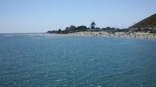
Malibu Beach is a 167 acre beach at 23050 and 23200 Pacific Coast Highway that includes Malibu Lagoon, Malibu Lagoon Museum and the Malibu Pier. Malibu Surfrider Beach next to the pier is quite popular with local surfers. Parking available for a fee, or park on streets surrounding Malibu Country Mart and walk across PCH at the signaled crosswalk at Cross Creek Road.

Malibu Surfrider Beach viewed from the Malibu Sportfishing Pier

Malibu Surfrider Beach viewed from the Malibu Sportfishing Pier

Perhaps the most expensive strip of beach in the world is Carbon Beach, which stretches about a mile and a half between the Malibu Pier and just east of Carbon Canyon Road. This wide beach is a beautiful strip of sand, but public access points can be challenging to find and parking can be a challenge. Learn specifics at THIS LINK but specifically, the public accessway points are at 22670 PCH, 22466 PCH and 22126 PCH. No restrooms and no dogs allowed at this beach.

Las Tunas Beach is located at 19444 Pacific Coast Highway, about 4 1/2 miles east of the Malibu Pier. It is a narrow beach beneath the bluffs that holds a special attraction to surf casters. Free parking lot. Located between Tuna Canyon and Las Flores Canyon Roads.

CoastalAccess2.JPG

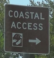
And there's more...the California Coastal Commission Shoreline Public Access Program helps maximize public access to the beach along the California coast. When you see one of those "Coastal Access" signs, that means you can get to the beach. More on the program at www.coastal.ca.gov/access/accndx.html. The L.A. County Dept of Beaches and Harbors has published Malibu beach accessways at file.lacounty.gov/dbh/cms1_151453.jpg, including 11 accessways on PCH, Malibu Road and Broad Beach Road. But if you do check them out, be mindful of those who live there!

Events in Ventura County and Nearby Areas That Have Been Around Over 40 Years

Conejo Valley Guide is the most comprehensive resource ever known to human civilization for events, activities and things to do throughout Ventura County and adjacent areas stretching to Santa Barbara, Malibu and Calabasas, as all of you already know. We've noticed there are numerous events that have taken place in our local community for quite a long time! Let's take a look at the longest duration events in the area - those that have been around at least 40 years.

The 150th Ventura County Fair will take place in summer 2024, the longest duration community event in the county. According to this Fillmore Gazette article, the VC Fair originated in 1874 at Pierpont Bluffs and Hueneme before moving to Seaside Park in Ventura. www.venturacountyfair.org

The Ventura County Fair is the longest-running community event in the area.

The Ventura County Fair is the longest-running community event in the area.

The Midsummer Festival at Vasa Park in Agoura Hills is hosted the weekend closest to June 24th each year by the Swedish American Central Association of Southern California to encourage the preservation of Swedish culture, traditions and customs.  The 103rd iteration of this event will happen in June 2024. www.vasapark.org

The 100th Anniversary Old Spanish Days Fiesta in Santa Barbara will take place over five days, July 31 to August 4, 2024. It is an annual festival that honors and preserves Santa Barbara’s history, spirit, culture, heritage and traditions with music, art, food, parade, tours and more in various locations. Learn more at www.oldspanishdays-fiesta.org.

The 76th Annual Santa Barbara International Orchid Show took place in March 2024. It is one of the largest and oldest orchid shows in the United States. www.sborchidshow.com

The 74th Annual Oxnard Christmas Tree Lighting Ceremony will occur in December 2024 (generally the first Friday night of the month), making it one of the oldest traditions in Ventura County. And the tree is the County's tallest, at about 110 feet! downtownoxnard.org

The 74th Annual Santa Paula Christmas Parade takes place on the first Sunday after Thankgiving 2024, Quite a tradition for this town that was incorporated in April 1902!

The 70th Annual Semana Nautica 15K in Santa Barbara takes place on July 4, 2024 and on July 4th of each year. It is the oldest foot race on the Central Coast. www.sbrunning.org

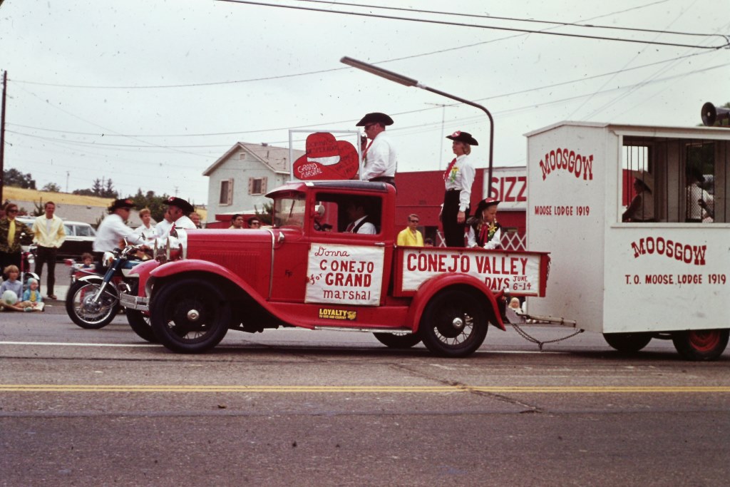
The 68th Conejo Valley Days carnival is anticipated to take place in June 2024. It is the oldest event of its kind in Thousand Oaks. The event officially became called Conejo Valley Days in 1956; previously referred to as a "Community Circus" when held at the old Jungleland (now The Lakes) compound conejovalleydays.us.

Scene from Conejo Valley Days Parade of 1970.

Scene from Conejo Valley Days Parade of 1970.

The 63rd (give or take) Topanga Banjo-Fiddle Contest and Folk Festival will take place at King Gillette Ranch in Agoura Hills on May 19, 2024. The event was established in Topanga Canyon and moved around a bit as it grew and moved to the current venue in 1990. It is one of the largest acoustic music events in Southern California. Learn more at www.topangabanjofiddle.org.

The second-longest running Christmas parade in Ventura County is the Camarillo Christmas Parade, which celebrates its 64th annual event in December 2024 www.pvrpd.org

The 62nd Annual Simi Valley Halloween Carnival took place on October 31, 2023 at Rancho Santa Susana Park. Hosted by the Rancho Simi Recreation & Park District, this is one of the longest running Halloween carnivals in Ventura County. www.rsrpd.org

Local area gem and mineral societies have been organizing fun annual shows for decades, including the Ventura Gem & Mineral Society's 61st Annual Gem, Mineral, Fossil and Lapidary Show happened in March 2024. vgms.org/category/gem-show.

The 57th Annual Parade of Lights at Channel Islands Harbor dazzles spectators in December 2023. This may well be the longest-running boat parade in Ventura County. Great fun watching the boats lighted up at the Harbor. www.channelislandsharbor.org

Pierce Brothers Valley Oaks Memorial Park is hosting its 55th Annual Easter Sunrise Service on March 31, 2024, quite possibly the longest running local Easter service in Ventura County www.piercebrothersvalleyoaks.com

The 53rd Westlake Village 4th of July Parade and Party in the Park will \be taking place yet again on July 4, 2024, making it the longest running Conejo Valley area 4th of July parade. (Like most events, it was cancelled in 2020.) www.wlv.org

The 45th Ventura County Greek Festival will take place at St. Demetrios Greek Orthodox Church in Camarillo in June 2024 www.vcgreekfestival.org.

The Conejo Gem & Mineral Club’s 47th Pageant of a Thousand Gems Show will take place in April 2024 in Newbury Park. www.cgamc.org

The 50th Anniversary Scandinavian Festival at California Lutheran University in Thousand Oaks takes place in May 2024.  www.scandinavianfest.org

The 47th Annual Ojai Art in the Park event will take place Memorial Day weekend 2024. This I believe is the longest-running outdoor art show within Ventura County. www.ojaiartcenter.org

This is just a tiny fraction of ALL the great events that take place in Ventura County and surrounding areas each year that are highlighted in the Events Calendar and Local Events section of Conejo Valley Guide.

These are just a sampling of the various activities and events in Conejo Valley Guide, so make sure to explore and find something fun to do!

Indoor Play Places In and Around Ventura County

There are hundreds of parks with play areas throughout the Conejo Valley and Greater Ventura County compiled at THIS LINK, but if you are looking for an indoor playtime experience with your little ones, from toddlers to teens, here are a number of options to check out.

This is just a small sampling of kids' activities highlighted here on Conejo Valley Guide.

FUN FOR THE KIDS AT LOCAL VENTURA COUNTY AREA SHOPPING MALLS

The three story foam ball projectile and climbing area at Kids World in Oak Park.

The three story foam ball projectile and climbing area at Kids World in Oak Park.