Lizard Rock Hike in Wildwood Park, Thousand Oaks

Lizard Rock is just over a mile from the main entrance to Wildwood Park at the west end of Avenida de los Arboles. Walk/run/hike the Mesa Trail towards Lizard Rock and you will be treated to beautiful views of the surrounding spaces where shows like Gunsmoke and The Rifleman were filmed.

The entrance area and dirt parking lot at the Wildwood Park main trailhead.

The entrance area and dirt parking lot at the Wildwood Park main trailhead.

LizardRockInDistance.JPG
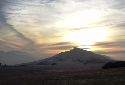
Lizard Rock in the distance

Lizard Rock in the distance

View from on top of the lizard

View from on top of the lizard

Trail sign south of Lizard Rock indicating Lizard Rock Trail to Wildwood Canyon Trail

Trail sign south of Lizard Rock indicating Lizard Rock Trail to Wildwood Canyon Trail

You can make this hike a 4 1/2 mile loop past Paradise Falls and the Indian Creek Trail by reviewing the map on the Conejo Open Space Foundation website at cosf.org/trails/wildwood/wildwood-park-easy-hike-indian-creek.

Santa Rosa Loop Hike in Wildwood Park

The Santa Rosa Loop Hike at Wildwood Park in Thousand Oaks is a 6 1/2 mile trek with moderately challenging uphills and downhills. You’ll be rewarded with beautiful views of the Conejo Valley and Santa Rosa Valley.

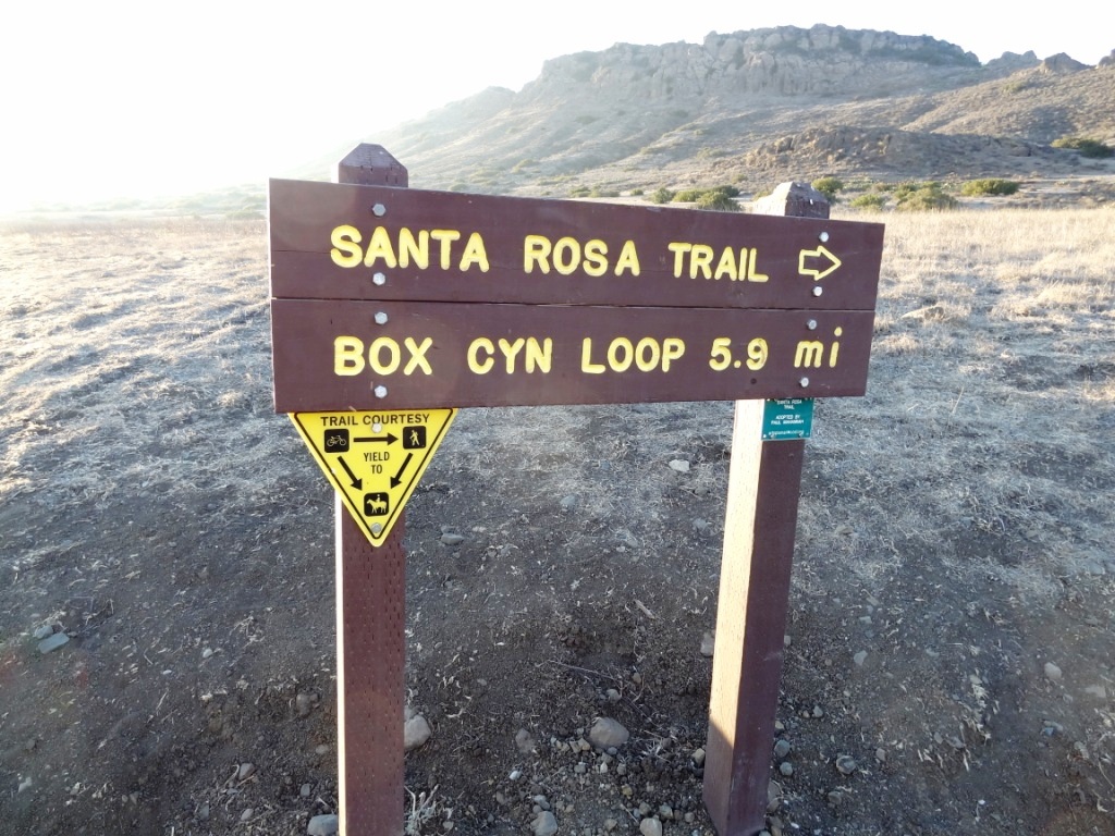
Start at the main Wildwood trailhead at the west end of Avenida de Los Arboles. Take the main Mesa Trail towards Lizard Rock. You'll soon reach the Santa Rosa Trail sign, which points you north.

Box Canyon Loop Trail
As you crest the hill, follow the arrows toward the Lower Santa Rosa Trail.

As you crest the hill, follow the arrows toward the Lower Santa Rosa Trail.

Views of Santa Rosa Valley

So you're heading east and almost feeling like maybe you're getting lost, but this indeed is the Santa Rosa Trail. Just stay towards the left. It is single track much of the way over here. Then, you'll see the following sign as you get closer to the bottom of the Santa Rosa Valley.

So now you are zig zagging down the Shooting Star Trail, which eventually merges into the Lower Santa Rosa Trail.

(That said, you can continue east from the above juncture and make your way to Cal Lutheran.)

Now you're going to turn left (west) on Lower Santa Rosa Trail for some gentle slopes alongside private residences and farms in the Santa Rosa Valley for about a mile or so.

Some old farming equipment on the side of the Lower Santa Rosa Trail.

Some old farming equipment on the side of the Lower Santa Rosa Trail.

Then soon you come to the end of the trail and there's a sign that tells you to get back into Wildwood Park via the Box Canyon Trail, take the road up ahead 4/10ths of a mile. You're actually in Camarillo now on Rocky High Road.

The trail ends at the juncture of Talal Ct (private) and Rocky High Road.

The trail ends at the juncture of Talal Ct (private) and Rocky High Road.

At the end of the short stretch of road is the trailhead back into Wildwood Park.

And soon you'll see the Box Canyon Trail sign. Veer left (although I think if you go right it loops around to the main trail also).

Box Canyon Trail Sign

It's about a 300 foot climb over less than half a mile up the Box Canyon Trail that gets you back to the main Mesa Trail artery in Wildwood Park. Take your time...you're almost there!

Box Canyon Lizard Rock Sign Wildwood Park

Then you'll see the Lizard Rock / Box Canyon sign that signifies you are back at the Mesa Trail to head about half a mile back to the parking lot. Or turn right to check out the views from Lizard Rock before you go.

To see a map of this hike, visit www.cosf.org/website/html/santa-rosa-loop.html.

OK, so if you're looking to take a break and sit back and enjoy the view near the juncture of the Mesa Trail and Box Canyon Trail?  Then head back (west) from the "Lizard Rock/Box Canyon" trail sign above toward Box Canyon and take the trail on the left to the Box Canyon Overlook, where you will find the following place to park your rear end. Not a bad view, eh?

Bench at Box Canyon Overlook.

Bench at Box Canyon Overlook.

Gardens of the World - Thousand Oaks

Gardens of the World at 2001 Thousand Oaks Boulevard is a 4 1/2 acre garden across from the Civic Arts Plaza in Thousand Oaks.  It is free and open to the public Tuesday through Saturday from 9 a.m. to 5 p.m. (last admittance is 4:30 p.m.)  Closed Sunday and Monday and most national holidays. Gardens of the World is a gift from the Hogan Family Foundation.

GOTW_front2.JPG

Gardens of the World is an oasis of beauty in the middle of Thousand Oaks. There is a large bandstand in the center of the Gardens that is a perfect venue for outdoor music.  And the array of plants, flowers, waterfalls (including a stunning fountain that looks out toward the Civic Arts Plaza) and a serene koi pond next to an authentic Japanese Pagoda.

GOTW_WaterFountain.JPG

There is a Japanese garden, a French garden and waterfall (shown above), a Mission Courtyard, an English perennial and rose garden and an Italian garden.  A beautiful place to visit and relax for a bit, right in the heart of Thousand Oaks.  Also a great place for a picnic lunch, with plenty of tables, benches and grassy areas. More information at www.gardensoftheworld.info or 805.557.1135.

I never promised you a rose garden...but here's a beautiful one to check out!

I never promised you a rose garden...but here's a beautiful one to check out!

Koi pond in the Japanese Garden

Koi pond in the Japanese Garden

Shaded picnic area

Shaded picnic area

Since 2003, Gardens of the World has hosted a great Jazz Series on Sunday afternoons in August in this traditional American Bandstand area.

Since 2003, Gardens of the World has hosted a great Jazz Series on Sunday afternoons in August in this traditional American Bandstand area.

Lang Ranch/Woodridge Open Space Trails in Thousand Oaks

Looking for some spectacular trail hiking and panoramic views stretching from the Conejo Valley to the Simi Hills? Then take a look at the open space trails in the Lang Ranch/Woodridge system in the northeast portion of Thousand Oaks in the Lang Ranch area (where Avenida de los Arboles meets Westlake Boulevard).

The 1,025 acre area is maintained by the Conejo Open Space Conservation Agency (COSCA) and connects with another 8,000 acres of open space that is part of the Santa Monica Mountains. There are 10 miles of well-maintained trails that are outstanding for hiking, running and biking. The views are spectacular and you can actually hike from Thousand Oaks to Simi Valley (via the Long Canyon Trail) and Agoura Hills (Woodridge to Cheeseboro/Palo Comado).

More information about the various trails in the Lang Ranch/Woodridge Open Space on the Conejo Open Space Foundation website at cosf.org/trails/lang-ranch.

The specific trails seen below can be accessed from the Autumn Ridge trailhead at Westlake Boulevard and Autumn Ridge Drive in Thousand Oaks.

Access to this trail is at the corner of Westlake Bd and Autumn Ridge Dr

Access to this trail is at the corner of Westlake Bd and Autumn Ridge Dr

You can get a clear view of Bard Lake (Calleguas Water District Reservoir) from the Sunrise Trail, which parallels to the north of a portion of the Autumn Ridge Trail.

LangRanchTrail4.jpg
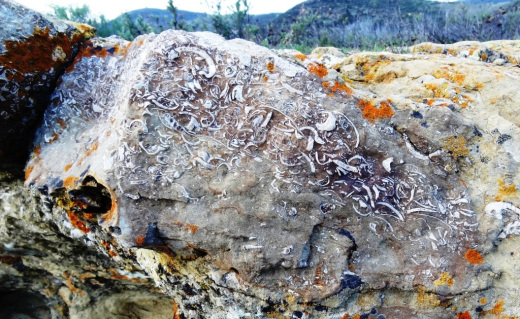
Checking out fossils on display in the open space. Pretty fun to see with the kids. The approximate spot of these fossil rocks is at THIS LINK.

Checking out fossils on display in the open space. Pretty fun to see with the kids. The approximate spot of these fossil rocks is at THIS LINK.

This bench is located at the juncture of the Sunrise and Meadow Vista Trails in the Lang Ranch Open Space and Long Canyon Trail, which is accessible via the Wood Ranch section of Simi Valley. Not a bad view, eh?

This bench is located at the juncture of the Sunrise and Meadow Vista Trails in the Lang Ranch Open Space and Long Canyon Trail, which is accessible via the Wood Ranch section of Simi Valley. Not a bad view, eh?

Trailhead at east end of Lang Ranch Parkway, to Albertson Fire Road trail.

Trailhead at east end of Lang Ranch Parkway, to Albertson Fire Road trail.

There’s another fun path I like to take in the Lang Ranch Open space. Take the Autumn Ridge Trail about half a mile and veer left at the Woodbridge Connector Trail, looping up and around to Wood Ranch in Simi Valley to the Long Canyon Trail trailhead, then back up to Lang Ranch. It’s only about 4 or 5 miles. See the map at cosf.org/files/maps/lang_ranch_trail_map.pdf for details.

Two Springs Trail and Wildwood Canyon Trails in Wildwood Park, Thousand Oaks

Sign on the west side of the Wildwood Park parking lot after walking down some steps

Sign on the west side of the Wildwood Park parking lot after walking down some steps. (Indian Creek Trail was renamed Two Springs Trail in May 2022.**)

If you enjoy the sound of running water, the Two Springs Trail (formerly Indian Creek Trail) and Wildwood Canyon Trail at Wildwood Park in Thousand Oaks are for you.

The Two Springs Trail can be accessed from the main Wildwood Canyon trailhead area parking lot at the east end of Avenida de los Arboles as well as at a separate trailhead on Arboles, slightly west of the parking lot.

Indian Creek Trail entry point from Avenida de los Arboles

Two Springs Trail (formerly Indian Creek Trail) entry point from Avenida de los Arboles

There are shady sections hidden among the trees and sections in the sun. Most of the trail runs along a creek that flows into Paradise Falls. This is not a completely easy hike as there are some hilly sections, a number of steps, and a stream crossing. That said, there's enough variety to make this a fun and interesting hike with the kids.

Visit the Conejo Open Space Foundation website at cosf.org/trails/wildwood/wildwood-park-easy-hike-moonridge-trail/ for a handy map of these trails.

About half a mile or so into the hike, you'll come across a fairly significant waterfall down below, way below, in the creek. Not as large as Paradise Falls, but definitely prominent. Adjacent to that area is a bench. And from there you have some steps and a stream crossing to make it down to the flatter section of the trail.

The waterfall seen from the Indian Creek Trail. Be careful!

The waterfall seen from the Two Springs Trail (formerly Indian Creek Trail). Be careful!

The bench on the Indian Creek Trail in Wildwood Park

The bench on the Two Springs Trail (formerly Indian Creek Trail) in Wildwood Park

Eventually you get to a bridge. If instead of crossing the bridge, you veer left (southwest), you'll be on the Wildwood Canyon Trail along the creek. This is a wide path that can take you on another little sidetrack loop up the Castillo Trail to Castillo Circle (street). A bit of a steep, roughly 3/8ths of a mile trail to Castillo Circle, where you can walk back to a separate trailhead via Velarde Drive north to San Miguel Circle to the San Miguel Trail. You'll end up back at the bridge area.

The Wildwood Canyon Trail is pretty cool. Fairly flat, wide and runs along a creek. The water they say is mostly urban runoff but fun to check out up close with the kids.

The Wildwood Canyon Trail is pretty cool. Fairly flat, wide and runs along a creek. The water they say is mostly urban runoff but fun to check out up close with the kids.

The Meadows Center next to the bridge has restrooms and a drinking fountain. The Conejo Rec & Park District leads many hikes here for s'mores and fun activities.

The Meadows Center next to the bridge has restrooms and a drinking fountain. The Conejo Rec & Park District leads many hikes here for s'mores and fun activities.

The bridge that intersects the Indian Creek Trail and Wildwood Canyon Trail. Lots of options!

The bridge that intersects the tWO sPRINGS (FORMERLY iNDIAN cREEK) Trail and Wildwood Canyon Trail. Lots of options!

Or, veer right (west) over the bridge, continuing on perhaps the Wildwood Canyon Trail southeast towards the top end entry into the Paradise Falls area (pretty cool to go this way). You can also sidetrack a bit by crossing the bridge and making a sharp right (north) to the short Little Cave Trail** and check out the Little Cave **.

The Indian Cave is really easy to get to. Wear good hiking shoes though as it can get slippery. I slipped several times recently because the sole of my sneakers was so worn down.

The Little Cave (formerly Indian Cave**) is really easy to get to. Wear good hiking shoes though as it can get slippery. I slipped several times recently because the sole of my sneakers was so worn down.

You can return to the parking area by either backtracking up the Two Springs Trail or by taking the trail directly across from the bridge (basically go straight) up the steep, moderately winding path to a public access road (there is overflow parking available here) to the main Mesa Trail. From there, go right (east) back to the parking lot.

I could go on but there are so many different options in Wildwood Park that we'll stop here for now. Here are links to some other options:

THE TEEPEE, LITTLE CAVE AND PARADISE FALLS

LIZARD ROCK

SANTA ROSA LOOP

SANTA ROSA TRAIL AND LOWER BUTTE TRAIL FROM WILDWOOD PARK TO CLU

** The change in name was approved by the Conejo Open Space Conservation Agency (COSCA) in May 2022. COSCA received a request to change the Indian Creek Trail name earlier that year. On its own, the work "Indian" refers to individuals from India, rather than Native Americans, and thus did not accurately reflect the origin of the people to whom it refers.

The Indian Cave and Indian Cave Trail were renamed Little Cave as it was unclear if the cave was naturally formed and/or historically used by Native Americans.

The Indian Creek Trail in Wildwood Park was renamed Two Springs Trail as two natural springs contribute to the stream flow in this portion of the channel.

Dave & Buster's in Thousand Oaks

Dave & Buster’s opened in the Janss Marketplace at 145 W. Hillcrest Drive in Thousand Oaks on March 4, 2019. This 40,000 square foot location offers a full lunch and dinner menu, large bar area with dozens of TVs, arcade games, virtual reality games, billiards, and more. Visit www.daveandbusters.com/us/en/about/locations/thousand-oaks for more information or call 805-857-7800.

Over 150 Movie Theater Screens Around Ventura County

Here's a handy list of movie theaters with over 130 (originally it was over 150, but there’s been some closures over the years) screens throughout Ventura County and adjacent areas. Click the links for theater websites and/or showtimes.

Thousand Oaks, Westlake Village, Agoura Hills

Cinépolis Luxury Cinemas at the Promenade at Westlake, 100 Promenade Way, Westlake Village  (8 screens). Order food and drink from your seat and enjoy. cinepolisusa.com/locations/cinepolis-luxury-cinemas-westlake-village (805) 413-8838

AMC Dine-In Thousand Oaks 14, 166 West Hillcrest Drive at The Oaks Mall. Tickets at www.amctheatres.com/movie-theatres/los-angeles/amc-dine-in-thousand-oaks-14. $5 Tuesdays all day for AMC Stubs members.

Regal Janss Marketplace 9 is located at Janss Marketplace in Thousand Oaks, 255 North Moorpark Road. www.regmovies.com/theatres/regal-janss-marketplace-1418

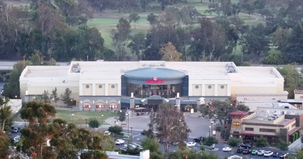
Former Muvico (now AMC Dine-In) Thousand Oaks.

Former Muvico (now AMC Dine-In) Thousand Oaks.

Century Riverpark 16 at The Collection at Riverpark

Cinemark Century Riverpark 16 at The Collection at Riverpark

Regal Edwards Camarillo Palace 12 and IMAX, 680 Ventura Boulevard, Camarillo (805.383.8879) (Located adjacent to The Promenade section of Camarillo Premium Outlets. www.regmovies.com/theatres/regal-edwards-camarillo-palace-1009

Plaza Stadium Cinemas 14, 255 West Fifth Street, Oxnard (805.487.8380). santarosacinemas.com

Regal Civic Center Plaza, Tapo Canyon Road, just north of the 118.

Other Local Theaters

Regency Theatres at The Commons at Calabasas.www.regencymovies.com/locations/calabasas-commons

Regency Santa Paula 7, 550 West Main Street, Santa Paula (805.933.6707). www.regencymovies.com/locations/santa-paula-7 Seats just $7 on Sundays!

Ojai Playhouse at 145 East Ojai Avenue (805.646.1011) (1 screen) - CLOSED FOR REPAIRS SINCE 2018 at the theater that originated in 1914. Anticipated to reopen in 2024.

CLOSED

Regal Malibu Twin at 3822 Cross Creek Road, Malibu (310.456.6990) (closed in September 2017)

Simi Valley 10 Tristone Cinemas, 1457 E. Los Angeles Avenue (805.526.4329) simivalley.tristonecinemas.com (Closed 12/5/19 “due to leasing disagreements”)

Regency Paseo Camarillo Cinemas (3 theaters), 390 North Lantana Street, Camarillo (805.383.2267). regencymovies.com/main.php?theaterId=3 (“TEMPORARILY CLOSED” SINCE AUGUST 2021.)

Regency Westlake Village Twin, 4711 Lakeview Canyon Road, Westlake Village (818.889.8061) regencymovies.com/main.php?theaterId=1 Closed 1/17/22.

Edwards Grand Palace Stadium 6, 4767 Commons Way, Calabasas (818.223.0223). www.regmovies.com/theaters/edwards-calabasas-stadium-6/C00791471576 Closed 9/15/22

Conejo Ridge Open Space in Thousand Oaks

The Conejo Ridge Open Space is located in Thousand Oaks in a 406 acre area enclosed roughly as follows:

  • Rancho Road, Rimrock Road and the Los Padres Open Space on the west.

  • Los Robles Trail on the south.

  • The industrial park at 2400 Willow Lane (at Conejo Ridge Ave)

  • Highway 101 on the north.

While I have not completely explored this area, I do find it a great place for views of the Conejo Valley. One access point is at the west end of the parking lot at 2400 Willow Lane building that faces the 101. The trail briefly parallels the adjacent businesses in a southward direction, then veers west. It is a single track trail that is surprisingly well maintained.

At the top you’ll be treated to views towards the Conejo Grade on the west, Highway 23 and beyond on the north and Ladyface Mountain in Agoura Hills towards the east. You’ll also see what the traffic looks like on the 101 down below.

You can continue southwest bound to catch other trails and trailheads.

www.conejo-openspace.org/conejo-ridge.html

conejo ridge 2.jpg
conejo ridge 3.jpg

The Oaks Mall in Thousand Oaks

The Oaks in Thousand Oaks is located between the 101 Freeway and Lynn Road at 350 West Hillcrest Avenue, running east to Wilbur Road. Originally constructed in 1978, the 1.3 million square foot shopping mall was renovated in 1993 and again in 2008. In total, there are over 170 stores and services at The Oaks.

Well known brands at The Oaks include Nordstrom, Macy’s, JCPenney, The Apple Store, Anthropologie, Pottery Barn, Williams Sonoma and J.Crew.

Restaurants include The Cheesecake Factory, The Lazy Dog Café, Olive Garden, Urban Plates, Chipotle, Pedals & Pints Brewing Co., Bazille (inside Nordstroms), Wood Ranch BBQ, and coming soon, Plata Taqueria, as well as numerous options in the food court area.

The 2008 remodel brought a multi-level parking structure with over 1,300 parking spaces and digital signs that tell you how many spaces are available. There's a beautiful outdoor shops area on the east side of the mall that leads to AMC Thousand Oaks 14 and adjacent restaurants.

For more information, visit www.shoptheoaksmall.com or call 805.495.2032.

EV charging at The Oaks: Available on the south side behind AMC Theaters and the outdoor shops area from EVgo. Additional EV charging available free of charge on north side near Macy’s Men’s & Home Store and on the west side near Macy’s Women’s Store. There are Tesla Urban Superchargers on the south side of the parking structure.
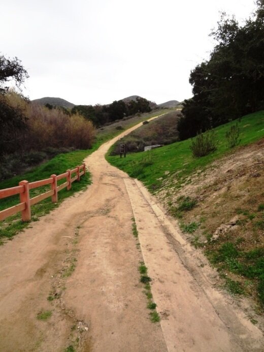
Arroyo Conejo Trail in Thousand Oaks

The Arroyo Conejo Open Space consists of 302 acres, bounded by Wildwood Park and Conejo Canyons on the north, Lynnmere Open Space on the east and the Rancho Conejo residential development on the west. There’s a trailhead at Rancho Conejo Playfield at 950 N. Ventu Park Road in Newbury Park.

RanchoConejoPlayfield_sign.JPG

The Arroyo Conejo Trail trailhead is on the far right/east section of the parking lot facing the park's restrooms and tennis courts.

Arroyo Conejo Trailhead is on the right side of the parking lot.

Arroyo Conejo Trailhead is on the right side of the parking lot.

The trail veers to the left (if you go down the initial trail to the right, you will see this is not open to the public). After passing the park, you will notice that the canyons below are mighty steep and you will hear the creek down below.

After you get to a gate (see below), the downhill is pretty significant and you may see a mini-waterfall on your way down to the creek, where you will immediately come to a crossing that, the last time I was there, had several wooden pallet crossings.

The gate that signals you are about to head downhill into the canyon.

The gate that signals you are about to head downhill into the canyon.

The first stream at the bottom of the hill had these nicely placed wooden planks to alleviate the problem of wet shoes.

The first stream at the bottom of the hill had these nicely placed wooden planks to alleviate the problem of wet shoes.

If you continue on straight, you will come across four more creek crossings. Often you will find large rocks or wood planks to walk across, but sometimes you won't find one, so be prepared for the possibility of wet feet if your plan is to reach the Hill Canyon Water Treatment Plant. If you do get that far, then turn back, you'll have done about 5 miles round trip.

Some of the stream crossings are a bit dicier getting across, that is if you don't want to get wet.

Some of the stream crossings are a bit dicier getting across, that is if you don't want to get wet.

You've reached your destination but probably don't want to be jumping in these wetlands.

You've reached your destination but probably don't want to be jumping in these wetlands.

If you're looking to extend the hike into something more strenuous, after the first stream crossing, if you look on your right you'll find a steep trail that gets you to the Lynnmere Trail.

Learn more and see a map on the Conejo Open Space Foundation website at cosf.org/trails/other-trails/moderate-hike-arroyo-conejo-to-hill-canyon.

Hill Canyon, Hawk Canyon and Western Plateau Trails in Thousand Oaks

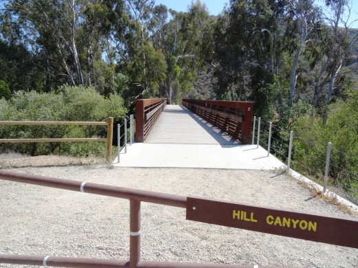
In 2012, the Conejo Canyons bridge was constructed in Thousand Oaks, opening up more trails to explore in the Western Plateau area of Thousand Oaks, which ties into Wildwood Park. Visit cosf.org/trails/conejo-canyons for trail maps.

The Hill Canyon bridge that takes you to all the action!

The Hill Canyon bridge that takes you to all the action!

Access the Conejo Canyons bridge to get to the Hill Canyon Trail, a flat path that after a mile takes you to an intersection where you can go straight ahead to the Hawk Canyon Trail, take a right turn to the Western Plateau Trail or veer left to make your way to the Arroyo Conejo Trail that takes you about 2 1/2 miles to the Rancho Conejo Playfields in Newbury Park.

The Hill Canyon Trail is as flat as they come. I see bikers, hikers and runner back here.

The Hill Canyon Trail is as flat as they come. I see bikers, hikers and runner back here.

This creek parallels the Hill Canyon Trail

This creek parallels the Hill Canyon Trail

HillHawkJuncturesign.JPG

One path I enjoy is the Hill Canyon Trail to the Hawk Canyon Trail, which veers right towards the Western Plateau Trail, which loops back to Hill Canyon Trail.  Do look at a map first as signs are not always at trail junctures (the sign above is clearly an exception!). You can actually take the Hawk Canyon Trail as well as Western Plateau Trail to Newbury Park.

There’s also the Elliot Mountain Trail and Outlaw Loop Trail, accessible from the Western Plateau Trail.

Western Plateau Trail

Western Plateau Trail

When you reach the Western Plateau Trail, if you go just a bit further north/northeast, you'll be rewarded with great views down the Conejo Grade towards Camarillo and the Oxnard Plain.

Views from the Western Plateau Trail on a bit of an overcast June morning

Views from the Western Plateau Trail on a bit of an overcast June morning

Access the Conejo Canyons bridge via Santa Rosa Road. Coming from Thousand Oaks, take Moorpark Road north down the Norwegian Grade, where it intersects with Santa Rosa Road. Continue about 3.7 miles on Santa Rosa Road and make a left on Hill Canyon Road. Drive down Hill Canyon Road and you will see a large, flat dirt parking area on the right, adjacent to Santa Rosa Valley Regional Park.

Sunset Lanes Bowling Center at Sunset Terrace Restaurant in Thousand Oaks

After much anticipation, the four-lane Sunset Lanes bowling center opened in mid-January 2024 at the Sunset Terrace Restaurant & Lounge at Janss Marketplace, 235 Moorpark Road, Thousand Oaks.

I had the good fortune to be walking by on apparently the first night of soft opening. No one was there. I was alone. So I had to give it a try.

The cost is $60 per hour, up to six bowlers per lane, plus the cost of renting shoes. Years ago I told myself I need to buy a pair of bowling shoes and put them in my trunk. I never did.

In any case, I thought, since it’s just me, I’ll just bowl for 30 minutes, which I did. I got a total of 2 1/2 games in. They have nice selection of bowling balls. I was actually impressed by how many they had on hand for just a four-lane alley.

The only thing I did not like is that the approach felt too short. There’s a table behind the lanes that I’d prefer to have a couple feet back. But I made due. It just felt like I was not able to take long enough steps in my approach. But I adjusted.

The latest trend in bowling alleys is the pins attached to strings. After you bowl, the machine lifts all the pins, then places back the pins that were not knocked down. To me, while it does not have the same feel and sound of traditional pin setting machines, it didn’t impact my bowling that much. I’m terrible at bowling, regardless. Pins on strings saves quite a bit in operational costs and repairs compared to traditional bowling, so I suspect this trend is here to stay.

Overall, this is an awesome addition to our local community. Some will complain, “it’s only four lanes,” to which I’ll reply, “it’s better than NO lanes!” Looking for something fun to do nearby…this is a great new option.

sunsetterracerestaurant.com

Los Robles Trail System in Thousand Oaks

LosRoblesTrailSign.JPG

The Los Robles Trail winds from Potrero Road, just east of Wendy Drive in Newbury Park, to Foothill Drive near Fairview Road (near Hampshire Road in Westlake Village). A popular access point is at South Moorpark Road and Greenmeadow Avenue in Thousand Oaks.

Along with its many connecting trails (Triunfo Canyon Trail, Rosewood Trail, White Horse Canyon Trail, Los Padres Trail and more), awesome opportunities abound for hikers, bikers and equestrians to enjoy the open space.

If you're looking for an easy, one mile trail hike with the kids, the Oak Creek Canyon Loop is a nice one to do. There is also a unique Interpretive Trail at Oak Creek Canyon Loop that is accessible to handicapped/wheelchairs and blind individuals! Or extend the Oak Creek Canyon Loop to an easy 3 mile hike to the Los Robles Nature Walk. Also, the 1 mile Spring Canyon Trail is an excellent choice for families with young children.

OakCreekCynLoop_sign.JPG

For some of the most spectacular views of the Conejo Valley, try hiking up to Angel Vista Peak in Newbury Park.

A rugged, single track trail popular with mountain bikers and hikers is the Los Robles Trail West that goes up "Space Mountain" in Thousand Oaks. And Los Robles Trail East is another nice hike accessible from several points.

This nearly 2,000 acre ridgeline trail system with its many neighborhood feeder trails is located at the southern portion of the Conejo Open Space. The Los Robles Trail also traverses several open space areas including Los Padres, Los Vientos, Conejo Ridge. Hope Nature Preserve, Old Conejo, Deer Ridge, Rancho Potrero and Ventu Park.

Additional Los Robles Trail trailhead points west of the Rosewood Trail trailhead to Angel Vista Peak include Felton Street, east of Lynn Rd in Newbury Park (end of cul de sac) and Potrero Road, about 1/4 mile east of S Wendy Drive in Newbury Park (parking lot available).

Views from Angel Vista Peak are iconic.

Views from Angel Vista Peak are iconic.

To the west of Los Robles is Rancho Sierra Vista/Satwiwa and Point Mugu State Park which creates a public backcountry of over 27,000 acres of open space that stretches to the Pacific Ocean at Sycamore Cove. This scenic region is part of the Santa Monica Mountains National Recreation Area and provides panoramic views of Hidden Valley, the Conejo Valley and the Channel Islands.

Los Robles Trail trailhead and parking area on Potrero Road in Newbury Park.

Los Robles Trail trailhead and parking area on Potrero Road in Newbury Park.

The Los Robles Trail has historical significance. On February 28, 1776, Juan Bautista de Anza and his band of 198 settlers came through the Conejo Valley on their way from Mexico to San Francisco. Though the 101 freeway is the actual route, the National Park Service has designated the Los Robles Trail as the official recreational route so that everyone can enjoy the only national historical trail in the state of California.

Approximately 25 miles of trails provide a contiguous route from Westlake Village to Newbury Park with several shorter loops into narrow canyons and up steep ridges. The adjoining open space areas are managed by the Conejo Open Space Conservation Agency (COSCA), a joint powers authority created by the City of Thousand Oaks and the Conejo Recreation and Park District in 1977.

Unless you are an ant, this Los Robles Trail map is too small to read...click it for a full-size pdf map!

Unless you are an ant, this Los Robles Trail map is too small to read...click it for a full-size pdf map!

For more information about the Los Robles Trail, visit the Conejo Open Space Foundation website at cosf.org/trails/los-robles.