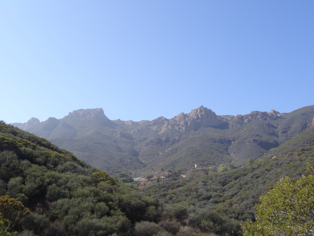
Wheeler Gorge Visitor Center and Campground in Ojai

WheelerGorge.jpg

The Wheeler Gorge Visitor Center is located at 17017 Maricopa Highway, Ojai. To reach the Center from Ventura take Highway 33 towards Ojai at the “Y” intersection (by the Vons shopping center) turn left on Hwy 33 for about eight miles.

The Center provides information about the Los Padres National Forest and also sells maps, trail guides, forest-related books, Adventure Passes and other items. It opened in June 2001. Staff are on hand to help you plan your backcountry trip planning in the area.

The Center also serves as a hub for interpretive and educational activities and programs. These include membership functions and presentations about the resources and issues of Los Padres National Forest. One of the more popular programs is the Introduction to Backpacking course.

The Visitor Center has a kitchen, classroom, library, audiovisual equipment, large parking area, outside picnic areas, and tools/equipment storage and serves as a staging area for forest projects in the southern section of the Los Padres National Forest.

The Center is open on weekends from 9am to 3pm, except Thanksgiving and Christmas. More information at lpforest.org/wheeler or call 805.640.9060.

Across the street is the Wheeler Gorge Campground, which is open year-round and offers over 60 single-family sites for tent or RV camping. Some sites are available on a first-come, first-served basis. Visit www.recreation.gov/camping/Wheeler_Gorge/r/campgroundDetails.do?contractCode=NRSO&parkId=70392 to learn more about the Wheeler Gorge Campground.

Condor Express Whale Watching in Santa Barbara

CondorExpress.jpg

The Condor Express is Santa Barbara's newest, most modern whale watching, party cruise, and private charter vessel, launched in March 2002. A beautifully appointed vessel, the Condor Express boasts large walk-around decks, a generous upper sun-deck, and a raised forward bow area. These features provide unparalleled, close-to-the-action, viewing of the Santa Barbara Channels' marine life and scenic coastline. The luxurious teak-paneled cabin seats 68 people for comfortable dining with a smoked glass skylight.

The Condor Express is the ideal platform for whale watching, island excursions, weddings and receptions, company charters, dinner cruises, educational and research trips - virtually any type of ocean outing! The Condor Express's unique combination of speed, luxury, safety, and experienced crew offers our passengers the opportunity to see and experience more of the sights, wildlife, and beauty of the Santa Barbara Channel and the Channel Islands than any other vessel.

Today, with the California Gray Whale population restored to its pre-whaling numbers (18,000-26,000), and the recent appearance of Humpback and Blue whales during the summer months (since 1992), whale watching aboard Condor Cruises has evolved into a year-round adventure.

With more than 30 years of experience, over 100,000 satisfied passengers, and a love and appreciation for the ocean and its inhabitants, Condor Cruises has evolved into one of the most successful whale watching and private charter boat operations in the U.S.

Visit www.condorexpress.com or call 805.882.0088 for more information. Trips depart delay from the Sea Landing (Cabrillo Blvd and Bath St).

Alumni Park at Pepperdine University

Situated in front of Pepperdine's Malibu campus at 24255 Pacific Coast Highway, Malibu, Alumni Park is a beautiful 30 acre expanse of lawn, rolling hills, ponds and coral trees. The two ponds are actually open reservoirs (about 40,000 square feet each) of reclaimed water, but add beauty and serenity to the park. Intramural games are played in the flat field area, and picnics can be held under the scenic coral trees lining the crest of the park.

You cannot ask for a more serene setting overlooking the Pacific Ocean on a Sunday afternoon...unless of course I'm there with my kids.  This park is not geared towards children in that there is no playground facility, etc.  But...if you're looking for a very inexpensive, yet wonderful, peaceful and romantic date, bring a picnic basket and blanket to this park with your significant other and take in the unbelievable views.

If you are looking for peace, quiet and the most amazing views of the Pacific Ocean, stop by Alumni Park in front of Pepperdine University in Malibu. Pepperdine students are blessed to have such an incredible location.

Park View Trail in Dos Vientos Section of Newbury Park

ParkViewTrail_sign1.JPG

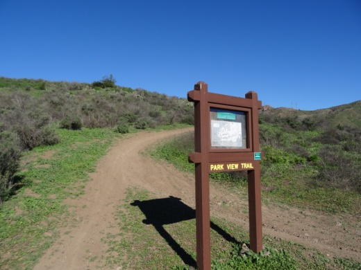
The Park View Trail is a short little 1/2 mile trail adjacent to Dos Vientos Community Park in Newbury Park. There are two main access points. There is a trailhead near the corner of Rancho Dos Vientos and Via Rincon at the southwest corner of the park, and there is another trailhead on Via Ricardo, one block east of Via Pisa.

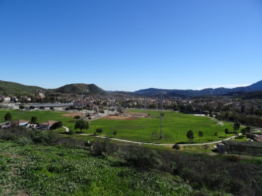
Views of Dos Vientos Community Park from the Park View Trail.

Views of Dos Vientos Community Park from the Park View Trail.

This short hike is perfect with the kids as it is not too strenuous and is adjacent to the park. Good for a quick getaway. There's also at least one geocache on this trail that's pretty cool.

Moderate trail it is. Not too steep, yet not completely flat.

Moderate trail it is. Not too steep, yet not completely flat.

View of the Edison power lines going up Conejo Mountain from Park View Trail.

View of the Edison power lines going up Conejo Mountain from Park View Trail.

Nice quick access to views of the park, Dos Vientos, the Powerline Trail and beyond. And speaking of the Powerline trail, the trailhead is directly across the street from the west end of the trail.

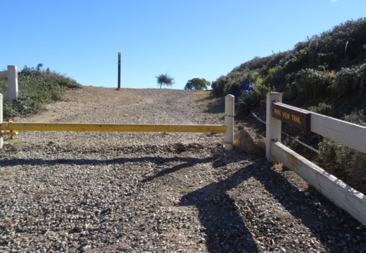
Trailhead on west side of Park View Trail off of Via Ricardo

Trailhead on west side of Park View Trail off of Via Ricardo

Interested in other Dos Vientos trails? Learn about the El Rincon, El Cerro and Las Brisas trails and the nearby (access point just south on Via Ricardo) Vista Del Mar Trail.

Fossil Trail Loop Hike in Point Mugu State Park

If you have two to three hours to spare and are looking to do about six miles of strenuous local hiking, consider trying the Fossil Trail loop in Point Mugu State Park, starting at the adjacent Rancho Sierra Vista/Satwiwa managed by the National Park Service in Newbury Park . If you're looking for a FLAT hike, this one isn't for you! Click the image below for detailed information and photos.

Oak Park Community Center and Gardens

OakParkCommCtr.jpg

Oak Park Community Center and Gardens is located at 1000 North Kanan Road, Oak Park. This is a nicely appointed indoor/outdoor facility with a 2,500 sq ft banquet room with a capacity of 140, a half court gym and recreation room and as you can see in this video, a beautifully maintained pond, waterfall, gazebo and outdoor area.  Plenty of parking available too. More information at www.rsrpd.org/oak_park/community_center/index.php or call 818.865.9304.

Santa Barbara Audubon Aviary

EyesInTheSky.png

Eyes in the Sky (EITS) is an education program with the Santa Barbara Audubon Society (SBAS) that brings a variety of programs to children and adults in the Santa Barbara area. EITS features wildlife messengers - birds of prey native to the area that are no longer capable of surviving in the wild. 

The SBAS has teamed with the Santa Barbara Museum of Natural History (2559 Puesta del Sol, Santa Barbara) to build the Santa Barbara Audubon Aviary, a physical structure located in the "backyard" area of the Museum. The Aviary is open every afternoon between 2 and 4PM. During this time, volunteers bring the birds out for exercise, sunshine, misting/baths and close up encounters with visitors.  We have seen these animals up close and they are quite impressive!

For more information, visit www.eyesinthesky.org.

AudubonAviary_building.JPG
AudubonAviary.JPG
AudubonOwl.JPG
Kisa the Peregrine Falcon

Kisa the Peregrine Falcon

Serra Retreat in Malibu

The Serra Center sign as seen from Pacific Coast Highway

The Serra Center sign as seen from Pacific Coast Highway

The Serra Retreat is a Catholic retreat and conference center located in the hills of Malibu on a 26 acre knoll, across the street from the Malibu shoreline. The location, since 1943, has welcomed church groups, schools, non-profits and other organizations a quite space for retreats and workshops.

Courtyard area facing the Pacific Ocean

Courtyard area facing the Pacific Ocean

During the week, the public is allowed to visit the grounds between 9 am and 4:30pm for personal prayer and reflection. No reservations are required. You must stop at the guard gate, located on Serra Road at PCH, about a 1/4 mile east of Cross Creek Road, obtain a guest pass, then slowly drive up Serra Road, for about a mile until you seen the turnoff on to the Retreat on the left. The actual address of the facility is 3401 Serra Road, Malibu.

Parking pass received at guard gate

Parking pass received at guard gate

There are no public restrooms at the facility and dogs are not allowed, nor or picnic lunches. This is a place for reflection, not to mention taking in the great views. There are a number of benches to reflect as you look down below as you enjoy paths and walkways and enjoy the gardens and sights. There is also a stone lined labyrinth for walking and reflection. 

Labyrinths are always cool, both to look at and to walk.

Labyrinths are always cool, both to look at and to walk.

You can get married here too, with two locations to celebrate after the ceremony. Capacity is 120 guests.

Learn more at serraretreat.com.

The view is not too shabby either!

Grotto Trail Hike at Circle X Ranch in Malibu

Although it takes a bit of patience getting from the Thousand Oaks area to Circle X Ranch nestled in the Santa Monica Mountains in Malibu, Sandstone Peak (highest point in the Santa Monica Mountains), the Mishe Mokwa Trail (including the amazing Balanced Rock) and the Grotto Trail make it a worthwhile trek.

The Grotto Trail is a 3 1/2 mile round trip hike from the Ranger Station at Circle X Ranch at 12896 Yerba Buena Road, Malibu

You can park in front of the Circle X Ranch building, then follow the signs down to the Grotto Trail trailhead adjacent to the group campground. Parking is free. There is a restroom and drinking fountain along with maps available. A park ranger may also be on hand to answer any questions.

The mostly single track trail leads you on rolling terrain down to an area called The Grotto, where you will find a creek and, in winter months, a waterfall. The trail is a bit rocky but can be done by most ages. The hills are rolling, the terrain varies with rocks, a areas with steps, etc. There is also ample amounts of poison oak growing on the sides of the trail various section, so do be aware. That said, I've been here several times with the kids and we managed to avert any issues.

Bikes are not allowed on the Grotto Trail. Dogs are allowed on leash, until you reach the streambed at the bottom of the canyon.  Learn more at www.nps.gov/samo/planyourvisit/circlexranch.htm.

Grotto Trailhead sign adjacent to circle X campground

Grotto Trailhead sign adjacent to circle X campground

So what makes the Grotto Trail special? Well, you hike down through a canyon leading to the west fork of the Arroyo Sequit. Plenty of shade and views all over. Once you reach the bottom of the trail, there is a creek. You'll hear running water pretty much year-round (though in late summer it can be a trickle). If you keep trekking down the unimproved creek bed, you'll come across large boulders and rock formations down to the "Grotto," a caved area pooled with water. But to get down there is not for everyone. You'll want to have both hands available as you climb down the boulders to the cave below. It is pretty cool though and you can explore without actually getting into the water. Photos below.

About .4 mile into the hike, you'll see see this sign for the Canyon View Trail, which takes you .6 mile up to a small parking area off of Yerba Buena Road (about halfway between Circle X Ranger Station and Sandstone Peak trailhead)

About .4 mile into the hike, you'll see see this sign for the Canyon View Trail, which takes you .6 mile up to a small parking area off of Yerba Buena Road (about halfway between Circle X Ranger Station and Sandstone Peak trailhead)

Watch out for the poison oak on the sides of the trail...there's plenty of it but you can avert it if you are aware.

Watch out for the poison oak on the sides of the trail...there's plenty of it but you can avert it if you are aware.

Another sign, the final sign you'll see, .7 miles from the trailhead.

Another sign, the final sign you'll see, .7 miles from the trailhead.

Some nice views of the surrounding canyons and towards Sandstone Peak.

Some nice views of the surrounding canyons and towards Sandstone Peak.

Eventually you'll reach this tree-lined area next to a creek that leads to the grotto area.

Eventually you'll reach this tree-lined area next to a creek that leads to the grotto area.

Continue your way to the grotto through this unmarked, increasingly rocky section.

Continue your way to the grotto through this unmarked, increasingly rocky section.

For many, this may be the endpoint for your hike once you see these boulders. But there's a path (I won't call it a trail, because it isn't) on the right hand side that, with a bit of patience, will get you to the cave below.

For many, this may be the endpoint for your hike once you see these boulders. But there's a path (I won't call it a trail, because it isn't) on the right hand side that, with a bit of patience, will get you to the cave below.

Not exactly easy but do-able. After the boulders there's a dirt path that I slipped on and flew nearly parallel to the ground, landing my lower back on a tree root. I survived but my utterances had to be bleeped out by censors.

Not exactly easy but do-able. After the boulders there's a dirt path that I slipped on and flew nearly parallel to the ground, landing my lower back on a tree root. I survived but my utterances had to be bleeped out by censors.

View of the grotto cave from the outside. You can go inside there either through the water if you are prepared or through a hole formed by boulders above the cave, which we opted not to attempt. Maybe next time. It is pretty cool in there!

View of the grotto cave from the outside. You can go inside there either through the water if you are prepared or through a hole formed by boulders above the cave, which we opted not to attempt. Maybe next time. It is pretty cool in there!

Definitely an interesting place to explore. this is above the cave area. But do watch for snakes and such down here too 

Definitely an interesting place to explore. this is above the cave area. But do watch for snakes and such down here too 

Community Center Park in Camarillo

Community Center Park in Camarillo is home to the administrative offices of the Pleasant Valley Recreation and Park District, Community Center, Senior Center, classrooms and quite a nice park that is host to numerous community activities year-round. The park is nearly 13 acres and plenty of parking.

Community Center Park is located at 1605 E. Burnley Street in Camarillo. For more information, visit www.pvrpd.org/community-center-park or call 805.482.1996.

Eagle View Park in Oak Park

EagleViewPark_sign.JPG

Eagle View Park is located at 1240 Hidden Springs Avenue in Oak Park, near the very top of Lindero Canyon Road. This is a nice little neighborhood park with a basketball court, bike path, recreational trail, picnic tables and play areas. No restroom though! The park is maintained by the Rancho Simi Recreation and Park District at www.rsrpd.org.

Play area for bigger kids

Play area for bigger kids

Play area for little kids

Play area for little kids

Recreational trail accessible just southeast of the park

Recreational trail accessible just southeast of the park