Hiking to the Waterfall in Pt Mugu State Park from Rancho Sierra Vista/Satwiwa

One of the most popular hikes in the Rancho Sierra Vista/Satwiwa open space in Newbury Park is to a small waterfall in the adjacent Boney Mountain Wilderness. The hike is about 3 1/2 miles round-trip from the Satwiwa Native American Indian Culture Center and is a moderate hike that can be done by all ages.

Keep in mind that in drought years, there’s sometimes not more than a trickle flowing down this waterfall, while in rainier years like 2023-2024, the waterfall is quite active. In either case, it’s a fun hike to do.

You have two primary options for where to start the hike. You can drive into the Rancho Sierra Vista park entrance on Via Goleta in Newbury Park and park in a lot that is a brief walk to the Culture Center, or you can park at the Wendy Drive and Potrero Road trailhead and add an another two miles, round trip, to your adventure.

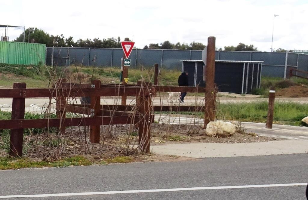
The entrance to Rancho Sierra Vista/Satwiwa at Via Goleta, 1 mile west of Reino Road.

The entrance to Rancho Sierra Vista/Satwiwa at Via Goleta, 1 mile west of Reino Road.

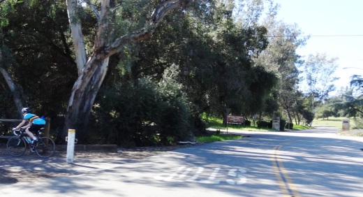
The trailhead where Wendy Road ends at Potrero Road in Newbury Park

The trailhead where Wendy Road ends at Potrero Road in Newbury Park

The Satwiwa Native American Indian Culture Center is a small building open from 9am to 5pm on weekends where you can learn about native Chumash items and local wildlife.

The Satwiwa Native American Indian Culture Center is a small building open from 9am to 4pm on weekends (as of April 2024) where you can learn about native Chumash items and local wildlife.

Next to the Culture Center, you'll see multiple paths, all of which can get you to your destination, but the most direct path is the Satwiwa Loop Trail seen on the left, which crosses through a meadow that can be quite green and beautiful in late Winter/early Spring and dry and brown the rest of the year. An alternate route is on the right of the picture above - the Big Sycamore Canyon Trail (paved road) to the Boney Mountain Trail, where you'll take a left.

Satwiwa Loop Trail section that takes you diagonally through the meadow. Seen here when it is nice an green.

Satwiwa Loop Trail section that takes you diagonally through the meadow. Seen here when it is nice and green.

At the end of the meadow, continue straight up a fairly steep hill, where on the right hand side you'll see the Sycamore Canyon Overlook bench shown below.

RSVW_sycoverlook.JPG

bench on sycamore canyon overlook

Hike up the moderately steep and rocky path up the hill behind the bench and you'll reach another fork in the road. If you veer left at this juncture you'll be on the Hidden Valley Overlook Trail within Rancho Sierra Vista/Satwiwa. Stay to the right and you'll be entering the Boney Mountain Wilderness area within Point Mugu State Park.

Sign that shows you the Hidden Valley Overlook Trail is on the left.

Sign that shows you the Hidden Valley Overlook Trail is on the left.

Veering right into the State of California managed Pt Mugu State Park; as you can see, dogs are not allowed in the back country area of the park.

Veering right into the State of California managed Pt Mugu State Park; as you can see, dogs are not allowed in the back country area of the park.

This trail is referred to as Danielson Road, named after the last private owner of these lands. The path down into the canyon is seen below (taken from a higher point en route to the Danielson Monument).

View of the initial section of Danielson Road trail down into the canyon; this is the path you will be taking towards the waterfall.

View of the initial section of Danielson Road trail down into the canyon; this is the path you will be taking towards the waterfall.

Danielson Road is a bit on the steep side but I see folks young and old walking up and down this section all the time. Seen here in very dry conditions.

Danielson Road is a bit on the steep side but I see folks young and old walking up and down this section all the time. Seen here in very dry conditions.

RSVW_waterfalltrailsign.JPG

THIS IS THE OLD SIGN, WHEN IT WAS CALLED DANIELSON ROAD (PRIOR TO 2024)

NEW SIGN IN 2024 SHOWING THE “OLD CABIN TRAIL” INSTEAD OF DANIELSON ROAD.

After .4 mile, you will reach the bottom of the canyon and see the sign above, the final sign indicating you are on your way to the Waterfall Trail. Then you will cross a creek bed, which can have water in it after the rains. The photo taken below in January 2015 shows minimal moisture, making it easy to cross. Some years you may have to rock hop your way a bit over the creek.

RSVW_stream.JPG

Creek bed crossing on the way to the waterfall IN 2015

Creek Crossing in April 2024.

After you cross the creek, the remainder of the trail to the waterfall is single track. Be careful not to come in contact with poison oak often seen on the sides of the trails. For this reason, I would generally not recommend strollers be taken up here.

Soon you will reach the final fork in the road. Go straight and soon you will be at the waterfall. To the right, the Old Cabin Trail (formerly Danielson Road Trail) continues upward to the Danielson Monument.

RSVWaterfallFeb17.JPG

the waterfall in april 2024.

Over 140 Summer Camps and Programs In and Around Ventura County

SummerCamps.jpg

Looking for a summer camp within range of Ventura County? Here's a list of over 140 summer day camps and residential camps and programs in the area.

We've categorized the camps into three main groups; Traditional/Learning, Sports and Music/Arts, though many camps cover numerous fun activities all in one.

Know of more? Submit them here!

No doubt there will be some typos/errors on this list, so let us know if you find one.

Traditional Day Camps, Overnight Camps and Other Camps

Sports Camps

Music/Arts/Science Camps

Highlights of a Dozen Fun Things to See and Do In and Around Camarillo

Residents voted to incorporate Camarillo as a city on September 29, 1964 (the same day that Thousand Oaks residents voted to do the same). Today Camarillo has the 5th largest population out of 10 cities in Ventura County, with about 71,000 residents.

One neat feature of Camarillo is its revitalized Old Town on Ventura Boulevard, a one mile stretch adjacent to Highway 101 between Lewis Road and Carmen Drive. There is a mixture of eateries, galleries, salons, boutiques and shopping along the pedestrian friendly thoroughfare that has transformed the area. Parking is free. More at www.facebook.com/camarillooldtown.

Here are a dozen other fun things to explore, see and do in Camarillo:

The roughly 2 mile Calleguas Creek Bike Path from Pleasant Valley Fields to the corner of Flynn and Upland Road in Camarillo is a family favorite, providing 4 miles of bicycling round-trip. The path is adjacent to Calleguas Creek with several street underpasses, keeping the path completely free of vehicular traffic.

Calleugas Creek Bike Path

Calleugas Creek Bike Path

McGrath Family Farm off the Central Avenue 101 offramp grows organic fruits, vegetables and flowers and is open 7 days a week from spring through fall. McGrath also offers farm tours, visits with the farm animals and "pick your own" produce. A quick, healthy and fun stop with the kids.

McGrathProduce9.9.12.jpg
CAF170.jpg

The Commemorative Air Force Southern California Wing Aviation Museum is open Friday through Sunday at the Camarillo Airport with hangars devoted to preserving, displaying and flying World War II aircraft. Docents are extremely knowledgeable and eager to share information.  This is a Camarillo must-see.

Also at the Camarillo Airport is the annual Wings Over Camarillo Air Show in the August time frame. This is a weekend display of restored World War II military aircraft in flight, aerobatic, vintage and experimental aircraft displays, classic cars and plenty of family fun. This is one event in Camarillo that you have to see up close at least once. Visit wingsovercamarillo.com for more information.

The Camarillo Ranch House is a 3-story, 14 room, 6,000 square foot Victorian home built by Adolfo Camarillo in 1892. The City restored the beautiful home to what it looked like during the 1914 to 1930 time frame. Today the house is a popular event venue and is open for docent-led tours several days a week. The Camarillo Ranch was added to the National Register of Historic Places in 2003.

The Camarillo Ranch House is a popular wedding and other special events destination.

The Camarillo Ranch House is a popular wedding and other special events destination.

I'm amazed at how few of the people I talk to have heard of the Western Foundation of Vertebrate Zoology, more popularly known as the Camarillo Bird Museum. The 22,000 sq ft non-descript facility in an industrial office park hosts a collection of over 250,000 sets of bird eggs representing approximately 4,000 species; 18,000 nests and 56,000 bird study skins. The Museum is open to the public for one-hour tours on Wednesdays and Fridays from 10am to 2pm.

CamBirdMuseumLR.jpg
CamPremOutlets170.jpg

The Camarillo Premium Outlets is Ventura County's premiere outlet mall, featuring over 160 shops and eateries. On the east side are the original outlets, including the Main Court and Fashion Court, while on the west is the newer The Promenade section. In between is the Edwards Camarillo Palace 12.

Harley's Camarillo Bowl is the go-to spot for most kids that I know in the Conejo Valley who throw bowling birthday parties. I know because when the kids go bowling, I make sure to join them. Harley's gets the job done with 20 lanes, a small arcade, and a bar that serves up cold beer.

There are dozens of great farmers' markets around Ventura County, including the Saturday morning Camarillo Certified Farmers Market in Old Town Camarillo from 8am to noon.

There are a number of nicely appointed parks of all shapes and sizes in Camarillo, including six larger parks. One of my favorites is the hidden away Camarillo Grove Park at the bottom of the Conejo Grade, 6968 E. Camarillo Springs Road. This 24.5 acre park offers hiking trails, a dog park, outdoor nature center and more.

A trail at Camarillo Grove Park

A trail at Camarillo Grove Park

The Pleasant Valley Historical Museum is dedicated to the preservation of local history and the adjoining Charles L. Honn Botanical Garden features plants and trees indigenous to the Pleasant Valley and the surrounding region. Both are fun, short, worthwhile visits, which is good because the Museum and Garden are only open from noon to 4:00 p.m. on Saturday and Sunday, except holidays. Admission is free. (MUSEUM IS UNDERGOING EXPANSION AND IS CLOSED AS OF JANUARY 2024. Check their website for updates at pvhsonline.org.

Several Dozen Things to See and Do in the City of Oxnard

OxnardSign.JPG

The City of Oxnard was incorporated on June 30, 1903. Covering an area of just over 39 miles, of which 70% is land, Oxnard is the most populous city in Ventura County, with nearly 208,000 residents in 2016.

Oxnard's namesake is Harry T. Oxnard, who opened a beet factory in 1899 and taught local farmers the ins and outs of growing sugar beets. The land for the factory was purchased from Thomas S. Rice (of Rice Avenue fame) and the first plant manager was Major J. A. Driffill, who later became mayor.

There's plenty to see and do in Oxnard, and we've summed up some of our favorite activities below.

Great beaches in Oxnard include Mandalay Shores, Hollywood Beach and Silver Strand Beach, which are highlighted at THIS LINK.

Speaking of beaches, Oxnard Beach Park is a nice park with a pirate-themed, accessible playground area, large grassy area, restrooms and quick access to the beach.

The Channel Islands Maritime Museum located at the Channel Islands Harbor is home to world class maritime art, ship models and other maritime items. Admission is free the 3rd Thursday of the month.

Channel Islands Harbor is a great place to beat the heat with the family, offering a variety of activities, such as fishing trips, boat cruises, eateries, water sports, shopping and special events year-round.

Oxnard Beach Park

Oxnard Beach Park

There's a nice bike path in Oxnard that takes you from Oxnard Beach Park to Channel Islands Harbor that we enjoy from time to time.

The Henry T. Oxnard Historic District is located on F and G Streets, between Palm and 5th Streets. The area was added to the National Register of Historic Places in 1999. Most of the 144 historic homes and buildings in the area were built before 1925 and includes Mission/Spanish revival, bungalow/craftsman and Colonial Revival architecture.

A great time to check out the Historic Oxnard District is during the two weeks preceding Christmas each year, when dozens and dozens of residents decorate their homes in lights and holiday decor for Christmas Tree Lane.

The Oxnard Performing Arts Center hosts concerts, musicals, speakers and other performances year-round. At over 1,600 seats, it is one of the largest venues in Ventura County and is a performance venue for the New West Symphony.

The Collection at RiverPark is an outdoor shopping center located on the northeast side of the 101 between the Oxnard and Vineyard exits. The 650,000 sq ft center includes a combination of entertainment, retail, restaurants, open space with fountains, parks and playgrounds and quality art. Activities at The Collection include The Painted Cabernet, Color Me Mine Ceramics Studio, Century RiverPark Movie Theater and Levity Live Comedy Club, Jump ‘n Jammin Children’s Entertainment Center, Red Door Escape Room and Bowlero.

Something we have to be extremely thankful for here in Ventura County is the endless supply of strawberries grown on the Oxnard Plain. The annual California Strawberry Festival held the 3rd weekend of May each year in Oxnard showcases our favorite local fruit!

Swing for the fences at Who's on First Batting Cages in Oxnard. What's on second? I don't know's on third. Who? First base.

The Murphy Auto Museum houses a collection of over 40 vintage and classic cars, artifacts. (However, the museum announced it will be closing its doors in July 2024.)

Hollywood Beach

Hollywood Beach

River Ridge Golf Course is a public golf course offering two 18-hole courses as well as footgolf!

Skateboarders and in-line skaters are on a roll at the City of Oxnard Bedford Pinkard Skate Park near Channel Islands High School. Pinkard is a former City Council member who was a supporter of many youth and community programs.

First Thursdays Food Trucks at Plaza Park in Oxnard is a popular gastronomic destination.

The Elite Theatre Company, located at Fisherman's Wharf at Channel Islands Harbor, Fisherman's Wharf, is host to musicals, plays, comedies and more.

The Dallas Cowboys have held Summer Training Camp for a number of years at River Ridge Fields at Oxnard's Marriott Residence Inn. Practices and scrimmages taking place in August are open to the public and free of charge. Check for updates at www.dallascowboys.com/trainingcamp.

The Carpinteria Tar Pits are One of Five Natural Asphalt Lake Areas in the World

The Carpinteria Tar Pits at Carpinteria State Beach are located in a designated area called Tar Pits Park. The Carpinteria Tar Pits are one of five natural asphalt lake areas in the world, 2nd in size to and older than the La Brea Tar Pits in Los Angeles.

These tar pits date back to the Pleistocene Age (Ice Epoch), which 2.6 million to 11,700 years ago. Evidence of imperial elephants, the giant sloth, bison, wolf, tusked mastodons and camels have been discovered in t

Read More

Memorial Day Weekend Events and Activities Around Ventura County

Memorial Day is a holiday to remember those who died while serving in the armed forces. Memorial Day was declared a national holiday by an act of Congress in 1971, but its beginnings go back to after the Civil War in 1868.

According to the U.S. Department of Veterans Affairs, cities in the North and South claim to be the birthplace of Memorial Day in 1866. But in 1966, Congress and President Lyndon B. Johnson declared Waterloo, N.Y. as the birthplace of Memorial Day.

Memorial Day was originally called Decoration Day.

Traditionally, Memorial Day was May 30th each year. That was changed to the last Monday in May when the Uniform Monday Holiday Act was signed into law in June 1968 and put into effect in 1971.

In 2000, the National Moment of Remembrance Act was enacted by Congress to ask Americans to pause in an act of national unity at 3 p.m. local time on Memorial Day.

Here is a compilation of activities and events this 2023 Memorial Day weekend around Ventura County and adjacent areas.

Hike to the Teepee, Paradise Falls and Little Cave at Wildwood Park in Thousand Oaks

One hiking experience that everyone in the Conejo Valley and neighboring areas has to experience is Wildwood Park. With 14 trails covering 17 miles in the nearly 1,800 acre park managed by the Conejo Open Space Conservation Agency, there is plenty to see and do in Wildwood Park.

One particularly fun and fairly easy family hike at Wildwood takes you from the main parking lot at the west end of Avenida de los Arboles to the Teepee, Paradise Falls and Little Cave (formerly Indian Cave**). Take the Mesa Trail about a 3rd of a mile until you see the sign below, then take a left.

Another third of a mile and you're at the teepee, where you'll find another clearly marked sign pointing you in the direction of Paradise Falls.

Another third of a mile and you're at the teepee, where you'll find another clearly marked sign pointing you in the direction of Paradise Falls.

WildwoodTeepee3.JPG

Hike down some switchbacks and stairs and you'll see be at the beautiful Paradise Falls. Always a fun place to take the kids, though we're warned not to go into the water, which is largely urban runoff.

ParadiseFalls2.JPG
ParadiseFalls4.jpg

But it is sure popular and enjoyable to sit back and enjoy this year-round waterfall that is so nicely hidden yet so close to hustle and bustle of suburban Thousand Oaks.

ParadiseFalls11.3.13.JPG

The Little Cave is roughly half a mile east of Paradise Falls and can be accessed from the trail directly above the falls or by hiking back up to the teepee and going the other direction.

Trail adjacent to Paradise Falls that takes you towards the Indian Cave.

Trail adjacent to Paradise Falls that takes you towards little Cave.

A quarter of a mile or so and you'll see the sign below.

Little Cave (Formerly Indian Cave) sign

Here's the sign indicating you are near the Indian Cave in Wildwood Park.

Formerly called indian cave

Another 100 yards or so and you've reached the staircase that will take you up to the Cave.

Large enough to actually hang out in, though the last time we walked in there were signs of rodents.

Large enough to actually hang out in, though the last time we walked in there were signs of rodents.

IndianCave5.JPG

You can literally climb through the cave to an exit at the top and hike your way up to a connector trail that will lead you back towards the parking lot. My kids love this and so do I!

** The change in name was approved by the Conejo Open Space Conservation Agency (COSCA) in May 2022. COSCA received a request to change the Indian Creek Trail name earlier that year. On its own, the work "Indian" refers to individuals from India, rather than Native Americans, and thus did not accurately reflect the origin of the people to whom it refers.

The Indian Cave and Indian Cave Trail were renamed Little Cave as it was unclear if the cave was naturally formed and/or historically used by Native Americans.

The Indian Creek Trail in Wildwood Park was renamed Two Springs Trail as two natural springs contribute to the stream flow in this portion of the channel.