Dave & Buster's in Thousand Oaks

Dave & Buster’s opened in the Janss Marketplace at 145 W. Hillcrest Drive in Thousand Oaks on March 4, 2019. This 40,000 square foot location offers a full lunch and dinner menu, large bar area with dozens of TVs, arcade games, virtual reality games, billiards, and more. Visit www.daveandbusters.com/us/en/about/locations/thousand-oaks for more information or call 805-857-7800.

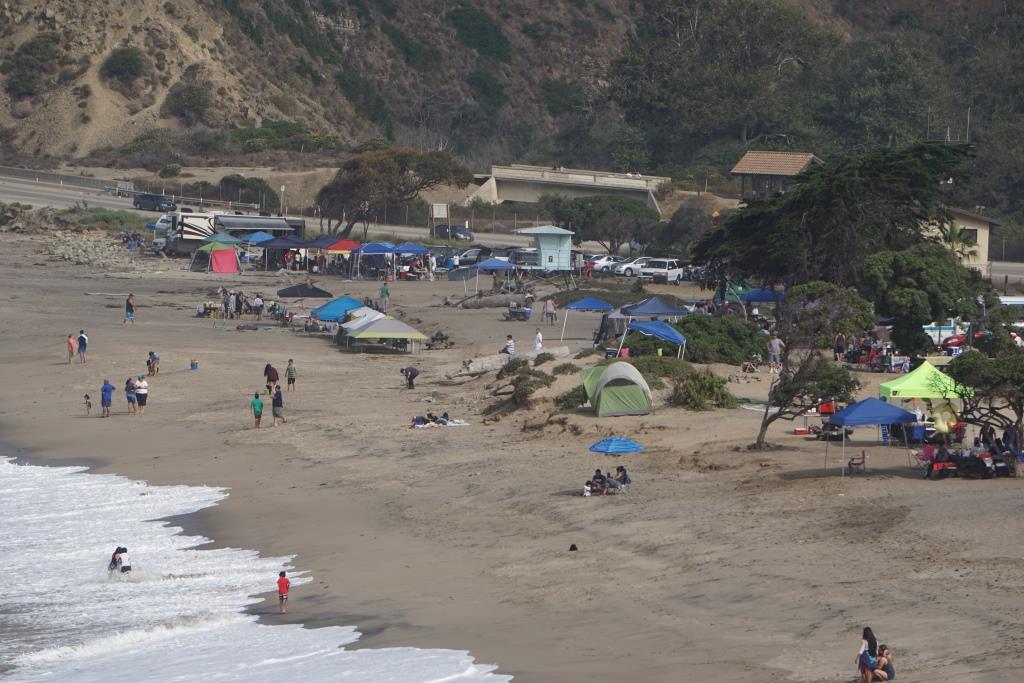
Sycamore Cove Beach in Point Mugu

sycamorecovesign.JPG

Sycamore Cove Beach is located at 9000 Pacific Coast Highway in Point Mugu. This beach is one of the closest and easiest to get to from the Conejo Valley and Camarillo via Las Posas and PCH.

Sycamore Cove Beach in the background. Sycamore Canyon Campground entrance on left.

Sycamore Cove Beach in the background. Sycamore Canyon Campground entrance on left.

The beach is popular with families looking to barbecue and enjoy quick and easy access to the beach. There are also porta-johns and restrooms available. Very limited parking on PCH (read the signs carefully as you don't want to get ticketed) but plenty of paid parking available (generally $12 to $14 for the day).

Dogs on a leash are allowed in day use areas, campgrounds and beaches within Point Mugu State Park. Dogs are not allowed on backcountry trails or dirt roads.

A view of Sycamore Cove Beach from the south.

A view of Sycamore Cove Beach from the south.

On the northwest end of the beach you can walk underneath PCH to the other side of PCH, where Sycamore Canyon Campground is located. From there, you can take Sycamore Canyon up to Newbury Park (about eight miles).

PCH is above. You can safely get from Sycamore Cove to Sycamore Canyon under this bridge (though at high tide can be a challenge). Beats risking your life crossing PCH!

PCH is above. You can safely get from Sycamore Cove to Sycamore Canyon under this bridge (though at high tide can be a challenge). Beats risking your life crossing PCH!

Due north of Sycamore Cove Beach is Thornhill Broome Beach/Campground, which along with Sycamore Cove and Sycamore Canyon is part of Point Mugu State Park. Across from Thornhill Broome is the large sand dune that makes for some fun climbing.

The humongous sand dune walking distance from Sycamore Cove.

The humongous sand dune walking distance from Sycamore Cove.

Visit www.parks.ca.gov/?page_id=630 for more information.

The Oaks Mall in Thousand Oaks

The Oaks in Thousand Oaks is located between the 101 Freeway and Lynn Road at 350 West Hillcrest Avenue, running east to Wilbur Road. Originally constructed in 1978, the 1.3 million square foot shopping mall was renovated in 1993 and again in 2008. In total, there are over 170 stores and services at The Oaks.

Well known brands at The Oaks include Nordstrom, Macy’s, JCPenney, The Apple Store, Anthropologie, Pottery Barn, Williams Sonoma and J.Crew.

Restaurants include The Cheesecake Factory, The Lazy Dog Café, Olive Garden, Urban Plates, Chipotle, Pedals & Pints Brewing Co., Bazille (inside Nordstroms), Wood Ranch BBQ, and coming soon, Plata Taqueria, as well as numerous options in the food court area.

The 2008 remodel brought a multi-level parking structure with over 1,300 parking spaces and digital signs that tell you how many spaces are available. There's a beautiful outdoor shops area on the east side of the mall that leads to AMC Thousand Oaks 14 and adjacent restaurants.

For more information, visit www.shoptheoaksmall.com or call 805.495.2032.

EV charging at The Oaks: Available on the south side behind AMC Theaters and the outdoor shops area from EVgo. Additional EV charging available free of charge on north side near Macy’s Men’s & Home Store and on the west side near Macy’s Women’s Store. There are Tesla Urban Superchargers on the south side of the parking structure.

Skateboarding Hall of Fame and Museum in Simi Valley

The Skateboarding Hall of Fame and Museum opened at the Simi Valley Town Center in December 2018. It is located directly across from the Vans store in the mall in a space of over 10,000 square feet.

The International Skateboarding Hall of Fame is a 501(c)(3) non-profit founded by Todd Huber. It was created to honor the passion, dedication and contributions to skateboarding history and culture by skateboarders and cultural icons through the decades.

The museum displays hundreds of skateboards and other skating artifacts spanning decades. There is also an art gallery, gift shop, theater/library (over 600 skating videos as well as skating magazines) and skate shop.

Also on site is s skate park with a fun wall ride available to local youth. Cost is $15 (as of March 2024).

Admission to the museum is free. Donations to the non-profit are always welcome.

Visit www.skateboardinghalloffame.org for more information. Hours as of March 2024 are Wed-Fri 2-8pm, Sat 11am-8pm and Sun noon-5pm.

Ventura County Area Parks

There are hundreds of parks in Ventura County and surrounding areas. DOZENS of them are described in the Kid Fun section of CVG with pics and videos for you to check out!

But here is a compilation with links to all the various parks in the area.

Agoura Hills: www.agourahillscity.org/department/community-services-parks-recreation/parks-facilities/parks (6 parks)

Calabasas: www.cityofcalabasas.com/government/community-services-parks-recreation/parks-trails-and-facilities (8 parks)

Gates Canyon Park in Calabasas

Gates Canyon Park in Calabasas

Camarillo: www.pvrpd.org/parks-list (28 active and passive use parks)

Malibu: www.malibucity.org/Facilities (6 parks)

Moorpark: www.moorparkca.gov/DocumentCenter/View/94 (18 parks)

Oak Park: rsrpd.org/parks/oak_park/parks/index.php (10 parks)

Ojai: www.ojairec.com/221/City-Parks (8 parks)

Oxnard: www.oxnard.org/city-department/public-works/parks (58 parks)

Port Hueneme: www.ci.port-hueneme.ca.us/index.aspx?nid=553 (6 parks)

Santa Paula: spcity.org/300/Parks-Facilities (11 parks)

Simi Valley: rsrpd.org/parks/simi_valley/parks/index.php (37 parks)

Conejo Valley (Thousand Oaks/Newbury Park/Westlake Village) www.crpd.org/parks-reservations/parks (51 parks)

Thousand Oaks Community Park

Thousand Oaks Community Park

Ventura: www.cityofventura.ca.gov/1952/City-Parks (24 parks)

County of Ventura Beach Front Parkswww.ventura.org/gsa/parks/beach-front-parks (3 parks)

County of Ventura Inland Parkswww.ventura.org/inland-parks (13 parks)

Westlake Village: www.wlv.org/city_services/parks-rec.asp (8 parks)

Arroyo Simi Bike Path in Simi Valley

The Arroyo Simi Bike Path is a two lane bike path in Simi Valley that runs from Madera Road, just south of Easy Street on the west, ending at Cochran Avenue between Fig Street and Ralston Street on the east (more recently, the path has been extended east to Tapo Street).

Over seven miles in total. It is also referred to as the Arroyo Simi Greenway.

The Arroyo Simi is a waterway that begins at Corriganville Park in east Simi Valley and extends west all the way through Simi Valley until into merges into Arroyo Las Posas and Conejo Creek into Calleguas Creek. It is managed by the County of Ventura but the Rancho Simi Recreation and Park District has access to the pathway for recreational use.

While this path is nowhere near as visually appealing as bike paths along Ventura Beach and such, the Arroyo Simi Bike Path is almost entirely flat and allows passageway along much of Simi Valley from east to west. You can really do a lot of exploration from this artery. We like to park at the East Street entry point and bike to Rancho Simi Community Park (2.2 miles one way), Rancho Santa Susana Park (6 miles one way) and various other areas.

Because this path is so long and flat (and not crowded), it is a nice destination for learning to ride. However, do be aware that there are a number of street crossings where you are asked to walk your bike across. They are protected by lights and signs, however.

Arroyo Simi bike path entry point at Easy Street and Madera.

Arroyo Simi bike path entry point at Easy Street and Madera.

Arroyo Simi Bike path may not be the most picturesque path but is nicely flat and goes a long way!

Arroyo Simi Bike path may not be the most picturesque path but is nicely flat and goes a long way!

There are numerous entry points to the path, which largely parallels Los Angeles Avenue; this one is just east of Ralston off of Los Angeles Avenue.

There are numerous entry points to the path, which largely parallels Los Angeles Avenue; this one is just east of Ralston off of Los Angeles Avenue.

Commemorative Air Force Aviation Museum at Camarillo Airport

Located at the Camarillo Airport at 455 Aviation Drive, the Southern California Wing of the Commemorative Air Force has hangars devoted to preserving, maintaining, displaying, and flying World War II aircraft.

The Commemorative Air Force Southern California Wing Aviation Museum is open Fridays and Saturdays from 10 am to 4 pm and Sundays noon to 4pm. (As of January 2024.)

Donations requested of $15 for adults, $10 for ages 10 to 18, $5 for ages 6 to 10. Kids under 6 and active military are free (as of January 2024). Visit www.cafsocal.com or call 805.482.0064 for more information.

Also, take a vintage WWII airplane ride on the only remaining U.S. Navy/Marine Mitchell B-25 PBJ Bomber, the open cockpit Primary Trainer PT-19, the SNJ Texan and the Aircoupe. Details at www.cafsocal.com/warbird-ride-program.

Docents are enjoyable to speak with as they have a lot of history to share at this museum. Two 15,000 sq ft hangars and a 32,800 sq. ft. hangar complex serve as a Museum Hangar and a Maintenance and Restoration Hangar.

The Museum Hangar contains some of the many artifacts that are currently on display as well as a gift shop. It also houses any of the aircraft that are not away on a mission or undergoing maintenance.  For safety reasons the maintenance hangar is not available for a walk-through, however visitors can observe any work in progress from behind a safety perimeter.

There are a number of aircraft on display, including several you can physically inspect, which is always fun to do with the kids. There are some interesting WWII exhibits on hand too. 

The only authentic Marine BPJ-1J variant of the famed Mitchell B-25 Bomber. It flew into Camarillo from Midland, TX in 1993 for a 20 year restoration project. It is now flight-ready!
The only authentic Marine BPJ-1J variant of the famed Mitchell B-25 Bomber. It flew into Camarillo from Midland, TX in 1993 for a 20 year restoration project. It is now flight-ready!

CAF_1.jpg
CAF_2.jpg
The Kakovlev Yak-3 is widely considered the lightest fighter aircraft between 1939 and 1945.

The Kakovlev Yak-3 is widely considered the lightest fighter aircraft between 1939 and 1945.

Santa Susana Depot Museum and Model Railroad in Simi Valley

SantaSusana_pic1.JPG

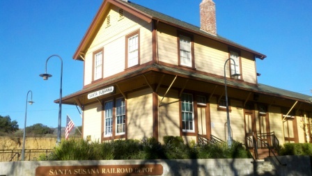
Visit a fully restored Southern Pacific Railroad depot that was built in 1903 with both freight and passenger trains rushing by at the Santa Susana Depot Museum and Model Railroad. The depot served passengers and farmers in Simi Valley for over 60 years, with a classic passenger waiting room featuring a pot-belly stove, the depot was also headquarters for local freight shipments.

The depot is a museum filled with hundreds of items having both railroad and local historical significance. The depot is owned and managed by the Rancho Simi Recreation and Park District, which took it over from the Southern Pacific Railroad in 1973. The depot was moved to its current location and after 10 years of neglect was restored to its current state by 1996. The depot was restored to what it looked like in 1938.

Also at the depot is the Santa Susana Model Railroad Club’s large operating HO scale model railroad. Located inside the depot's freight room, the layout of the railroad portrays Simi Valley during the mid 1950s. Trains run each weekend, with Sundays being the best day to see several trains operating simultaneously.

The depot is located on the grounds of Simi Valley’s beautiful Oak Knolls Park. For you rail fans, the depot is adjacent to the Union Pacific Railroad’s busy “Coast Line,” which is also utilized by both Amtrak and Metrolink passenger trains. You will standing in close proximity to passing trains, so get ready to wave!

The depot is located at 6503 Katherine Road in Simi Valley. For more information and a map to the depot/parking, visit www.santasusanapacific.org or call 805.581.3462.  The depot is open on Saturdays and Sundays from 1 pm to 4 pm.

SantaSusanaDepot.jpg
SantaSusana_pic2.JPG
SantaSusana_pic.jpg
SantaSusana_pic4.jpg

Ventura Harbor Village

VentHarborVillage2.jpg

Ventura Harbor Village at 1583 Spinnaker Drive, Ventura is home to 33 acres of harborside activities, shopping and restaurants.  The weather is always so cool over there it makes for a nice retreat.

Go for a walk along the boardwalk or at the beach or enjoy activities like kayaking, sailing, pedal boats, sport-fishing and cruises. Ventura Harbor Village hosts events and activities year-round, including music performances, kids' activities, themed events, festivals and more.

VentHarborVillage1.JPG
VentHarborVillage3.jpg

Eateries at Ventura Harbor Village include Andria's Seafood Restaurant, Baja Bay Surf N' Taco, Boatyard Pub, Brophy Bros. Clam Bar & Restaurant, Coastal Cone Ice Cream, Deep Sea Wine Tasting Room, Le Petit Cafe, Bakery & Restaurant, Margarita Villa Mexican Restaurant, On The Alley, Sugar Lab Bake Shop, The Greek Mediterranean Steak & Seafood and The Parlor. You won't go hungry here.

The Channel Islands National Park Visitor Center is located adjacent to Ventura Harbor Village. Free admission and an awesome resource for learning more about the Channel Islands and its protected habitat.

Island Packers at the Harbor has numerous boat rides and is the only authorized concessionaire to transport folks to Channel Islands National Park. 

Ventura Boat Rentals rents out electric boats, paddle boats, kayaks, power boats and charters cruises in the Ventura Harbor.  So much fun to be had!

VHarbor Kayaking.jpg

Across the street from Ventura Harbor Village is beach access at Harbor Cove Beach (a safe beach protected by jetties) and Surfer's Knoll Beach. Local area beaches at THIS LINK.

More information at www.venturaharborvillage.com or call 805.642.8538 (or 877.89.HARBOR).

Santa Clara River Valley Railroad Historical Society's Railroad Visitor Center in Fillmore

SCRVRailroad_logo.gif

The Santa Clara River Valley Railroad Historical Society was established in 1993 to help preserve and restore the railroad corridor between Montalvo and Saugus. This corridor, known as the Southern Pacific Santa Paula Branch, is a unique and historical local community asset.

Stop by the Railroad Visitor Center, located at 455 Main Street, Fillmore, on Sundays between noon and 3 p.m. (or by appointment) and check out historical artifacts, information and photographs, a large model train setup, gift shop, theater and more.

More information at www.scrvrhs.com or call 805.524.2254.

We stopped by the Sespe Creek Car Show at Fillmore & Western yesterday (4th of July) and while we were there walked into the Santa Clara River Valley Railroad Historical Society Railroad Visitor Center at 455 Main Street, Fillmore. We've been in here several times before with the model trains all running and the kids sit there mesmerized by them.

Spring Canyon Trail Hike in Thousand Oaks

The Spring Canyon Trail is a short, fairly easy hike in the Newbury Park/Thousand Oaks section of the Los Robles Trail system that is great family fun.

Although a good portion of the Spring Canyon Trail is flat like this, there definitely are some moderately hilly sections.

Although a good portion of the Spring Canyon Trail is flat like this, there definitely are some moderately hilly sections.

This one mile trail runs east from the vicinity of Lynn Oaks Park, 359 Capitan Street, Newbury Park as well from the eastern terminus of Hemlock Lane, at Heavenly Valley Road in Newbury Park (in the Ventu Park community) to a juncture where you can either continue straight ahead for about a half a mile towards the Los Robles Trail access point at South Moorpark Road and Greenmeadow Avenue in Thousand Oaks or veer up "Space Mountain" on the right. (The views at the top of Space Mountain are awesome but this is a bit of a climb and is very popular with mountain bikers...probably not the best direction with little ones).

The path that takes you from Lynn Oaks Park to the Spring Canyon Trail.

The path that takes you from Lynn Oaks Park to the Spring Canyon Trail.

Sign above Lynn Oaks Park that tells you that to the left is Los Robles Trail and to the right is the Hemlock Lane gate in Ventu Park.

Sign above Lynn Oaks Park that tells you that to the left is Los Robles Trail and to the right is the Hemlock Lane gate in Ventu Park.

Out and back you can make this a 2 to 3 mile moderate hike or more if you add in the Oak Creek Canyon Loop or Los Robles Nature Walk.

Sign at the east terminus of Spring Canyon Trail indicating Moorpark Road is half a mile away. Behind me is the trail toward "Space Mountain" and Los Robles Trail going east towards Newbury Park.

Sign at the east terminus of Spring Canyon Trail indicating Moorpark Road is half a mile away. Behind me is the trail toward "Space Mountain" and Los Robles Trail going east towards Newbury Park.

You can also park your car at the Moorpark Road/Greenmeadow trailhead and make your way west towards the Spring Canyon Trail and perhaps eat lunch or snack at Lynn Oaks Park (which by the way also has a nice playground area, basketball court and more...but no restroom however).

Sunset Hills Trail in Thousand Oaks

SunsetHillsTrail_sign.JPG

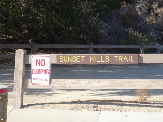
The Sunset Hills Trail is easily accessible off of Erbes Road in Thousand Oaks, just 7/10ths of a mile north of Sunset Hills Boulevard, just past Fernleaf Court.

There's a triangular dirt parking lot on the east.

There's a triangular dirt parking lot on the east.

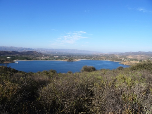
This is a pretty easy mile or so trail that takes you past the Bard Lake Reservoir. The reservoir is of course is fenced in but you'll be treated to its beauty as you make your way up. Lake Bard is owned by the Calleguas Water District for storage of up to 10,000 acre-feet (3.3 billion gallons) of water used to meet peak summer demand and emergency requirements.

SunsetHillsTrail2.JPG

In fact, most all the way up this fairly gentle, hilly slope, you'll get some great panoramic views of the entire area, including the Conejo Valley, Simi Hills and looking west towards Camarillo/Oxnard. Continue east and you will reach the Woodridge Open Space in Thousand Oaks.

SunsetHillsTrail1.JPG
SunsetHillsTrail4.JPG

The Sunset Hills Trail is maintained by the Conejo Open Space Foundation. More information at cosf.org/trails/other-trails/easy-hike-sunset-hills-trail.

SunsetHillsTrail5.JPG

An additional, and perhaps more popular hike provides even better view of the Bard Reservoir. Take the additional loop in the shape of Maine (kind of) either clockwise or from the first juncture or counterclockwise after cresting the hill. If you go to the top of the hill take the trail on the left and continue onwards. You will see some steps and a bench to take in the views along the way.

(Map courtesy of the conejo Open Space Foundation) Green highlighted section is a nice loop to hike - good family hike.

After cresting the first hill from Erbes Road, find the loop trail on the left.

After cresting the first hill from Erbes Road, find the loop trail on the left.

A short walk to this bench that overlooks Bard Reservoir.

A short walk to this bench that overlooks Bard Reservoir.

Continue on the trail until it loops around and goes south., parallel to Highway 23

Continue on the trail until it loops around and goes south., parallel to Highway 23

Soon you will be back at the main trail, passing through this tree-tunneled section.

Soon you will be back at the main trail, passing through this tree-tunneled section.

Conejo Creek Bike Path in Thousand Oaks

Conejo Creek Bike Path (Courtesy City of Thousand Oaks)

Conejo Creek Bike Path (Courtesy City of Thousand Oaks)

The Conejo Creek Bike Path is a 1.2 mile path in Thousand Oaks that connects Gainsborough Road on the south to Conejo Creek Park South. From there, you can cross Janss Road to get to the Thousand Oaks Library Conejo Creek Park North and the Thousand Oaks Teen Center

This path opened to the public in Spring 2011, providing a nice, flat alternative to city streets as it goes under State Route 23.

The paved path on Paige Lane ends at Janss Road across the street from the Thousand Oaks Library, but you can take the crosswalk at Janss Road at the crosswalk and from there get to a wide, fairly flat horse trail that takes you up to Avenida De Los Flores.

The east end of Gainsborough Road has an access point to the Conejo Creek Bike Path

The east end of Gainsborough Road has an access point to the Conejo Creek Bike Path

Nice flat path adjacent to city streets and neighborhoods

Nice flat path adjacent to city streets and neighborhoods

The path takes you under the 23 Freeway

The path takes you under the 23 Freeway

The path ends at Janss Road, across from the Thousand Oaks Library Conejo Creek Park North.

The path ends at Janss Road, across from the Thousand Oaks Library Conejo Creek Park North.

The City of Thousand Oaks maintains approximately 80 miles of bikeways, including about 3 miles of bike paths, roughly 54 miles of bike lanes and another 20 miles or so of bike routes.