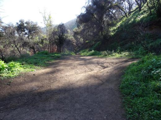
Hike to the Danielson Monument in the Boney Mountain Wilderness

One of the more popular and challenging hikes in the local area takes you from the Rancho Sierra Vista/Satwiwa Recreation Area in Newbury Park to the Danielson Monument in the Boney Mountain Wilderness (Point Mugu State Park). 

It is about 5.5 miles round trip and has a net elevation gain of about 600 feet. The Monument is close to 1,500 feet in elevation This is a fairly challenging trail as roughly two thirds of the hike you are going up and down fairly substantial hills. That said, I've seen hundreds of folks on these trails of all fitness levels and ages doing it at their own pace.

Entrance into Rancho Sierra Vista/Satwiwa at Lynn Road and Via Goleta in Newbury Park

Entrance into Rancho Sierra Vista/Satwiwa at Lynn Road and Via Goleta in Newbury Park

Starting at the Satwiwa Native American Culture Center, make your way to the Danielson Road trail by either taking the Big Sycamore Canyon Fire Road (paved) south for roughly .3 mile and then a left on Danielson Road (trail) or take the Satwiwa Loop Trail that runs diagonally southeast until you reach a fork on the trail.

(Note: You can also park at the trailhead at Wendy and Potrero Roads and add another few miles to your trek.)

Sycamore Canyon Road southbound towards Point Mugu State Park from Satwiwa Center

Sycamore Canyon Road southbound towards Point Mugu State Park from Satwiwa Center

Veer right (south) at the juncture of the Danielson Road and Satwiwa Loop trails towards a bench that overlooks Sycamore Canyon. This is called the Upper Sycamore Canyon Overlook.

The bench at the Upper Sycamore Canyon Overlook in Rancho Sierra Vista

The bench at the Upper Sycamore Canyon Overlook in Rancho Sierra Vista

The short, rocky trail eastbound from there (behind the bench) takes you to another fork, where you can either veer left to the Hidden Valley Overlook trail (part of Rancho Sierra Vista/Satwiwa) or right into the Boney Mountain Wilderness. (Note that dogs and bikes are not allowed in the Boney Mountain Wilderness.)

Entering the Boney Mountain Wilderness

Entering the Boney Mountain Wilderness

After a steady descent of about another .4 mile, you'll see another sign. Continue towards the left. On the right is the Upper Sycamore Canyon Trail, kind of a fun, winding trail at the bottom of the canyon. Save that for another day.

In non-drought years, there is often a creek you may need to walk through as you continue on Danielson Road. It has been years since the stream was of any significance but it was back in February 2017 after recent rainstorms. But it is generally easy to get across.

After navigating the narrowest portion of trail, you will see a juncture. The unmarked "Waterfall Trail" is straight ahead (only about 120 steps to the "Waterfall" when there's not a severe drought). You can check it out as it is such a short distance. But to get to the Monument, veer sharply right, continuing up Danielson Road.

Juncture of Waterfall (straight ahead) and Danielson Road (to the right)

Juncture of Waterfall (straight ahead) and Danielson Road (to the right)

This is a long, grinding, uphill trail of about a mile until you get to a juncture where you can make a right-hand turn to the Old Boney Trail. As you make your way up, you'll be treated to great views from Sycamore Canyon to Newbury Park and beyond.

This is a bit of a dried out view from Upper Danielson Road looking down from where we came from in 2015.

This is a bit of a dried out view from Upper Danielson Road looking down from where we came from in 2015.

You're almost there once you see this Old Boney trail sign - just .3 mile to go

You're almost there once you see this Old Boney trail sign - just .3 mile to go

Continue straight on Danielson Road. There are some areas coming up that periodically get overgrown. Watch out for poison oak particularly in these areas, continuing on to the Monument. In .3 mile, you're reached your destination.

The Danielson Monument is a tribute to Richard Ely Danielson, Junior who lived on the 7,800 acre Rancho Sierra Vista after purchasing the land from the estate of Carl H. Beal in 1947 for roughly $500,000. Danielson lived on the ranch for over three decades with his family. He donated 5,585 acres of the ranch to the State of California, which became part of Point Mugu State Park, and sold 850 acres, including the horse ranch, to the National Park Service in 1980.  He passed away on December 27, 1988. 

Ranching in the area dates back to the early 1800s, when Spanish soldiers were granted 48,672 acres of land, "Rancho El Conejo," which through the years was subdivided and sold to other landowners. One of these ranchers was Carl Beal, who in 1937 named the area Rancho Sierra Vista "Mountain View Ranch." 

The Monument is in a peaceful setting, surrounded by trees. And it stays fairly green up here. A good place to eat lunch or sit and relax. Adjacent to the Monument is a remnant of Danielson's cabin - the chimney. If you continue up this path to the right, you can get to the top of Boney Mountain.

Remnant of Danielson's cabin adjacent to the monument - a chimney.

Remnant of Danielson's cabin adjacent to the monument - a chimney.

One thing I've never seen in my decades on this particular trail are strollers. I think strollers would be a bit of a challenge for many due to rocky and narrow sections, periodic overgrowth and poison oak on the sides of a small portion of the trail and, when we're not in a drought, a stream crossing. 

COMPILATION OF TRAILS IN AND AROUND VENTURA COUNTY

Roller Dome Thousand Oaks Originally Opened in the Spring of 1995

Roller Dome, which was located at 950 Avenida de Los Arboles in Thousand Oaks, closed its doors in October 2010.

Roller Dome originally opened in May 1995. "Roller Dome, a new roller skating facility...might be the best new rink in the country." - Richard Graham, Inline Hockey News.

Ah yes, the good ole days, with the occasional kids' birthday parties at Roller Dome.

The 99 Cents Only Store has been thriving in this spot since 2013.

COMPILATION OF ROLLER SKATING, ROLLER BLADING, ICE SKATING AND SKATEBOARDING VENUES IN AND AROUND VENTURA COUNTY

Point Mugu Missile Park in Port Hueneme

Naval Base Ventura County hosts "Missile Park" at the juncture of Wood Road and Naval Air Road in Port Hueneme. It is roughly 20 miles from central Thousand Oaks. Take the 101 west to Lewis Road south, then left on Wood Road until it ends at Missile Park. You can't miss it!

While it is called a park, Missile Park is primarily an interesting display of various aircraft and missiles that have been tested at the Naval Base since World War II.

Aircraft on display include an F-14 Tomcat and an F-4 Phantom II. The Phantom II was a two seat, tandem, twin-engine, all weather, long range supersonic jet interceptor fighter that was in service from 1960 to 1996. The Tomcat is a supersonic, two seat, twin-engine fighter craft. The F-14A on display was the 24th F-14 Tomcat manufactured by Grumman Aerospace Corporation and was last flown in January 1993. It belongs to the National Museum of Naval Aviation and is on permanent display at Missile Park.

There is quite a wide array missiles on display at the park, including an AMRAAM missile, Regulus submarine-launched missile, Sidewinder missile, the Loon missile (an American copy of the German V-1), the BQM-34S "Firebee" Aerial Target, the Polaris ballistic missile, Petrel torpedo, Harpoon missile, Phoenix air-to-air missile, Bullpup air-to-surface missile and others.

There is a small parking area at Missile Park, a picnic bench, trash receptacles, but nothing else, other than the displays. No restrooms. Open daily from sunrise to sunset. 

E. P. Foster and Orpha Woods Foster Were Among the Early Settlers in the Conejo Valley

Eugene Preston and Orpha Woods Foster Family in 1890.

Eugene Preston and Orpha Woods Foster Family in 1890.

This is the Eugene Preston and Orpha Woods Foster family in 1890. This family has quite a history in Ventura County.

Eugene (E.P.) built a home in the Conejo Valley in 1874, where he operated a sheep business. Most of the 10,000 sheep perished in the terrible drought of 1876-1877. E.P. sold what remained of his business and moved to Ventura in 1877 (the same year that Egbert Starr Newbury and family moved back to the midwest...where Newbury passed away in 1880 at age 36).

Before the drought, in 1875, the Fosters became the parents of the first child of settlers born in the Conejo Valley. That daughter, the eldest of 10, only four of which survived childhood, was Orpha W. "Pearl" Foster. Pearl became president of Community Memorial Hospital in Ventura for over 25 years. She passed away at age 97 in 1973.

After his successes and struggles in the Conejo Valley, E.P. Foster became a highly successful entrepreneur and investor in Ventura, where he helped to establish the city's first electric light plant, developed natural gas wells and invested in the Bank of Ventura (now Bank of America) and the Union Oil Company. His philanthropic efforts led to the creation of Camp Comfort (the county's first park), Foster Park and the 91 acre Seaside Park, where the Ventura County Fair operates.

Additionally, the E.P. Foster Library on Main Street in Ventura is named after him; he and his wife donated funds for the original public library and city hall. The Fosters also donated funds and land to build what is now Community Memorial Hospital in Ventura.

But no, the Foster's Freeze in Ventura is not associated with E.P. Foster. :)

The E.P. Foster Library is part of the Ventura County Library system The cities of Thousand Oaks, Simi Valley, Moorpark and Camarillo operate their own, independent library systems.

State Route 23 Between the 101 and 118 is Dedicated to Japanese American World War II Soldiers

Moorpark Freeway section of SR 23 taken from Marview Trail in Thousand Oaks.

Moorpark Freeway section of SR 23 taken from Marview Trail in Thousand Oaks.

State Route 23 stretches from Malibu to Fillmore in three sections. The south section is the winding, hilly Decker Canyon Road that connects Pacific Coast Highway to Westlake Village and Hidden Valley. This section is approximately 10 miles from PCH to the Potrero Road intersection, but generally takes 20 to 25 minutes to drive.

SR 23 continues as Westlake Boulevard to the Ventura Freeway (U.S. Route 101), where it runs concurrent with the 101 north a couple miles until you reach the Moorpark Freeway overpass. This is another 4 to 4 1/2 miles.

The most visible section of SR 23 in Thousand Oaks is the Moorpark Freeway, which stretches from the 101 to the Los Angeles Avenue exit in Moorpark; about 8 miles. This middle section of the 23 was named the Military Intelligence Service Memorial Highway in 1994 by the California State Assembly. The renaming was made in honor of Nisei, or Japanese American, Soldiers of World War II who served in units of the U.S. Armed Forces comprising the 100/442/MIS triad (Military Intelligence Service, 100th Infantry Battalion and 442nd Regimental Combat Team). **

Military Intelligence Service Memorial Highway sign

Military Intelligence Service Memorial Highway sign

The northern section of SR 23 begins at Los Angeles Avenue (SR 118) in Moorpark and goes north as Grimes Canyon Road, ending at SR 126 in Fillmore. This is about a 12 mile stretch includes some eye opening, hilly twists and turns in the Grimes Canyon Road area.

The total length of SR 23 is about 32 miles.

** Some additional clarification from the 1994 legislation: Segments of State Highway Routes 23 and 99 are officially designated as follows: (a) State Highway Route 23, from Highway 101 to Highway 118, as the Military Intelligence Service Memorial Highway. (b) State Highway Route 99, between the Cities of Fresno and Madera, as the 100th Infantry Battalion Memorial Highway. (c) State Highway Route 99, between the Cities of Salida and Manteca, as the 442nd Regimental Combat Team Memorial Highway. Each of the signs to also include "A unit of the 100/422/MIS triad.

A Look Back at The Rock House in Thousand Oaks

rockhouse 1966 cvdays.JPG

Here's a photo of an entry in the 1966 Conejo Valley Days parade featuring The Rock House

The Rock House was located at 983 Thousand Oaks Blvd., which today is the overpass where State Route 23 transitions to the 101 north.

"Drink Fire Water and Eat Fine Food at the Rock House."

rock house.jpg

This second photo of The Rock House in 1961 is from the Thousand Oaks Library Conejo Through the Lens collection. How cool it would have been to keep this very unique place standing through all these years.

Sections of the Juan Bautista de Anza Trail in Ventura County and Nearby Areas

In 1776, while American patriots fought for their independence from England, Spanish Lt. Colonel Juan Bautista de Anza led more than 240 men, women, and children some 1,800 miles to establish a settlement at San Francisco Bay. These families were the first colonists to come overland across the frontier of New Spain into present-day California.

The trail connects Mexico to San Francisco. The group included the settlers, military escorts, support workers and Indian guides, as well as 1,000 head of livestock. The expedition reached “el río de San Francisco “ on June 27, 1776 and established Spain’s northernmost colony in Alta California.

Local hikers will see signs like this on sections of the De Anza Trail.

Local hikers will see signs like this on sections of the De Anza Trail.

The historic trail today is memorialized with a 1,210 mile route extending from Nogales on the U.S./Mexico border through sections of southern Arizona into California. You will see signs from time to time signifying you are on the De Anza Trail.

Locally here in Ventura County, you’ll encounter sections of the De Anza Trail as follows:

There are nearly 17 miles of trail in the Santa Monica Mountains National Recreation Area designated for the Juan Bautista de Anza National Historic Trail.

The coastal parks of San Buenaventura and Emma Wood State beaches, the Faria and Hobson County Parks and the recreation trail on the Ventura beach boardwalk all provide memorable ocean views.

More details on the Ventura County portions of the De Anza Trail at www.anzahistorictrail.org/visit/counties/ventura.

Learn much more at www.anzahistorictrail.org.