El Rincon, El Cerro and Las Brisas Trails in Dos Vientos Section of Newbury Park
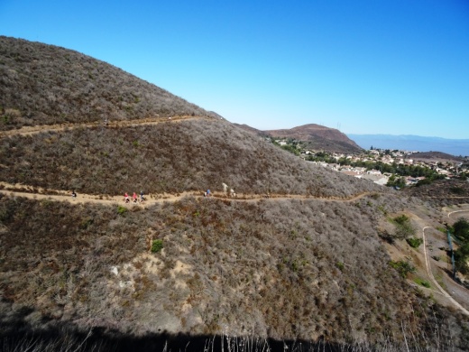
In the heart of Dos Vientos (Spanish for Two Winds), there are three trails that are accessible from multiple spots by walkers, hikers, runners and bikers. These are the El Rincon, El Cerro and Las Brisas trails. These trails are all nicely maintained, single track and provide great views of the surrounding areas. Other trails surrounding Dos Vientos include the Vista Del Mar Trail, Sierra Vista Trail, Sumac Trail (kind of parallels Sierra Vista Trail), El Encanto Trail and Powerline (Edison Road) Trail, as well as the Potrero Ridge Trail.

ElRincon_trailhead.JPG

Access to the El Rincon Trail is near the corner of Via Rincon and Rancho Dos Vientos. The trail is about 4/10ths of a mile and connects with the El Cerro and Las Brisas trails.

ElRinconTrail1.JPG
ElRinconTrail2.JPG

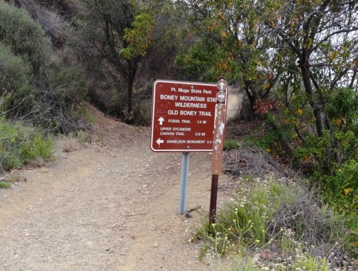
Access to El Cerro and Las Brisas trails is at the juncture of Via Las Brisas and Calle Del Prado and several other points. Visit https://cosf.org/files/maps/dos_vientos_trail_map.pdf for a trail map on the Conejo Open Space Foundation website.

ElCerroLasBrisas_sign.JPG

Satwiwa Native American Indian Culture Center in Newbury Park

The Satwiwa Native American Indian Culture Center is located at Rancho Sierra Vista / Satwiwa in Newbury Park. Sycamore Canyon, which cuts through Rancho Sierra Vista/Satwiwa and Point Mugu State Park, was part of a Chumash trade route. Satwiwa, which means "the bluffs," was the name of a nearby Chumash village.

View of the Satwiwa area with the Center on the right and an Indian village area on the left.

View of the Satwiwa area with the Center on the right and an Indian village area on the left.

In the Center is a variety of native Chumash items. Native American workshops, programs and art shows occur throughout the year. The Center is open 9 am to 4 pm on weekends, with rangers on hand to answer questions. There's a small gift shop in the Center too, as well as restrooms and a water fountain.

There is a Chumash house, or 'ap, on the grounds of the Center. It is made with willow trees and tule.

There is a Chumash house, or 'ap, on the grounds of the Center. It is made with willow trees and tule.

Inside the Culture Center. The table contains items that children are encourage to touch.

Inside the Culture Center. The table contains items that children are encourage to touch.

Small but nicely appointment gift shop in the Center has something for everyone.

Small but nicely appointment gift shop in the Center has something for everyone.

Park in the adjacent National Park Service parking lot via Lynn Road to the access road at Via Goleta in Newbury Park.

Visit www.nps.gov/samo/planyourvisit/satwiwa-native-american-indian-culture-center.htm for more information.

Access point to the Rancho Sierra Vista / Satwiwa area in the Santa Monica Mountains National Recreation Area off of Lynn Road in Newbury Park.

Access point to the Rancho Sierra Vista / Satwiwa area in the Santa Monica Mountains National Recreation Area off of Lynn Road in Newbury Park.

Rancho Potrero Community Equestrian Center in Newbury Park

RPEquestCenter.JPG

Ride On Therapeutic Horsemanship manages the former Rocking K Horse Rentals and Boarding at 4790 Lynn Road in Newbury Park. The new facility is called the Rancho Potrero Community Equestrian Center.

The 20 acre facility adjacent to the Rancho Potrero Open Space is home to about 100 horses. Horseback riding is available on Fridays at 5pm, Saturdays at 9:30am and 11:30am and Sundays at 9am and 10:30am.

$65 per person for a one hour guided trail ride. Must be reserved and paid for in advance at www.ranchopotrerotrailrides.org.

More information at ranchopotrero.org or call 805-491-1230.

Sunday morning guided horse ride in Rancho Potrero on a mid-August Sunday morning 2022.

Western Plateau Trail Loop Hike From Newbury Park

If you're looking for a trail a bit off the beaten path, check out the Western Plateau Loop from Conejo Center Drive in Newbury Park.

The trailhead for this hike is adjacent to the City of Thousand Oaks Household Hazardous Waste Facility at 2010 Conejo Center Drive, Newbury Park. You can park in the dirt lot next to the trailhead and head on your way.

The trailhead on Conejo Center Drive.

The trailhead on Conejo Center Drive.

It is mostly downhill over the first half mile or so of this 5 mile round-trip hike until you get to the Hawk Canyon Trail turnoff.

It is mostly downhill over the first half mile or so of this 5 mile round-trip hike until you get to the Hawk Canyon Trail turnoff.

You can either go straight from here and do a clockwise loop via the Western Plateau Trail or you can turn right on Hawk Canyon, which is a direct route to the Conejo Canyons Bridge.

Hawk Canyon Trail is a fairly narrow, mostly single-track trail.

Hawk Canyon Trail is a fairly narrow, mostly single-track trail.

The Hawk Canyon Trail is a fun, narrow trail surrounding by trees and other vegetation, like you're in the middle of nowhere. There's an old car in a crevice as you approach the Conejo Canyons towards Santa Rosa Valley.

Odd to see this old car out in the middle of nowhere. steep embankment makes it somewhat challenging reaching it.

Odd to see this old car out in the middle of nowhere. steep embankment makes it somewhat challenging reaching it.

Bring a snack and sit at a picnic table in the middle of what feels to be nowhere. Then either head back the way you came or find your way to the Western Plateau Trail and loop back counter-clockwise back towards where you parked.

See the Conejo Open Space Foundation's map of this trail at cosf.org/trails/conejo-canyons/conejo-canyons-moderate-hike-western-plateau-loop-from-conejo-center-dr

It can get a bit overgrown in the spring as seen here on the Hawk Canyon Trail but quite beautiful nonetheless!

It can get a bit overgrown in the spring as seen here on the Hawk Canyon Trail but quite beautiful nonetheless!

Point Mugu State Park

Point Mugu State Park is located in the Santa Monica Mountains, stretching from Newbury Park on the north to five miles of ocean shoreline on the south. The park includes 14,000 acres of land with over 70 miles of trails popular with hikers, cyclists and runners.  It is truly an amazing place, with rocky peaks that include the prominent Boney Mountain State Wilderness that looks over the western Conejo Valley.

The sign in Rancho Sierra Vista/Satwiwa in Newbury Park indicating you are entering State-managed Point Mugu State Park.

The sign in Rancho Sierra Vista/Satwiwa in Newbury Park indicating you are entering State-managed Point Mugu State Park.

You can actually hike, run or bike from Newbury Park, from the Rancho Sierra Vista/Satwiwa area managed by the National Park Service down to the ocean via Sycamore Canyon "Sycamore to the Sea," which is about an 8 mile trip one way. But do be aware - the initial 800 foot drop from Rancho Sierra Vista into the canyon via Big Sycamore Canyon Road is a bit more challenging coming back up.

The paved hill drops into the canyon via Sycamore Canyon Fire Road.

The paved hill drops into the canyon via Sycamore Canyon Fire Road.

There are four main canyons in Point Mugu State Park. Sycamore Canyon is perhaps the most well known, stretching practically the entire north/south length of the park, where at the bottom of the canyon you'll find the 58 space Sycamore Canyon Campground at 9000 W. Pacific Coast Highway (make reservations at ReserveCalifornia.com and search for “Point Mugu SP”).

The Sycamore Canyon Campground connects to the Sycamore Canyon Fire Road, which is your access point to a day of fun and adventure in Point Mugu State Park trails.

The Sycamore Canyon Campground connects to the Sycamore Canyon Fire Road, which is your access point to a day of fun and adventure in Point Mugu State Park trails.

The La Jolla Valley Natural Preserve is on the western side of the park, with a main access point near Thornhill Broome State Beach at the Ray Miller Trailhead to the La Jolla Canyon Trail which connects with the Loop Trail. Another access point to La Jolla Valley is the Chumash Trail trailhead, a rocky, steep trail across from Point Mugu Beach. La Jolla Valley was purchased by the State of California in 1966 and was established as a Natural Preserve in 1972.

Wood Canyon is in the northwest section of the park, where you will find the north/south running Wood Canyon Fire Road, which connects to the Guadalasca Trail, among others.

Serrano Valley is accessible from the south off the Big Sycamore Canyon Fire Road/Trail about a mile north of the beach. A beautiful, serene, area, with a connection to the Old Boney Trail that takes you to the Danielson Monument in the Boney Mountain Wilderness.

The main beach areas in Point Mugu State Park, running southeast to northwest, are Sycamore Cove, Thornhill Broome and Point Mugu. Sycamore Cove is a fun day-use park popular with families for gatherings with BBQ grills and picnic tables. Learn more about beaches in the Malibu area at this link.

This is the PCH overpass where on low tide you can walk underneath here to get from Sycamore Cove Beach to Sycamore Canyon Campgrounds and hiking in Point Mugu State Park. In higher tides, this area can be dicey, so be careful.

This is the PCH overpass where on low tide you can walk underneath here to get from Sycamore Cove Beach to Sycamore Canyon Campgrounds and hiking in Point Mugu State Park. In higher tides, this area can be dicey, so be careful.

If you are looking for beachfront camping, try Thornhill Broome Beach, with just over 60 spots available for RVs and tents. No hookups here and only porta-johns available, but can't beat the views! And across the street you can't miss the Giant Sand Dune!

Day use parking at the various sites is available for $12. There is very minimal street parking at Sycamore Cove but plenty of street parking adjacent to Thornhill Broome Beach.

Dogs on a leash are allowed in the Park's day use areas, campgrounds and beaches. Dogs are not allowed on the back country trails or dirt roads.

Keep driving northwest on PCH and you'll past the famous Mugu Rock and see Pt. Mugu Beach, which also has day use parking, with some parking on PCH. Learn more at the California State Parks website at www.parks.ca.gov/?page_id=630.

Mugu Rock up ahead, driving north on PCH from Thornhill Broome.

Mugu Rock up ahead, driving north on PCH from Thornhill Broome.

Lastly, let's cover some of the highest peaks in Point Mugu State Park. The Boney Mountain Wilderness Area, ever so prominent from the Conejo Valley, is located in the Park. But Boney Peak itself, at 2828 feet, is actually in the Circle X Ranch area managed by the National Park Service, along with Sandstone Peak, the highest spot in the Santa Monica Mountains at 3111 feet.

Boney Mountain range overlooks the western Conejo Valley.

Boney Mountain range overlooks the western Conejo Valley.

Other peaks include Tri Peaks at 3010 feet, Laguna Peak (the peak which has equipment from Naval Base Ventura County below), La Jolla Peak and Mugu Peak

Map of Point Mugu State Park courtesy of National Park Service.

Map of Point Mugu State Park courtesy of National Park Service.

K1 Speed Indoor Go Kart Racing in Thousand Oaks

K1 Speed indoor go kart racing opened its 8th Southern California location - K1 Speed Thousand Oaks, in February 2022

Guests can enjoy indoor go kart racing, games for all ages, food and drinks, and a private event room for any occasion.

The all-electric Adult Karts for adults and teens can reach speeds of up to 45 mph. Kids 4’ (48”) or taller can drive electric Junior Karts that can reach up to 20 mph on the professionally designed circuit.

Guests can also play over 30 popular video games from the past and present, plus pool tables, air hockey, basketball hoops and prize machines.

The Paddock Lounge is an onsite café that serves classic favorites such as hamburgers, pizza, nachos, and wings in addition to a wide assortment of non-alcoholic beverages. In the near future, this location plans to serve beer & wine for adults 21 years of age and older to enjoy after racing.

A private event room for birthdays, corporate events, bachelor parties, and other group events is also available. For private events, the entire venue may be rented by the hour, half-day, or full day.

K1 Speed Thousand Oaks is open seven days a week at 770 Lawrence Drive. Reservations are not required to race.

More information at www.k1speed.com/thousand-oaks-location.html.

A portion of the arcade at K1 Speed Thousand Oaks

Boney Mountain Trail to Hidden Valley Overlook, Danielson Monument and Waterfall

At Rancho Sierra Vista/Satwiwa in Newbury Park is a nice assortment of trails that reward hikers with beautiful views and peaceful surroundings.  Find your way to the Satwiwa Native American Culture Center and from there walk up Big Sycamore Canyon Road where you'll reach a fork in the road. If you go straight you'll be taking Big Sycamore Canyon road about 6-7 miles down to Sycamore Canyon Campground and Sycamore Cove Beach. The road is paved for about 3 miles until it intersects the Backbone Trail, at which point it is dirt trails to PCH.

Benches at the top of Big Sycamore Canyon Road.

Benches at the top of Big Sycamore Canyon Road.

Views from the benches looking down Big Sycamore Canyon. Photo taken a few months before the Springs Fire of 2013.

Views from the benches looking down Big Sycamore Canyon. Photo taken a few months before the Springs Fire of 2013.

View of Big Sycamore Canyon after the Springs Fire of 2013.

View of Big Sycamore Canyon after the Springs Fire of 2013.

Getting back to the benches at the top of Sycamore Canyon, looking off to the east you'll find the Boney Mountain Trail sign that takes you towards the Hidden Valley Overlook, Waterfall and Danielson Monument, a .4 mile, 1 mile and 2.2 mile one way hike, respectively.

BoneyMountainTrailMarker.JPG
Boney Mountain Trail sign in Rancho Sierra Vista post-Springs fire 5/5/13.

Boney Mountain Trail sign in Rancho Sierra Vista post-Springs fire 5/5/13.

Take the trail to the fork in the road. A sharp left takes you directly back to the Satwiwa Center, a "normal" left takes you on a trail towards Wendy Drive and/or back to the Satwiwa Center in a loop, and a right turn takes you up the hill towards the destinations mentioned above.

A short walk up the trail gets you to yet another bench that overlooks Sycamore Canyon from another angle. This is called the Sycamore Canyon Overlook.

This photo of the Sycamore Canyon Overlook was taken before the Springs Fire of 2013.

This photo of the Sycamore Canyon Overlook was taken before the Springs Fire of 2013.

Bench at Sycamore Canyon Overlook on 5/14/13.

Bench at Sycamore Canyon Overlook on 5/14/13.

The rocky trail from there takes you to a fork. Veer LEFT to the Hidden Valley Overlook trail or right to the Danielson Monument and Waterfall (as well as the Old Boney Trail).

BoneyMountainSign.JPG

The Hidden Valley Overlook trail is rocky, pretty steep in some sections and a bit challenging. But...you will be rewarded with some nice views of Dos Vientos, Camarillo and eventually an "overlook" of Hidden Valley.

Endpoint of the Hidden Valley Overlook trail, peering into Hidden Valley. This photo was taken in April 2014.

Endpoint of the Hidden Valley Overlook trail, peering into Hidden Valley. This photo was taken in April 2014.

If you veer right at the fork in the trail, after a .4 mile jaunt down the hill you'll see a sign that tells you you're getting close the waterfall. There are lots of rocky sections as well as crevices as you make your way down this trail, so do be careful. But it is fairly wide most of the way.

Sign at bottom of hill indicating you distance to waterfall trail and danielson monument

Sign at bottom of hill indicating you distance to waterfall trail and danielson monument

There's a stream crossing that most of the year is easy to get across as there's not a lot of water in it, although in particularly rainy winters it can get more challenging in the winter/spring.

Mostly mud in the stream crossing that gets you to the Danielson Monument in mid-February 2013, but some years there's more water in there (like 2017, after the winter rainstorms).

Mostly mud in the stream crossing that gets you to the Danielson Monument in mid-February 2013, but some years there's more water in there (like 2017, after the winter rainstorms).

So after you cross the stream, you're off on a mostly narrow, single-track trail. Watch out for poison oak on the sides of the trails. I usually run up here in shorts, but you're much safer wearing long pants. The next juncture in the trail, you go straight to the waterfall, or veer right up to the Danielson Monument.

We've been to the waterfall when it had a lot of water flowing in it. This year (2013) there's barely a trickle.

We've been to the waterfall when it had a lot of water flowing in it. This year (2013) there's barely a trickle.

So if you take the sharp right hand turn, you're on your way to the Danielson Monument (a tribute to Richard Ely Danielson, Junior, who lived on land in this area for 32 years with his family, until it was sold to the National Park Service in 1980). Awesome views from several vantage points as you head up the trail. A bit of a climb. Be prepared! Check out other photos of the monument HERE and larger pics HERE.

Danielson Monument

Danielson Monument

About 4/5ths of the way from the bottom of the canyon to the Danielson Monument, you can veer right to the Old Boney Trail, an interesting, mostly single track trail that has great views of Boney and intersects with the Fossil Trail.

Here's the sign at the juncture of the Danielson Road trail and the Old Boney Trail turnoff, about .3 mile away from the Danielson Monument.

Here's the sign at the juncture of the Danielson Road trail and the Old Boney Trail turnoff, about .3 mile away from the Danielson Monument.

Rabbit Hill (Knoll Open Space) in Newbury Park

KnollTrail1.JPG

The Knoll Open Space is a 21 acre plot of land owned by the Conejo Open Space Conservation Agency located at the corner of Reino Road and Old Conejo Road in Newbury Park (across the street from Peppertree Playfields). This plot of land is more affectionately known as Rabbit Hill. While it doesn't take too much effort to get to the top of Rabbit Hill, you will definitely be rewarded with a nice, panoramic view towards Boney Mountain, Thousand Oaks and Conejo Mountain. This hill is somewhat less challenging than the steeper Tarantula Hill in Thousand Oaks, so if you're looking for a nice after-dinner stroll, this is a fine choice. While not the most exciting hill to look at, the views make it worthwhile! You can park on Reino Road to start your short journey.

You can either take a straight shot up the hill or a more gradual curved trail. 

You can either take a straight shot up the hill or a more gradual curved trail. 

Views toward Boney Mountain.

Views toward Boney Mountain.

Views towards Thousand Oaks

Sierra Vista Trail in Newbury Park

The Sierra Vista Trail in the Dos Vientos section of Newbury Park is a roughly one mile long trail that connects the Vista Del Mar Trail on the west to the Potrero Ridge Trail on the east. The entry point on the west side is off of Rancho Dos Vientos just south of Via El Cerro and on the east side is on Via Las Brisas near Paseo Santa Rosa. As with most trails in this area, you will be treated with some great views of the surrounding mountains and neighborhoods. This trail is maintained by the Conejo Open Space Foundation.

SierraVistaTrail_1.JPG
SierraVistaTrail_2.JPG
SierraVistaTrail_3.JPG
SVistaBoney.JPG

California Sycamore Tree - Historic Landmark in Newbury Park

10.20.07 016.jpg

This extremely large and old California Sycamore tree was designated as a Ventura County Historic Landmark (#44) on May 1st, 1978.  The City of Thousand Oaks historical marker (see picture to the right) says the tree is over 250 years old.  It is believed that the Chumash Indians bent the lower branches to mark the location of groundwater.

This beautiful tree is located in the Stagecoach Inn Museum and complex at 51 South Ventu Park Road.  Park at the Stagecoach Inn parking lot and walk your way down the pathway to visit the tree, an Indian house and other old structures.

HistoricSycamoreTreeNP.JPG

Boney Mountain Peak Hike From Newbury Park

At an elevation of 2,825 feet, the presence of Boney Peak (also known at Mount Boney), is felt throughout the Conejo Valley and surrounding areas. Want to climb it?

BoneyPeakHikers.JPG

Well you can! It is challenging, but possible. Boney Mountain is located in the Santa Monica Mountains. One way to get to Boney Peak is via the Upper Canyon Trail from the Danielson Monument.

Danielson Monument

Danielson Monument

First off, hike your way up to the Danielson Monument, click this link for details. The monument is next to the remains of a burned down cabin shown below.

There is a trail that veers left next to the chimney. This is where you want to go. You're looking at a challenging 2 mile climb to Boney Peak. Most of the trail is narrow single track. There are some really steep, rocky sections, some with deep crevices, that may freak you out. You may have to duck your head from time to time. The trail is definitely challenging, both going up and coming back down. Definitely not for everyone.

The trail gets tight at times.

The trail gets tight at times.

The trail is not "officially" maintained by the National Park Service and thus there are NO SIGNS that say, hey, go this way to get to Boney Peak.  But I've seen plenty of people make it up there just fine as the path is fairly obvious. Just stay on the main trail.

After twists, turns, rocks, crevices and hills, the trail flattens out a bit near the top.

After twists, turns, rocks, crevices and hills, the trail flattens out a bit near the top.

One thing to note when you think you've reached the top. Look at the picture at the top of this post. To the left of the circled area is a large boulder. This is not the peak. There's a trail to the left behind it that you'll have to go up to get to the actual peak. Again, there are no signs. But you should be able to see the path pretty easily. You will be climbing some sheer rock face to get there. Can be slippery. And standing on the top of Boney can be both exhilarating and scary as hell! So be careful!

The final ascent to the top on sheer rock path.

The final ascent to the top on sheer rock path.

How long does it take to get from the trailhead at Wendy and Potrero and back? I'd allow for 4 to 5 hours if you are hiking. If you are a strong runner you can get up to it in as little as an hour (I'm talking top notch runner) to hour and a half, but you will only be able to "run" about half of the trail above the Danielson Monument. The rest is more of a technical hike in and around the rocks, boulders and crevices.

Here are some views you'll be treated to at the top.

BoneyPeakView3.3.13.JPG
BoneyPeak3.3.13_MoreViews.JPG
BoneyPeak3.3.13_Islands.JPG
BoneyPeak3.3.13_Top.JPG
BoneyPeak3.3.13HidVal.JPG
BoneyAnotherView.JPG

Stagecoach Inn Museum - Newbury Park

StagecoachInnSign.JPG

The Stagecoach Inn Museum is a replica of a Monterey style inn, the 1876 Grand Union Hotel. The complex also includes a Chumash Indian village, an early California adobe, a pioneer house and a few other buildings. There is a nice park adjoining the property along with nature trails and a stream that make this a nice place to bring the entire family.

Spanish Adobe structure at Stagecoach Inn is a replica of housing that would be seen in the Conejo Valley in the early 1800s.

Spanish Adobe structure at Stagecoach Inn is a replica of housing that would be seen in the Conejo Valley in the early 1800s.

The Stagecoach Inn Museum is State Historical Landmark No. 659.  The original structure was destroyed by fire in April 1970 but has been rebuilt and relocated.  It was originally located at the corner of what is now Ventu Park Road and the Highway 101, where a historical marker has been placed.

The Stagecoach Inn is located at 51 South Ventu Park Road, Newbury Park.  Call 805.498.9441 or visit www.stagecoachinnmuseum.com for more information. As of September 2021, the museum is open from 1 pm to 4 pm on Wednesdays and Saturdays. Admission is $7 per adult and $5 per child. Special event pricing and hours may vary.

Stagecoach Inn front web.jpg
StagecoachInnNP_Landmark.JPG

Angel Vista Peak in Newbury Park

AngelVistaBench_June2013_2.JPG

The 1,530' elevation Angel Vista Peak in Newbury Park may well have the most spectacular views of the Conejo Valley. You can see the entire Conejo Valley, stretching from the Conejo Grade to central Thousand Oaks, Agoura Hills, Hidden Valley, Boney Mountain and beyond from here!

Angel Vista can most easily be accessed via the Rosewood Trail at the southern terminus of Regal Oak Ct, off of Lynn Road) Or for a much longer hike, take the Los Robles Trail (either the Thousand Oaks side accessible at South Moorpark Road and Greenmeadow Ave or Newbury Park side off of Potrero Road). The Conejo Open Space Foundation provides a useful map at www.cosf.org/website/html/los-robles-angel-vista.html. There's a bench as well as a picnic table up there with wonderful views.

The hike is about 3 1/2 miles round trip.

You'll eventually see this sign if you make the trek up the Rosewood Trail.

You'll eventually see this sign if you make the trek up the Rosewood Trail.

The bench is in sight!

The bench is in sight!

AngelVista4 - Copy.JPG
AngelVista5 - Copy.JPG
Fun to see at least a portion of Hidden Valley from up here.

Fun to see at least a portion of Hidden Valley from up here.