Compilation of Public Beaches Spanning From Oxnard to Hueneme to Malibu

In a separate post, we highlighted beaches ranging from Carpinteria down south to the beaches at the Ventura Harbor. This is the 2nd installment of local area beaches that stretch from McGrath State Beach on down to the beaches gracing Malibu. We hope these compilations prove useful in guiding you to all the oceanfront fun Ventura County and adjacent areas have to offer!

Additionally, here's a compilation of beaches in the Santa Barbara area (excluding Carpinteria).

McGrath State Beach is currently open for day use and trails, but there are no facilities or parking available. Camping is not open as of June 2021. Visit parks.ca.gov/?page_id=607 or call 805.968.1033 for more information.  McGrath has 2 1/2 miles of beach available. Swimming, surfing, and water sports are discouraged because of rip currents. McGrath is 5 miles south of Ventura off the 101 freeway via Harbor Boulevard.

Mandalay Beach Park is 94 acres of undeveloped beachfront land located south of Reliant Energy's Mandalay Generating Station. The natural sand dunes and the wetlands ecosystem are recognized for their important natural value and houses several threatened bird species. This is a passive, natural open space park with no support facilities. The sandy ocean beach and adjacent coastal dunes are available for public day use only. The beach is managed by the County of Ventura on behalf of the California State Parks Department. Located at the corner of Harbor Boulevard and 5th Street in Oxnard. Visit www.parks.ca.gov/?page_id=609. No dogs allowed.

Oxnard Beach Park has one of the best kids play areas around town, restrooms, lots of grass, and easy access to miles and miles of beach. The sand dunes are really large in Oxnard. The park is located at 1601 S. Harbor Boulevard. For more information, contact the Oxnard Recreation & Community Services Department at www.oxnardrec.org/17/3/960.

Oxnard Beach Park looking towards the beach.

Oxnard Beach Park looking towards the beach.

Hollywood Beach is a great spot for swimming, sunning and viewing the Channel Islands. Free public beach volleyball courts, public restrooms on the north end of the beach, on-street parking and lifeguards on duty between Memorial Day and Labor Day. Located right next to Channel Islands Harbor off of Harbor Boulevard. Dogs are allowed at Hollywood Beach on leash before 9am and after 5pm. West-facing beach means it’s great for catching the sunset!

Hollywood Beach

Hollywood Beach

Silver Strand Beach is a 1 mile long beach near Channel Islands Harbor, about 150 yards in width. It is capped by north and south jetties, both of which have small parking lots; one next to San Nicholas Avenue (at Ocean Drive), the other next to Sawtelle Avenue. Free parking from sunrise to sunset with limited restroom facilities. This is a sandy bottom beach break which may have rip tides and an undertow, so be careful. Dogs on leash allowed before 9am and after 5pm. Lifeguards on duty daily during summer months. Accessed via S. Victoria Avenue. Visit visitoxnard.com/things-to-do/beaches/silver-strand-beach for more information.

There's a Kiddie Beach Park off of S. Victoria Avenue at Sunset Drive with available parking, restrooms and benches. It is a small sliver of sand that fronts the south end of Channel Islands Harbor and thus does not face ocean waves.

Hueneme Beach Park is 50 acres with picnic tables, barbecue pits, walking paths, a fishing pier, sand volleyball courts, Surfside Seafood snack bar, lifeguards and restrooms. Beach parking lots and Surfside Drive parking available for a fee. No dogs allowed! Visit www.ci.port-hueneme.ca.us/index.aspx?NID=926 for more information. Located at 550 E. Surfside Drive, Port Hueneme

Ormond Beach is 1,500 acres composed of agriculture, industry and wetlands. A two mile long beach extends from Port Hueneme on the north to Naval Base Ventura County on the south. This is one of the few areas in southern California with an intact dune transition zone marsh system, hosting over 200 migratory bird species. The California Coastal Conservancy is restoring these wetlands. A bit off the beaten path, it is probably more geared towards bird watchers and hikers. Get there via Hueneme Road, going south on either Perkins Road on the north and Arnold Road on the south.

Naval Base Ventura County occupies roughly 6 miles of oceanfront space between Ormond Beach on the north and Point Mugu State Park on the south. This space is not accessible by the general public. However, there are periodic opportunities for civilians to catch a glimpse of the Pacific Ocean from NBVC during organized events open to the public.

Mugu Beach is the first publicly accessible beach area south of Naval Base Ventura County off of PCH, located adjacent to the prominent Mugu Rock. For the most part this is the most quickly accessible beach to Camarillo and Conejo Valley residents. There is paid parking ($12 last time I was there) as well as parking available on PCH. Popular with fisherman. One thing to be aware of here is that there is a significant undertow. If you bring the little ones, best to stay out of the water or just be extra careful.

South of Mugu Rock there is also some beach that is accessible with plenty of parking on PCH. No facilities and not a lot of beach, but beautiful views and a quick place to explore.

ThornhillBroome.JPG

Thornhill Broome Campground and Beach is also part of Point Mugu State Park, located a mile or two south of Mugu Beach. This is a campground right on the beach with a capacity for about 60 or so RVs. But of course you can visit for the day for a parking fee. Plenty of parking also available on PCH. Porta-potties available. Dogs are allowed around here as long as they are on a leash (and paleeeze...pick up after them).

Across the street on PCH is a gigantic, steep sand dune that I've always found to be interesting. Learn more about that sand dune here.

Unusually large sand dune on the east side of PCH across from Thornhill Broome Campground

Unusually large sand dune on the east side of PCH across from Thornhill Broome Campground

Sycamore Cove is at the southernmost beachfront portion of Point Mugu State Park. Point Mugu State Park features 3.6 miles of ocean shoreline (Sycamore Cove to Mugu Beach), with rocky bluffs, beaches, sand dunes, rugged hills and uplands, two major river canyons and wide grassy valleys dotted native trees.

Sycamore Canyon Campground across PCH from Sycamore Cove has 58 campsites. For a challenge, ride or hike down through Sycamore Canyon from Rancho Sierra Vista/Satwiwa in Newbury Park. You'll most likely have to pay to park here (most recently $12 for day use) as there are not many spots on PCH available on the south side...watch out...there are no parking signs all over the place.

SycamoreCove_sign.JPG

Sycamore Cove Beach has a number of picnic benches shaded by trees and is thus a popular spot on summer weekends for the BBQ crowd as well as with the campers from the campground on the other side of PCH. Located at 9000 Pacific Coast Highway. Visit www.parks.ca.gov/?page_id=630.

Trees shade the picnic tables at Sycamore Cove Beach

Trees shade the picnic tables at Sycamore Cove Beach

In the 3.3 mile stretch of PCH between Sycamore Cove Beach and County Line Beach (below) there are three or four places where you can park on PCH and access the beach.

One of these beaches I refer to as Call Box 1-35 Beach, about a mile southeast of Sycamore Cove Beach. This is not the official name of this beach in the unincorporated section of Ventura County northwest of Malibu city limits. But since the dilapidated staircase leading down to the beach is next to this call box, it seems appropriate. The address is approximately 9649 Pacific Coast Highway, Malibu (yes, technically not Malibu, yet in Google maps the address says Malibu).

About half a mile southeast of Call Box 1-35 is Call Box 1-27 Beach, which I also refer to as 26 Steps Beach. 26 Steps Beach is approximately 1.9 miles northeast of County Line Beach (see below) and 1.5 miles southwest of Sycamore Cove Beach (see above), at approximately 9999 PCH, just west of Deer Creek Road. I made up the name 26 Steps Beach because there is a well-worn, tagged up staircase that leads you from your parked car on PCH near the 1-27 Call Box sign to the beach. This is not a bad little section of beach that rarely has many people. No restrooms. Parking is free on PCH.

County Line Beach is located across the street from the iconic Neptune's Net, 3 miles south of Sycamore Cove at 42505 Pacific Coast Highway, Malibu. Lots of surfers and places to explore. Park on PCH. Watch out for bikers...there can be hundreds of them hanging out here on many a weekend. There are outer reefs for scuba diving that have an abundance of sea life. Activities include diving, surfing, and tide pools. No lifeguards on duty. There are a few porta-johns here. Technically, County Line Beach is located in Solromar, an unincorporated community in Ventura County - but they use the Malibu zip code so hey, it’s ok to say it is in Malibu.

NeptunesNet.JPG

Leo Carrillo State Park has 1 1/2 miles of beach for swimming, surfing, windsurfing, surf fishing and beach combing; one of our favorites for exploring sea caves, rocks and tidepools. Leo Carrillo is about 1 1/2 miles south of Neptune's Net at 35000 West PCH, Malibu. On the other side of PCH, Leo Carrillo has 135 campsites, with over 2,500 acres of land. Visit www.parks.ca.gov/?page_id=616 or call 805.488.1827. Dogs on a leash are allowed in day use areas, campground and north beach (north of lifeguard tower 3). Dogs are not allowed on back country trails or south beach (south of lifeguard tower 3). Park on PCH or in the State lot ($12) and take the tunnel under PCH to the beach. More details on how to get to Leo Carrillo from the 101 freeway at this link.

Before the main Leo Carrillo Beach area while heading south on PCH is the Leo Carrillo State Park Staircase Beach area. There’s a California State Parks parking lot at approximately 40000 PCH Room for I’m gonna guesstimate 50 cars. There’s a moderately narrow trail that takes you down to the beach, which is also fairly narrow. You can also walk to this beach from the main Leo Carrillo Beach. Dogs allowed on leash.

Leo Carrillo State Park Staircase Beach parking lot.

Leo Carrillo State Park Staircase Beach parking lot.

NicholasCanyon.JPG

Nicholas Canyon County Beach is 1 mile east of Leo Carrillo at 33850 Pacific Coast Highway. Great beach where you can hang out, fish, picnic, surf and more in about 25 acres. About 150 parking spaces available. Generally $10 to park on summer weekends, or park on PCH. More info at beaches.lacounty.gov/nicholas-canyon-beach. Restrooms available.

A view of Nicholas Canyon County Beach, just a mile east of Leo Carrillo.

A view of Nicholas Canyon County Beach, just a mile east of Leo Carrillo.

Located between Leo Carrillo and Point Dume State Beaches, Robert H. Meyer Memorial State Beach is made up of a number of cove or cliff-foot strands known as "pocket beaches" along the west end of Malibu, including El Pescador, La Piedra and El Matadorwww.parks.ca.gov/?page_id=633 Dogs are not allowed on state beaches.

El Pescador State Beach is 1.4 miles east of Nicholas Canyon at 32900 Pacific Coast Highway, Malibu. Steep, uneven stairs lead to about 10 acres of narrow, sandy beach. It is just east of Decker Canyon, the curvy, steep road that takes you up to Hidden Valley/Westlake Village. Dogs are not allowed on state beaches. Limited parking is available (fees vary) or park on PCH. Small, secluded beach. When the tide is not too high, you can trek you way east towards La Piedra Beach and back.

Porta-potty available. www.parks.ca.gov/?page_id=633.

Sign on PCH east of Decker Canyon Road, prior to El Pescador State Beach to the west of it.

Sign on PCH east of Decker Canyon Road, prior to El Pescador State Beach to the west of it.

La Piedra State Beach is .3 miles east of El Pescador at 32700 Pacific Coast Highway. A fairly long hiking path (may be a bit challenging for those lugging a lot of stuff) leads to 9 acres of narrow, sandy beach. Dogs are not allowed on state beaches. Limited parking available for a fee (which vary) or park on PCH. Porta potty available. www.parks.ca.gov/?page_id=633.

El Matador State Beach is .3 miles east of La Piedra at 32350 Pacific Coast Highway, just east of where Encinal Canyon Road intersects with PCH. A dirt path, then dozens of stairs, leads to 18 acres of narrow, sandy beach with stunning, rock formations and caves.

Dogs are not allowed on state beaches.  There is a parking lot with room for 25 or so cars where you can pay $3/hour or $10 for all day (as of July 2023).  You can also park on PCH, but on the north side...for whatever reason parking is prohibited on the south side of PCH. This means you have to cross PCH, which can be a challenge. There are porta-potties available. www.parks.ca.gov/?page_id=633

Stunning rock formations at El Matador State Beach.

Stunning rock formations at El Matador State Beach.

Lechuza Beach in Malibu, a mile east of El Matador State Beach, is maintained by the Mountains Recreation and Conservation Authority. It is a small, sandy beach with beautiful rock formations and views up the coast. Accessible via the northeast end of Broad Beach Road.  More information and specific access points at mrca.ca.gov/parks/park-listing/lechuza-beach. Dogs not allowed on the beach.

Zuma Beach is located at 30000 Pacific Coast Highway about 3.5 miles east of El Matador. At 4 miles long, Zuma is one of the largest and most popular beaches in Los Angeles County, Zuma is known for its long, wide sands and excellent surf. Plenty of facilities, including several food stands, restrooms, showers, volleyball, etc. Plenty of street parking on PCH and over 2,000 parking spaces (currently $8 weekdays and $10 weekends). Visit beaches.lacounty.gov/zuma-beach for more information. Zuma is known for riptides, so do be careful out there.

NOTE: Fires, including BBQs, are not allowed on any beach in Malibu; the exception is that fires may be allowed in designated spots at some state beaches. Dogs not allowed on the beach also.

Zuma Beach

Zuma Beach

Point Dume State Beach is a 63 acre promontory that juts out into the Pacific and features headlands, cliffs, rocky coves and vast beach access for swimming, surfing, scuba diving and fishing. Westward Beach borders Zuma Beach at Zuma's south side. There is plenty of parking on Westward Beach Road, which parallels Westward Beach. To the southeast of Westward Beach is a small 300 foot or so beachfront area called Pirate's Cove Beach (which due to its seclusion was once used as a nude beach).

PointDumeSign.jpg

At the end of Westward Beach Road (WBR), access to the protected 34-acre Point Dume Natural Preserve begins from the cul-de-sac. A gradual ascending trail leads to an ancient coastal bluff sand dune with spectacular views...we've seen whales, seals and dolphins over here. A stairway from the east side of the bluff-top preserve allows access to a more isolated beach and tidepools (look but don't touch). Location/Directions: Take Kanan south to PCH and turn right. WBR is over the rise, at the foot of the hill. Park free on WBR or pay a fee at Westward Beach lot. No restrooms at the Preserve but some can be found on WBR. Call 310.457.8143 or visit www.parks.ca.gov/?page_id=623 for more information.

NOTE: Dogs are not allowed on trails in the Point Dume Natural Preserve or on the beach.

Looking down on the beach at Point Dume

Looking down on the beach at Point Dume

Paradise Cove Beach is located at 28128 Pacific Coast Highway, accessed via Paradise Cove Road. Parking (as of June 2023) is $10 ($15 weekends/holidays) for if you spend up to 4 hours at the Paradise Cove Beach Cafe (and spend at least $30 there) or $45/$65/day (weekdays/weekends) if you park there just for the beach. Or, you can park on PCH and walk there. There are restrooms, cabanas, lounge chairs and chairs for rent, and a small pier. Visit www.paradisecovemalibu.com.

Escondido Beach is a short, narrow strip of beach accessible just west of Geoffrey's Malibu via a long stairway at 27420 PCH or near the corner of Escondido Beach Road and Malibu Cove Colony Drive. Look for access signs. No dogs allowed. No facilities.

Dan Blocker Beach is located at 26000 Pacific Coast Highway (between Solstice Canyon and Corral Canyon Roads. A sandy, narrow beach that draws surfers and scuba divers. Limited free roadside parking. Restrooms are available. Corral Canyon (trail map HERE) is located across the street at 25623 PCH. The trailhead is on the north side of PCH next to Malibu Seafood restaurant. The beach can be accessed from via a seasonal trail under PCH. 310.305.9546

On June 14, 2016, a new beach stairway access was completed at 24038 Malibu Road. Very little parking available there and no facilities at the beach. Read more at THIS LINK.

Malibu Beach is a 167 acre beach at 23050 and 23200 Pacific Coast Highway that includes Malibu Lagoon, Malibu Lagoon Museum and the Malibu Pier. Malibu Surfrider Beach next to the pier is quite popular with local surfers. Parking available for a fee, or park on streets surrounding Malibu Country Mart and walk across PCH at the signaled crosswalk at Cross Creek Road.

Malibu Surfrider Beach viewed from the Malibu Sportfishing Pier

Malibu Surfrider Beach viewed from the Malibu Sportfishing Pier

Perhaps the most expensive strip of beach in the world is Carbon Beach, which stretches about a mile and a half between the Malibu Pier and just east of Carbon Canyon Road. This wide beach is a beautiful strip of sand, but public access points can be challenging to find and parking can be a challenge. Learn specifics at THIS LINK but specifically, the public accessway points are at 22670 PCH, 22466 PCH and 22126 PCH. No restrooms and no dogs allowed at this beach.

Las Tunas Beach is located at 19444 Pacific Coast Highway, about 4 1/2 miles east of the Malibu Pier. It is a narrow beach beneath the bluffs that holds a special attraction to surf casters. Free parking lot. Located between Tuna Canyon and Las Flores Canyon Roads.

CoastalAccess2.JPG

And there's more...the California Coastal Commission Shoreline Public Access Program helps maximize public access to the beach along the California coast. When you see one of those "Coastal Access" signs, that means you can get to the beach. More on the program at www.coastal.ca.gov/access/accndx.html. The L.A. County Dept of Beaches and Harbors has published Malibu beach accessways at file.lacounty.gov/dbh/cms1_151453.jpg, including 11 accessways on PCH, Malibu Road and Broad Beach Road. But if you do check them out, be mindful of those who live there!

Campgrounds and RV Facilities In Ventura County and Adjacent Areas

Looking to "rough it" locally in the vicinity of Ventura County and surrounding areas? Here's a compilation of local camping facilities run by federal, state and private organizations that may help you make that final push to get off of that sofa and start smelling the fresh air! As you can see, there are literally thousands of campsites available in and within a one hour radius of Ventura County.

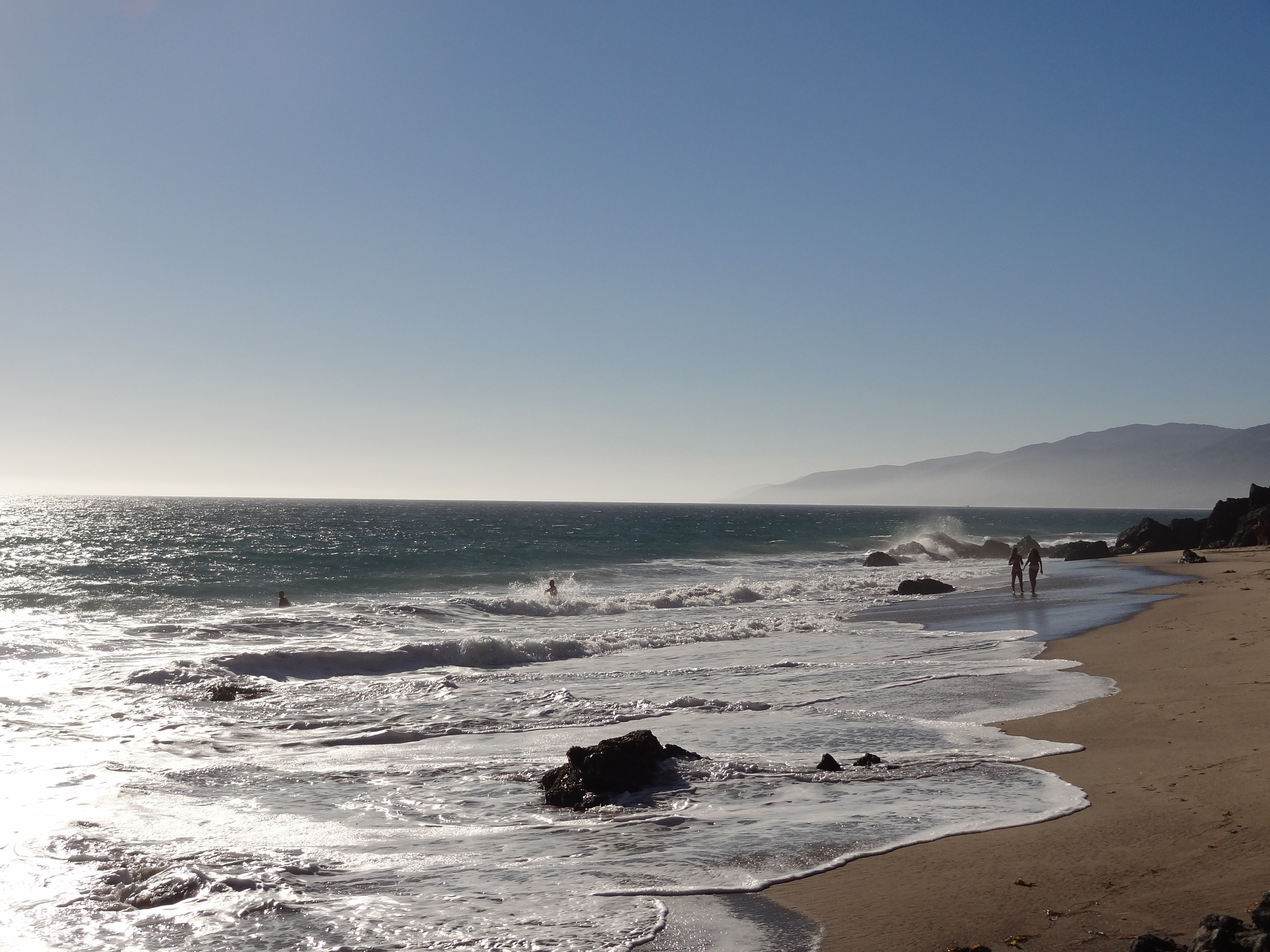
There are a number of camping options in the local Santa Monica Mountains, including Leo Carrillo, Point Mugu State Park and Malibu Creek State Park.

Senior Citizen Discount at State Parks!

California state parks offer senior citizen discounts for those age 62 or older with proof of age. Discounts include $1 discount for vehicle day use (except for fees under $2) and $2 discount per night for most campgrounds. www.parks.ca.gov/?page_id=23800


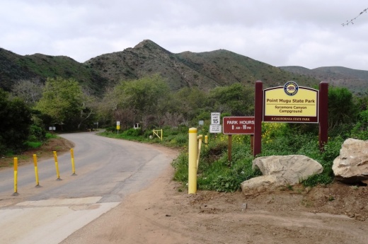
Leo Carrillo State Park is located at 35000 W. Pacific Coast Highway, Malibu. The Canyon Campground has 135 family sites, each with a table and fire ring. Restrooms, drinking water and coin-operated showers are available. "Hike and Bike" campsites are offered on a first-come, first-served basis. The group campground at the back of the canyon can accommodate up to 50 people. Peak season is March 1 to November 30 and off-peak is the month of December. Campsite is steps away from 1 1/2 miles of beach with tidepools, coastal caves and reefs to explore. Maximum of 8 people per campsite. Fees as of March 2023 are $10/person for Hike and Bike sites, $45 to $60/night for canyon sites and $225/night for the group site, plus $7.99 reservation fee. Visit ReserveCalifornia.com and search for “Leo Carrillo SP” to make reservations. More information about Leo Carrillo State Park at www.parks.ca.gov/?page_id=616.

Camping at Leo Carrillo State Park is extremely popular. (This was photo was taken before the Woolsey Fire of November 2018.)

Camping at Leo Carrillo State Park is extremely popular. (This was photo was taken before the Woolsey Fire of November 2018.)

PtMuguSignhr.jpg

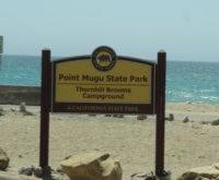
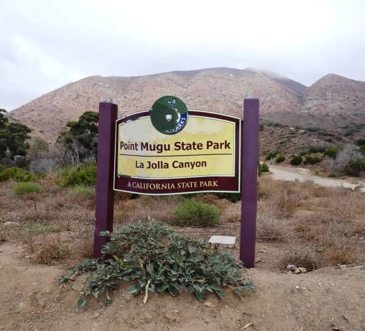
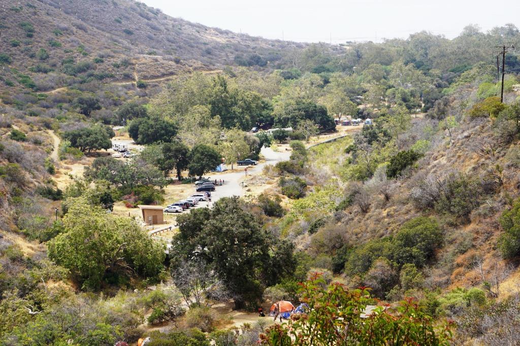
Point Mugu State Park is located at 9000 W. Pacific Coast Highway, Malibu, offering a variety of camping options described below.

The Big Sycamore Canyon Family Camp is north of PCH, offering 58 tent/RV spaces along with drinking water, restrooms, showers and fire rings. There is also 4 tent spaces available for "Hike and Bike" camper. Pets are allowed on leash in the campground. Fees as of March 2023 are $45/night and $10/night for Hike and Bike spots. Visit ReserveCalifornia.com and search for “Point Mugu SP” to make reservations.

SycamoreCynCamp_sign.JPG

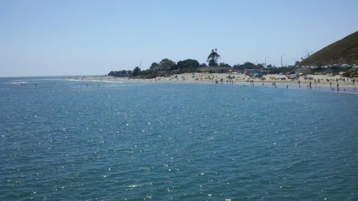
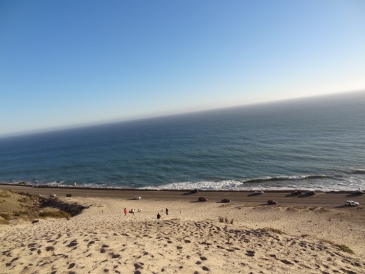
Thornhill Broome Family Camp offers 68 tent/RV spaces with no hookups, but you're talking literally on the beach camping. No flush toilets; just chemical toilets. Cold outside showers. Sites have picnic tables and fire rings. Pets are allowed on leash in the campground. Fees as of March 2023 are $35/night. Visit ReserveCalifornia.com and search for “Point Mugu SP” to make reservations.

Thornhill Broome RV Park as seen from across PCH.

Thornhill Broome RV Park as seen from across PCH.

La Jolla Valley Hike-In camping accommodates up to 3 tent spaces; no water, no fires. $10 per person, per night, payable at the La Jolla Valley/Ray Miller Trail parking area. There is also a group hike-in spot for 10 to 20 people.

There is also a reservable La Jolla Group tent camp for 9 to 50 people available near the entrance to the La Jolla Valley section of Point Mugu State Park that has drinking water, flush toilets, showers and a fire pit. Fees as of March 2023 are $225/night. This is a walk-in group camp for tents only with parking available for up to 12 vehicles, 25 yards from the campground. Located across from Thornhill Broome. Visit www.reservecalifornia.com and search for “Point Mugu SP” to reserve the group camp.

La Jolla Valley Group Camping Area

La Jolla Valley Group Camping Area

<

The Danielson Group Multi-Use Area is located in Sycamore Canyon within Pt Mugu State Park and is available for groups of 10 to 50 people. There is drinking water, flush toilets, showers, tent spaces and fireplace. Pets allowed on leash in campground. Contact California State Parks to book the reservation at 805.488.5223 or 805.488.1827.

The Sycamore Group Multi-Use Area accommodates 10 to 25 people and includes drinking water, chemical toilets, tent spaces and fire rings. Pets allowed on leash in campground. Contact California State Parks to book the reservation at 805.488.5223 or 805.488.1827.

Malibu Creek State Park at 1925 Las Virgenes Road, Calabasas offers a family campground with 62 tent/RV spaces, drinking water, restrooms, showers and fire rings. Pets are allowed in the campground (but not in the back country trails). Fees $45/night + $7.99 reservation fee as of March 2023. There is also a group campground available for 10 to 60 people at $225/night. Reservations at ReserveCalifornia.com by searching for “Malibu Creek SP” or by calling 800-444-PARK.

CircleXRanch_sign.jpg

The National Park Service maintains the Circle X Ranch Group Campground is located at 12896 Yerba Buena Road, Malibu. There is only one group campsite located here for tent camping only. Pets on leash are allowed. Drinking water and pit toilets available, along with picnic benches and grills. No electricity. Room for 10 to 75 people. Reserve a spot at www.Recreation.gov at THIS LINK. Cost as of Summer 2019 was $35/night for 10-25 people, $75/night for 26-50 and $125/night for 51-75. Open year-round. Enjoy hiking Sandstone Peak and the Grotto Trail from Circle X Ranch! NOTE: CIRCLE X RANCH GROUP CAMPGROUND CLOSED UNTIL FURTHER NOTICE DUE TO DAMAGE FROM WOOLSEY FIRE. CHECK FOR UPDATES AT RECREATION.GOV.

Tent camping is available year round on all five islands in Channel Islands National Park in National Park Service-managed campgrounds. Some of them have water. All have tables and vault toilets. There are a total of approximately 70 campsites. Campgrounds on each island are as follows:

  • Anacapa Island: Year-round camping. No water. 7 sites.

  • Santa Cruz Island East - Scorpion Anchorage Campground open year-round about 1/4 mile from the beach. Water is available here. 25 campsites and 6 group sites.

  • Santa Cruz Island Mid - Del Norte Campground at Prisoners Harbor open year-round. Backcountry camp four miles from the harbor. No water. 4 sites.

  • San Miguel Island - Above Cuyler Harbor is back country camping open May through October. No water. 9 sites.

  • Santa Rosa Island - At Water Canyon March through November. 15 sites. Water available.

  • Santa Barbara Island - Above the Landing Cove April through October. No water. 10 sites.

Advance reservations required by calling 877.444.6777 or through Recreation.gov. Currently $15/night fee as of March 2023 for individual campsites. No fires permitted; you can only use enclosed gas stoves.  More information at www.nps.gov/chis/planyourvisit/camping.htm.

Scorpion Anchorage campground on Santa Cruz Island (Channel Islands National Park)

Scorpion Anchorage campground on Santa Cruz Island (Channel Islands National Park)

The 1.75 million acre Los Padres National Forest (LPNF) stretches across almost 220 miles from Monterey County through San Luis Obispo, Santa Barbara, Ventura and Kern Counties. The Ojai Ranger District of LPNF includes the Matilija Wilderness and part of the Sespe Wilderness. There are five campgrounds in the Ojai portion of LPNF, including reservable Wheeler Gorge Campground and first-come, first-served campgrounds, Middle Lion, Pine Mountain, Reyes Peak and Rose Valley.

Wheeler Gorge Campground in Ojai is open year-round with dozens of available spots for tents and RVs. Parking spurs are paved and vary in length, accommodating RVs up to 35 feet. At the top of the campground is the Wheeler Gorge Nature Trail. Rangers at nearby Wheeler Gorge Visitor Center provide informative tours during summer/fall months. The campground is adjacent to Matilija Creek and is bordered by oak and sycamore trees and evergreen shrubbery. Most sites are shaded and summer temperatures reach up to 95 degrees.  Each site is equipped with a table and campfire ring with grill. Accessible vault toilets are provided, but drinking water is not available. Visitors must bring their own water and remove their trash from the campground. Make reservations on Recreation.gov at THIS LINK. Standard rate was $35/night ($2 extra on holidays/weekends) as of March 2023.

Photo Credit: Tom Alexander

Photo Credit: Tom Alexander

Rose Valley Campground in Ojai is located at an elevation of 3,450 feet. It is open year-round. There are nine campsites located in a single loop, each with tables, BBQ grills, and/or fire rings. There is one vault toilet in the campground and another across from the lake. Drinking water is not available, so be sure to bring your own. Adventure Pass is required to be displayed on car ($5/day or $30/year). Half a mile hike gets you to the Rose Valley Falls. Directions: Take Highway 33 north from Ojai 14.7 miles to mile marker 25.84.  Turn right at the Rose Valley Road turnoff and follow the paved road for 3.1 miles. Turn right again at the Rose Valley sign and drive 0.6 miles into the campground.

Reservations for 6 of the 9 campsites are available at www.recreation.gov at THIS LINK or by calling 1-877-444-6777. The remaining 3 sites are on a first-come, first-serve basis. $30/night ($2 extra on weekends and holidays) as of March 2023.

Middle Lion Campground is surrounded by chaparral covered mountains, shaded by cottonwood trees and is next to a peaceful stream. It has eight first-come, first-served campsites located along a single loop. Tables, barbecue grills and/or fire rings are provided at each site. There is a vault toilet. No drinking water on site; you must bring your own. Follow Highway 33 north of Ojai for 14.7 miles to the Rose Valley Road turnoff. Turn right and follow the paved road 4.8 miles. Turn right and go 0.8 miles to the campground.

Pine Mountain Campground is nestled in a small valley along the top of Pine Mountain and consists of six campsites in a circle with a large open area in the middle. Opens May 1st. There are tables, BBQ grills and/or fire rings, and one pit toilet at this campground.  Water is not available so be sure to bring your own.  The campground is surrounded by moderate hills and is a quiet place for relaxing. At an elevation of 6,650 feet, it offers cooler temperatures on hot summer days. The campground is closed during winter months, through April. Follow Highway 33 to the turnoff at Pine Mountain Summit (mile marker 42.50).  Turn right and follow partially paved road another 4.7 miles. Campground will be on the right. Reserve a spot at www.recreation.gov/camping/campgrounds/273843. Cost as of March 2023 is $30 per night ($2 extra on weekends and holidays).

One mile further up from Pine Mountain Campground, at an elevation of 7,000 feet is Reyes Peak Campground. It is situated along the southwest side of a ridge and consists of six campsites, each with a table, BBQ grill and a fire ring. There is one pit toilet located near the first few campsites. No water is available, so be sure to bring your own. Panoramic views! You can see the Cuyama Badlands on one side and the ocean from the other side. Reserve a spot at www.recreation.gov/camping/campgrounds/273877. Cost as of March 2023 is $30 per night ($2 extra on weekends and holidays).

The Lake Casitas Recreation Area located at 11311 Santa Ana Road in Ventura offers over 400 campsites. Sites can accommodate tents, tent trailers, campers and RVs, all with picnic tables and fire rings and some with playgrounds nearby. Book early as campgrounds sell out on weekends from mid-March through September. Casitas Water Adventure is open from Memorial Day weekend through Labor Day weekend. Make reservations at reservations.casitaswater.org, in person or over the phone at 805.649.1122. Sites are limited to six campers. Lake Casitas is a drinking water supply, so swimming is not allowed in it. Dogs are allowed but must be on a leash no longer than six feet long and are not allowed within 50 feet of the lake. Boating on the lake is allowed.

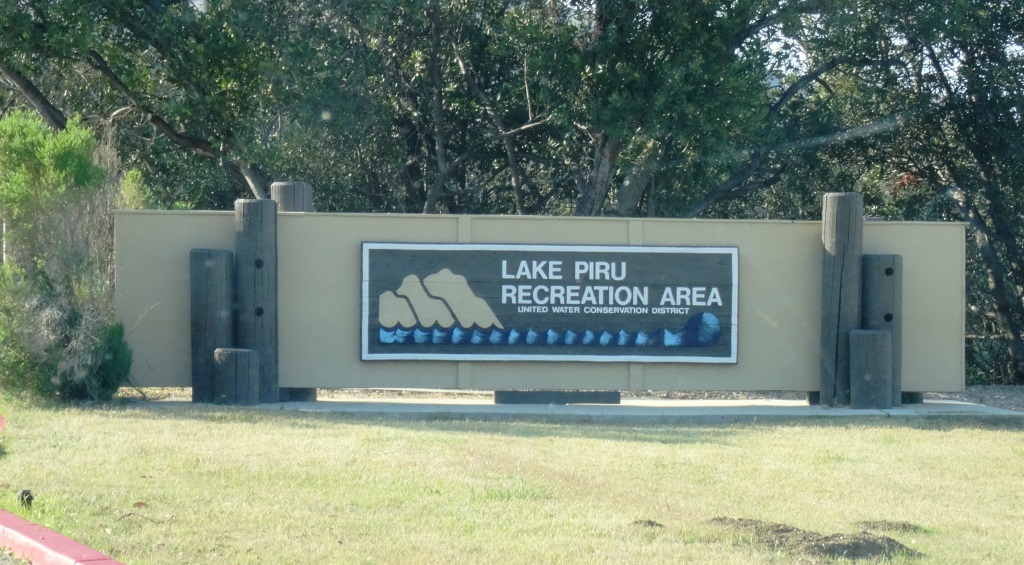
The 60 acre Lake Piru Recreation Area is located on the western shore of Lake Piru, an artificial lake in the Los Padres National Forest. Lake Piru offers 238 tree-shaded campsites, coin-operated hot showers and a store. Each site has a picnic table, fire ring and grill top. The dam is owned and operated by the United Water Conservation District of Santa Paula and a third party operates the campsite; visit explorelakepiru.com/#reservations for more information and to make reservations. Boat rentals and fishing available. Fees vary and are listed on the website. Or call 805.521.1500.

Other nearby California State Parks with camping are at McGrath State Beach, Emma Wood State Beach, Carpinteria State Beach, El Capitan State Beach, Gaviota State Park and Refugio State Beach as described below.

McGrath Sign.JPG

The McGrath State Beach Campground has 174 campsites with picnic tables and fire rings, and restrooms with coin-operated hot showers. A group campsite and a hike-and-bike site are also available. Reserve campsites at www.reservecalifornia.com and search for “McGrath SB” or by calling 800-444-7275. Dogs allowed on leash but not on the beach. The beach is five miles south of Ventura off Highway 101 via Harbor Boulevard. Available March through December. NOTE: MCGRATH CAMPING AREAS CLOSED - LAST UPDATE JUNE 2021.

Emma Wood State Beach offers camping for self-contained vehicles (e.g. RVs) only (tents not permitted). No water, restrooms, electricity, fire rings, phones or dump stations are available.  There are 90 spaces, with a maximum vehicle length of 40 feet, due to small turnaround areas. Camping at Emma Wood State Beach is reservation only from mid-May through Labor Day. Pricing as of March 2023 is $40/night and $280/week at www.reservecalifornia.com by searching for “Emma Wood SB.”

Emma Wood

Four developed group campsites with room for 30 campers are available at Ventura River Group Camp, located two miles south of Emma Wood. Reservations required year-round. There is also primitive RV camping for groups up to 50 people and 20 vehicles.  The maximum length for RV is 45 feet. Railroad tracks and Highway 101 are adjacent to the campground and can be noisy. Dogs on leash are allowed on campground but not on the beach. Chemical toilets available, as are cold showers. Reserve campsites at www.reservecalifornia.com and search for “Emma Wood SB”.

CarpStateBeach_sign.JPG

Carpinteria State Beach is a mile long beach that is great for swimming, surf fishing, tidepool exploring and camping. Dogs are allowed only at the picnic area. Four campground areas with 216 family campsites and seven group campsites available.  Exit the 101 at Casitas Pass Road, go west to Carpinteria Avenue, make a right at the signal; then turn left on Palm.  The beach is at the end of Palm Avenue near 4th Street. Call 805.968.1033 or visit www.parks.ca.gov/?page_id=599. Reserve campsites at www.reservecalifornia.com and search for “Carpinteria SB.” Family campsites are $45/night as of March 2023 plus reservation fee. There are also some “Hike and Bike” campsites available on a first come, first serve basis for $10 per person, per night, with a two night consecutive limit.

El Capitán State Beach is located off Highway 101, 17 miles west of Santa Barbara at Exit 117. A sandy beach, rocky tide pools, and stands of sycamore and oaks along El Capitán Creek. It’s a perfect setting for swimming, fishing, surfing, picnicking and camping. A 132-site campground is open year-round. A short walk takes you to the beach. Each site has a picnic table and stove or fire ring; restrooms with hot showers are nearby. Several sites are paved for RVs only. Some sites accommodate trailers and RVs up to 42 feet in length. Five group campsites, accommodating 40-100 people, are available. Hike and bike campsites are also available. Dogs allowed on leash but not on the beach. Reserve campsites at www.reservecalifornia.com and search for “El Capitan SB.” Family campsites $45/night as of March 2023.

More on El Capitan at www.parks.ca.gov/?page_id=601.

Gaviota State Park is located about 33 miles west of Santa Barbara on Gaviota Beach Road. Gaviota is popular for swimming, picnicking and surf fishing. This section of the coast was first called "gaviota" (seagull) by soldiers of the Portola Expedition in 1769. A pier on the west end of the beach is used by divers and surfers. A six mile trek up to Gaviota Peak offers a view of the coast and the Channel Islands. There are 41 developed, first-come, first-served campsites available at Gaviota that can accommodate tents, trailers up to 25 feet and RVs up to 27 feet. Between October 1 and March 31, the campground is open Friday through Sunday only. Dogs on leash allowed, but not on the beach. Reserve campsites at www.reservecalifornia.com and search for “Gaviota SP.” Family sites $45/night plus reservation fee as of March 2023.

1/16/23 GAVIOTA STATE PARK TEMPORARILY CLOSED DUE TO SEVERE STORM DAMAGE, FLOODING AND DEBRIS CLEANUP. Anticipated to re-open in April 2024. Check for updates at www.parks.ca.gov/?page_id=606.

Refugio State Beach is located at 10 Refugio Beach Road in Goleta, about 20 miles west of Santa Barbara. Refugio offers coastal fishing, trails, picnic sites. and palm trees. There are over 60 campsites with an eight camper maximum per campsite. Dogs on leash allowed, but not on the beach. Reserve campsites at www.reservecalifornia.com and search for “Refugio SB.” Campsites $45/night plus reservation fee as of March 2023. More information on Refugio State Beach at www.parks.ca.gov/?page_id=603.

The County of Ventura maintains campsites at Camp Comfort and Dennison Park in Ojai, Foster Park in Ventura, Kenney Grove Park in Fillmore, Oak Park in Simi Valley, Steckel Park in Santa Paula, Tapo Canyon, Simi Valley and Toland Park, Santa Paula. To make reservations, visit www.venturaparks.org or call 805.654.3951 for more information. Maximum stay in Ventura County parks is 14 nights per ordinance.

Camp Comfort is located about a mile from Downtown Ojai at 11969 North Creek Road, Ojai. Hwy 33, S.E. on Hermosa Road. San Antonio Creek runs through this tree-lined park. Individual and group campsites are available at www.ventura.org/parks-department/inland-parks/camp-comfort-ojai. There are 15 campsites. There are restrooms, drinking water, a playground, picnic tables, BBQs and fire rings. Showers, full hook-ups and laundry available. Dogs are allowed on up to 6 foot leash for a $1/night fee (2 dog maximum). Sites $46 to $48 per night plus $8 reservation fee as of March 2023.

Dennison Park is located at 7250 Santa Paula-Ojai Road in Ojai, on Hwy 150, south of Nordhoff Road. This is a quiet park with views of the Ojai Valley, offering a feeling of seclusion. There are covered family/group barbecue areas near the entrance of the park available by reservation only. Fees are $25-$26 per night plus an $8 reservation fee as of March 2023. There are 31 campsites. RV camping in lower portion of park only with 35 foot maximum length; no hook ups. Dogs allowed on leash for $1/night fee (2 dog maximum). Individual and group campsites are available at www.ventura.org/parks-department/inland-parks/dennison-park-ojai.

Foster Park is located at 438 Casitas Vista Road, Ventura, off of Highway 33. The park is lush with plenty of trees and two separate campgrounds, Residence Campground (14 campsites) and Red Mountain Campground (23 campsites). The Ojai Valley Trail runs through the park, which is great for cycling, walking and running. Maximum of 6 campers per site. Dogs allowed on leash for $1/night fee (2 dog maximum). Individual and group campsites are available at www.venturaparks.org. $27/night plus $10 reservation fee as of March 2023.

Kenney Grove Park at 823 North Oak Avenue, Fillmore is a developed RV campground with over 50 campsites for RVs and tents. It is owned by the county but is leased to a private party that manages the campground. Most sites have water and electrical hookups and some have fire rings and tables. Park use is by reservation only. There is a playground, restrooms, softball field, horseshoe pits, hot showers and other amenities. Dogs allowed on 6 foot leash in campground only ($1/night fee, 2 dog maximum). Ten full hookups available. Call 805-524-0750 for information. Make reservations at www.venturaparks.org.$39/night plus $10 reservation fee as of March 2023.

Oak Park Campground in Simi Valley is just off of the 118 freeway at 901 Quimsa Drive. There are approximately 30 campsites in this rustic, 100.5 acre open space park. Available for $40/night plus $10 reservation fee (as of March 2023). There are two playgrounds, amphitheater area, fire pits, restrooms and more. Maximum of 6 campers per site. Dogs allowed on leash for $1/night fee (2 dog maximum). Individual and group campsites are available at www.venturaparks.org.

There's a county-run 50 site campground at Steckel Park, 8080 Mistletoe Road, Santa Paula. Santa Paula Creek runs through this campground surrounded by rolling hills, mountains and trees. There's a playground, horseshoe pits, picnic tables, restrooms, etc. $54/night plus $10 reservation fee as of March 2023. Dogs allowed on a 6 foot leash. Individual and group campsites are available at www.venturaparks.org.

Tapo Canyon Regional Park is located in the midst of the rolling hills and canyons of the Santa Susana Mountains north of Simi Valley at 4651 Tapo Canyon Road. Hikers, equestrian riders, and mountain bikers enjoy this rugged and rural park, which features picnic areas, an equestrian arena and a RV campground with 16 full hook ups. Dogs allowed on a 6 foot leash. Individual and group campsites are available at www.venturaparks.org. $48 per night plus $10 reservation fee as of March 2023.

Rincon Parkway is located between Faria Beach Park and Hobson Beach Park on Highway 1 off the Ventura Freeway. 127 RV use only parking spaces are available. Tent camping is not allowed. All RVs must be fully self-contained, as there are no electrical hook ups, dump stations, shower/bathroom facilities or water onsite, although there are a handful of porta-johns. There is a 5 day parking limit from April 1 to October 31 and a 14 day limit from November 1 to March 31. Dogs allowed on 6 foot leash. There is a $1 charge per dog. Book a spot at venturaparks.org/rincon/camping. Prices are $45 per night plus $10 reservation fee as of March 2023.

(There is no day use at Rincon Parkway.)

Hobson Beach Park at 5210 W. Pacific Coast Highway in Ventura is north of Faria Beach Park and the Rincon Parkway. Similar to Faria Park, Hobson Park is wedged between the Pacific Ocean and the base of the Santa Ynez mountains along Highway 1 off the Ventura Freeway. There are 31 first come, first served sites available, 10 with hookups and the rest without. The beach is steps away and there are showers and a concession stand. Dogs allowed on a 6 foot leash ($1/night fee; 2 dog maximum). Book sites at THIS LINK. Non-hookup sites $43 peak season, $41 off-peak season and hook-up sites $65 peak season and $60 off season as of March 2023.

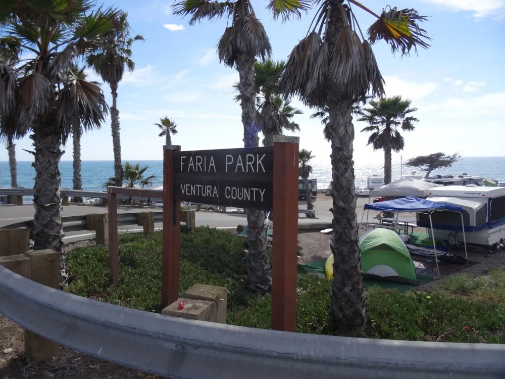
Faria Beach Park at 4350 W. Pacific Coast Highway in Ventura is south of Hobson Beach Park. Another popular beachfront spot with 42 spaces available on a first come, first served basis. Tent and RV camping available. There are showers and a concession stand. Dogs allowed on a 6 foot leash ($1/night fee; 2 dog maximum). Book sites at THIS LINK. Fees are $45 per day peak season and $41 per day off season for non-hookup sites, $40/$37 for non-campfire sites and $65 to $67 peak season, $60 to $63 off peak season for full hookup sites as of March 2023.

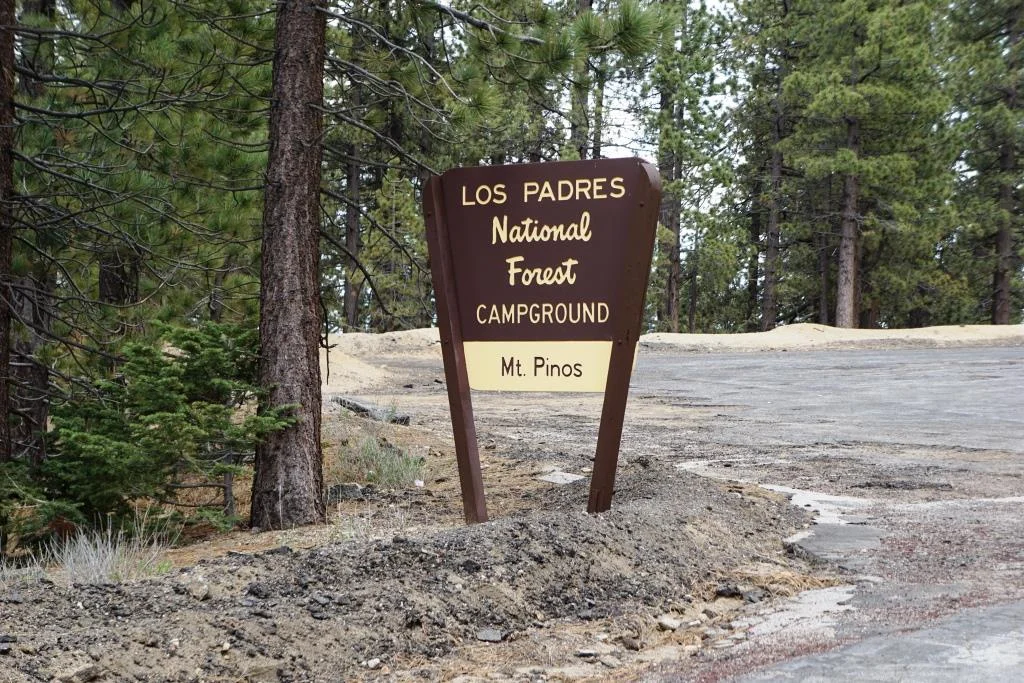
Mount Pinos in the Los Padres National Forest is the tallest peak in Ventura County, located about 1 hour, 45 minutes away from the heart of Thousand Oaks, adjacent to Kern County.

Directions to Mount Pinos: From I-5, take Frazier Park exit (Frazier Mountain Park Road). Go west approximately 6 miles. The road name changes to Cuddy Valley Road. Continue on it up Mt. Pinos. The road name changes to Mt. Pinos Highway.

The County of Santa Barbara runs two popular camping parks, Cachuma Lake and Jalama Beach. Both accept online reservations, but 40 sites at Cachuma and 20 sites at Jalama are first come, first served for walk-in customers. 

Cachuma Lake Recreation Area is located at 2225 Highway 154, Santa Barbara, midway between the beach and the town of Solvang. Tent sites, hookups, cabins, yurts and group area available. As Cachuma Lake is a domestic water supply, swimming, water skiing, windsurfing, or any other body contact with the water is prohibited. Fishing is allowed. Detailed list of fees at www.countyofsb.org/788/Cabins.

Jalama Beach County Park is located at 9999 Jalama Road in Lompoc, an hour drive from Santa Barbara. Named after what used to be a Chumash Indian settlement named Halama. ARCO donated 23.5 acres of land to the County of Santa Barbara in 1943. There are 109 campsites, all overlooking the ocean or beachfront, each with a picnic table and BBQ pit, with hot showers, restrooms and water nearby. 31 sites offer electrical hookups and dump stations are available. Detailed list of fees at www.countyofsb.org/788/Cabins.

Privately Operated Campgrounds In the Area

Ventura Oaks RV Park is located at 255 Burnham Road in Oak View, offering 60 full hookup sites just two miles from Lake Casitas. Park-like setting with picnic tables, fully furnished laundry area, picnic tables and WiFi throughout. Long-term rentals available. Visit www.venturaoaks.com for more information.

Santa Barbara RV Park is located at 516 S. Salinas Street. It is adjacent to the highway, so there will be some noise, but it is also located within a couple miles of the beach, the Santa Barbara Zoo and downtown area. There are 30 sites. Site has bathrooms, showers and a laundry room.  Free WiFi. Dogs allowed. Visit www.santabarbararv.com.

Ventura Beach RV Resort is located at 800 West Main Street in Ventura. The 14 acre park has 180 spots and is just a short walk to the ocean. Amenities include a pool, hot tub, recreation room, small playground, onsite general store, and half basketball court. Visit www.vbrvresort.com for more information.

Prospector Ranch in Westlake Village is nestled in the hills of the Santa Monica Mountains, offering camping options here in the Conejo Valley, including a luxury safari tent, an Airstream or bring your own RV. Visit www.prospectorranch.com/glamping for more information.

Rancho Oso Resort is located at 3750 Paradise Road, Santa Barbara, 8 miles east of Cachuma Lake. Accommodations include RV camping, horse camping, covered wagons, resort cabins and Tipi camping. Visit rvonthego.com/california/rancho-oso-rv-camping-resort.

El Capitan Canyon Resort is located at 11560 Calle Real, Goleta, adjacent to El Capitan State Beach. This is luxury camping, with nicely appointed cedar cabins with beds, kitchens and restrooms (my kind of camping) as well as 26 salari tents that are spacious with bedding and nearby restroom/shower facilities. Of course, there's also picnic tables, fire pits, etc as well as a store with all the stuff you need to "rough it." Activities include a pool, small playground, bike rentals, hiking, of course the nearby beach and much more. Visit www.elcapitancanyon.com.

Next door to El Capitan Canyon Resort is Ocean Mesa RV Resort at El Capitan, at 100 El Capitan Terrace Lane, Goleta. This resort has 20 tent camping sites and 80 RV sites. Amenities include heated pool and spa, WiFi, TV, convenience store, hiking, snack bar, horseback riding and more. Visit www.oceanmesa.com.

How cool is this...a llama farm is walking distance from El Capitan Canyon Resort.

How cool is this...a llama farm is walking distance from El Capitan Canyon Resort.

Evergreen RV Park at 2135 N. Oxnard Blvd in Oxnard has 94 full hookup RV spaces. Facility includes restrooms, showers, free WiFi, laundry room, BBQs, picnic tables and more. Visit www.evergreenrvpark.com.

Flying Flags RV Resort and Campground is located at 180 Ave Of The Flags in Buellton, just an hour and a half northwest of Thousand Oaks. Here you’ll find vintage trailer and airstream rentals, cottages, luxury tents or your own RV or tent camping. Amenities include pool, playground, WiFi and more. And less than half a mile away from Pea Soup Andersen’s! flyingflags.com

Malibu Beach RV Park is located at 25801 Pacific Coast Highway, just east of Malibu Seafood. The park has 142 RV spots and up to 35 tent sites, all with a view of the Pacific. Open 365 days a year. Rates range from $40 for an off-season tent spot to $190 for an ocean view premium spot during peak season on weekends. Amenities include store, game room, restrooms with heated showers, laundry and more. Visit www.maliburv.com.

There are no official campgrounds in the Conejo Valley, but the Conejo Valley Recreation and Park District hosts a Family Campout several times a year in Wildwood Park. Bring your tents and camping gear and enjoy an evening of fun with other local families, including hikes, exploring, meals and campfire. Visit www.crpd.org for more info.

Something noteworthy to add or correct? Contact us!

16th Annual Waves of Flags 2023 Display at Pepperdine University

wavesofflags2018.JPG

For the 16th consecutive year, Pepperdine University will commemorate the lives lost in the terror attacks on September 11, 2001, with the Waves of Flags display at Alumni Park on the Malibu campus.

Waves of Flags commemorates the 2,977 lives lost in the September 11 terror attacks and features a vast display of American flags for each American life lost as well as international flags representing the home countries of those from abroad. Made possible through the support of donors and volunteers, the installation will be on display at the corner of Pacific Coast Highway and Malibu Canyon Road from Saturday, September 2 to September 21, 2023.

In addition to the Waves of Flags installation, Pepperdine is the permanent home of the Thomas E. Burnett, Jr., Heroes Garden, a place to honor all those who live heroic lives, including Pepperdine alumnus Thomas E. Burnett, Jr. (MBA ’95), a passenger on United Flight 93, whose life was cut short in the September 11 attacks. The garden's plaque reads: “Dedicated to freedom's heroes of September 11, 2001, and the passengers of United Airlines Flight 93, among them Pepperdine alumnus Thomas E. Burnett, Jr., who sacrificed their lives to overcome terrorists’ intent on destroying American lives and landmarks in our nation's capital. We shall never forget.” Heroes Garden is currently closed to the public, along with the rest of the Pepperdine campus.

On Monday, September 12th, Pepperdine will host Honoring the Heroes of 9/11, a commemoration ceremony led by University chancellor Sara Jackson (’74) with special remarks by president Jim Gash (JD ’93) and Pepperdine alumni Ryan Sawtelle (’09) and Chris Garcia (’11), who brought the Waves of Flags idea to life in 2008. The ceremony will be held at 11 AM at Alumni Park.

www.pepperdine.edu/newsroom/articles/pepperdine-pays-tribute-to-lives-lost-on-9-11-with-annual-waves-of-flags-display.htm

wavesofflags2018_2.JPG

The Giant Sand Dune on PCH Across From Thornhill Broome Beach in Point Mugu

One of the many unique things to see in Ventura County is the gigantic sand dune located on the east end of Thornhill Broome Beach in Point Mugu.

ThornhillSandDune.JPG

Driving north up PCH, you'll see the sand dune on the east side after passing by Sycamore Canyon/Sycamore Cove Beach and before reaching the entrance to the Thornhill Broome Campground. 

ThornhillBroomeDune1.JPG

Park on the shoulder off of PCH. There's plenty of room, though you may be partially parked in the sand. You can also park on the beach side of PCH but rather than taking your life in your hands jaywalking across PCH, you're better off parking on the mountain side of the highway.

The mysteriously large sand dune is the result of "Aeolian transport," or the wind's movement of particles, in this case, sand. Quite steep this hill is, but your effort will be rewarded with some beautiful views of the Pacific Ocean. Plus, you get a nice bird's eye view of Mugu Rock.

ThornhillBroomeDune3.JPG

We noticed that the southern-most portion of the sand dune seems to have more large rocks in the sand from erosion of the mountains above. The northern hill, at least the several times we've now been there since originally posting this, has somewhat less rocks, leaving the sand smoother and more comfortable to walk on.

Going down the hill is certainly a lot easier than coming up!

Over 40 Things to Do in Malibu

This "27 Miles of Scenic Beauty" sign was swapped out for "21 Miles of Scenic Beauty" sign in April 2017 in order to correct the actual length of City of Malibu coastline.

This "27 Miles of Scenic Beauty" sign was swapped out for "21 Miles of Scenic Beauty" sign in April 2017 in order to correct the actual length of City of Malibu coastline.

The new sign updated in 2017.

The new sign updated in 2017.

Malibu was incorporated as a separate city in Los Angeles County on March 28, 1991, with 84% of Malibu voters supporting incorporation in a 1990 election.

The Conejo Valley lies just 8 to 10 miles away from the Malibu beachfront, making Malibu a natural choice to beat the heat and enjoy to its south-facing beaches. Here's a compilation of over 40 things to do in and around Malibu.

Beaches (East to West)

Surfrider Beach from the Malibu Pier

Surfrider Beach from the Malibu Pier

Adamson House

Adamson House

Ray Miller Trail at Pt. Mugu State Park in Malibu

Views from the Ray Miller Trail at Pt. Mugu State Park.

Views from the Ray Miller Trail at Pt. Mugu State Park.

The Ray Miller Trail is located in the La Jolla Canyon section of Pt. Mugu State Park in Malibu. The trail is named after Ray Miller, "Guardian of the Canyon," who was the first official California State Park Camp Host, having volunteered from March 1, 1979 until his death on April 28, 1989.

Monument to Ray Miller on boulder in the La Jolla Canyon Day Use parking lot.

Monument to Ray Miller on boulder in the La Jolla Canyon Day Use parking lot.

On its own, the trail is 2.7 miles each direction, taking you from the base of La Jolla Canyon to an overlook of the Pacific Ocean that provides sweeping views towards Mugu Rock on the west and Sycamore Cove on the east.

La Jolla Canyon sign in need of repair in September 2015.

La Jolla Canyon sign in need of repair in September 2015.

The trail looks harder than what it really is in my opinion. The elevation gain is close to 1,000 feet over the 2.7 miles, but none of the climbs are particularly steep.  The trail zigs and zags its way up as you take in views below. You will love this trail. Many people I know say this is their favorite trail!

Ray Miller Trail Trailhead Sign
Single track trail all the way up, but the surface is pretty good overall. Can get slippery when wet, however.

Single track trail all the way up, but the surface is pretty good overall. Can get slippery when wet, however.

After you reach the overlook, you continue on until you reach the Overlook Fire Road at the end of the trail (there's a sign). At that point, you can turn back or you can continue on the fire road going either north towards the La Jolla Valley Fire Road, or south towards Sycamore Campground.

Views are in abundance most of the way up this trail. This photo was taken in September 2015, in the midst of a four-year drought. It will green up in the winter.

Views are in abundance most of the way up this trail. This photo was taken in September 2015, in the midst of a four-year drought. It will green up in the winter.

This is the sign indicating you're reached the endpoint of the Ray Miller Trail, where it intersects with the Overlook Fire Road. Explore the road going both directions if you have time (and are carrying water), as there's plenty of views in all dir…

This is the sign indicating you're reached the endpoint of the Ray Miller Trail, where it intersects with the Overlook Fire Road. Explore the road going both directions if you have time (and are carrying water), as there's plenty of views in all directions.

At the bottom of La Jolla Canyon is a group campground.  

La Jolla Canyon is located at 9000 Pacific Coast Highway in Malibu. Take PCH south/southeast from Los Posas Road in Camarillo. Takes about 30 minutes to get there from the center of Thousand Oaks via either the 101 or via Potrero Road in Newbury Park. It is located just east of Mugu Rock and near Thornhill Broome Beach.

You can park in the La Jolla Day Use Parking Lot (as of September 2015, $8 for day use; $7 for seniors), or you can park on PCH and walk in. Dogs and bikes are not allowed on this trail, though horses are. It can get pretty hot up here in the summer, so be careful and bring plenty of water and wear sunscreen. 

The La Jolla Canyon Trail, accessed adjacent to the Ray Miller Trail, has been closed since January 2015 due to mudslides and rain damage. However, you can access the beautiful La Jolla Valley from the the La Jolla Valley Fire Road.

More information about Pt. Mugu State Park

Other local hikes and trails

The Truck Escape Ramp on Kanan Dume Road at the Intersection of Pacific Coast Highway

From time to time we take Kanan Road in Agoura Hills to Malibu for quick access to Zuma Beach, Westward Beach and Point Dume State Beach as well as Escondido Canyon Park, Paradise Cove and other great outdoor spots in Malibu.

From the 101, Kanan Road is about 12 miles from Pacific Coast Highway and takes roughly 15 minutes without traffic. Something that has always puzzled me is why it is called Kanan Road all the way from its juncture with North Westlake Boulevard in Thousand Oaks to the 101, through Oak Park and Agoura Hills, down to its intersection with Mulholland Highway in Malibu and then becomes Kanan Dume Road.

Runaway Truck Escape Ramp

The southernmost section of Kanan Dume Road is particularly steep, with an 8% grade over three miles.  My kids always ask about the "Escape Ramp" at the bottom of Kanan Dume Road at its intersection with PCH.

The Truck Escape Ramp was built in 1987 after a series of crashes and resulting deaths due to runaway trucks. The escape ramp, or arrester bed, is an 800 foot long, pit in the middle lane of the road filled 2 1/2 feet deep with gravel. The allowable weight limit for trucks on Kanan Dume was also dropped in 1987 from 14,000 to 8,000 lbs.

The arrester bed was renovated in 2014 to make it wider and improve signage. Thankfully we have never seen the escape ramp used, but it is there if it is ever needed.

Tunnel Vision

There are three tunnels on Kanan Dume Road between Latigo Canyon Road and PCH built in the late 1960s to early 1980s. They are affectionately referred to as T-1, T-2 and T-3. T-3 is two-lane tunnel located at approximately 1142-1208 Kanan Road in Agoura Hills, roughly five miles from Highway 101. A short distance later, you will drive through T-2, located just northeast of Rocky Oaks Park. About 2 1/2 miles from T-2 is the T-1 tunnel, just south of the Newton Canyon Backbone Trail trailhead.

One of three tunnels on Kanan Dume Road in Malibu. This one is called T-3. (Clever, eh?)

One of three tunnels on Kanan Dume Road in Malibu. This one is called T-3. (Clever, eh?)

Signage indicating approach of the truck escape ramp on Kanan Dume Road.

Signage indicating approach of the truck escape ramp on Kanan Dume Road.

A closer view of the escape ramp gravel pit. My son asked if we could drive in it (in my minivan). I said, "um, no" although if our brakes gave out, sure, I would use it.

A closer view of the escape ramp gravel pit. My son asked if we could drive in it (in my minivan). I said, "um, no" although if our brakes gave out, sure, I would use it.