Free Concerts and Live Music All Summer Long Around Ventura County

singingbunny.jpg

Summer 2024 will be here soon and we’ll have another outstanding summer of free live music throughout Ventura County and surrounding areas! Rock, jazz, pops, R&B, reggae, classical, 60s, 70s, 80s, 90s, Classic Rock, Latin, tribute bands, etc. The compilation below has links to more detailed information.

Concerts subject to change. List will be updated regularly as new events are added.

Thousand Oaks/Westlake Village/Newbury Park

Agoura/Oak Park/Calabasas/Woodland Hills

  • City of Agoura Hills Free Summer Concert in the Park at Chumash Park (except 7/21 concert at the Agoura Hills High PAEC. Concerts start at 6pm.

    • Sun, June 16: Foo Fighters Tribute

    • Sun, July 7: Neil Diamond Tribute

    • Sun, July 21: Conejo Valley Community Concert and Jazz Bands (at AHS PAEC)

    • Sun, Aug 4: Taylor Swift Tribute

    • Sun, Aug 18: The Yacht Groove

  • Valley Cultural Foundation’s Free Concerts at Warner Park in Woodland Hills on Sunday nights from June 16 to August 25 at 5:30PM (emerging artist) followed by headline acts.

    • June 16: Linda Ronstadt Tribute

    • June 23: The Soul Juice Band

    • June 30: The Doors Tribute

    • Thursday, July 4: 4th of July Event with Angela O’Neill and Outrageous8

    • July 14: Foreigner Tribute

    • July 21: Fleetwood Mac Tribute

    • July 28: Prince Tribute

    • Aug 4: Bon Jovi Tribute

    • Aug 11: ABBA Tribute

    • Aug 18: Taylor Swift Tribute

    • Aug 25: Aerosmith Tribute

  • Sun Sets Summer Concert Series at Calabasas Lake on Sunday nights at 6pm.

    • June 2: Tribute to Grease

    • July 21: On Tap Band (80s/90s)

    • Aug 11: U2 Tribute

    • Aug 25: R&B/Motown

  • Music in the Park at Oak Canyon Community Park in Oak Park on Saturday, July 13th (DSB - Journey Tribute)

Moorpark/Simi Valley

  • Summer Music in the Park Free Concerts at Rancho Simi Community Park on Saturday nights at 6:30pm.

    • Sat, June 15: Garth Brooks Tribute

    • Sat, July 20: Foo Fighters Tribute

    • Sat, August 17: Queen Nation (Queen Tribute)

  • Simi Civic Center Plaza Concerts in the Courtyard on six designated Sat nights from 6-9pm.

    • Saturday, June 29: 805 Social Club (Dance/Pop)

    • Saturday, July 13: Sidetracs (Top 40, R&B, Latin)

    • Saturday, July 27: Little Alice (Top 40)

    • Saturday, August 10: Beatles Tribute

    • Saturday, August 24: Pat Benatar Tribute

    • Saturday, September 7: The Dirty Lowdown (Yacht Rock/80s)

  • City of Moorpark Concerts in the Park at Arroyo Vista Park at 6pm

    • June 22: Rockin’ Oldies

    • July 27: Country/Pop/Rock

    • Aug 24: Classic Piano Rock

    • Sept 28: Moorpark Symphony Orchestra

Camarillo/Oxnard/Port Hueneme/Ventura

Santa Barbara

Free Thursday Night Concerts at Chase Palm Park in Santa Barbara on Thursday nights, June 27 and July 11, 18, 25 and August 8 from 6-7:30pm.

Have something to add to this list? CONTACT US!!

Check the Events Calendar for things going on around town as well as the Local Events and Community Messages sections of Conejo Valley Guide.

Fun for the Kids at Local Ventura County Shopping Malls

Shop and plop yourself down while your kids get entertained or, better yet, entertain themselves.  Here is a roundup of kids' activities and play areas at local shopping malls.  In addition to these ongoing activities, seasonal/holiday events are posted regularly here on Conejo Valley Guide.

The Lakes at Thousand Oaks has a nicely appointed outdoor playground with swings, slide and sandbox, large grassy area, two lakes (with ducks usually enjoying it) and waterfall.

Janss Marketplace in Thousand Oaks has Kids Fun Zone arts and crafts on the last Saturday of the month.  There is a small outdoor kids play area for the little ones and an impressive outdoor water fountain, not to mention a NEOS interactive play wall. And Sky Zone Trampoline Park is fun for all ages.

The Commons at Calabasas offers a Kids Club for kids 10 and under on Tuesday nights at 5pm typically March through October as well as an Edwards Theater.

Simi Valley Town Center has a small outdoor kids play area, dragon structure and $2 mini train rides. There’s also the Rockin’ Kids Play Center and Studio Movie Grill to round out the action.

The Oaks Mall in Thousand Oaks offers an indoor kids play area for little ones, Build-a-Bear Workshop, Jumpify Indoor Playground, Galactic Challenge airsoft B target range on level 2 of the outdoor shops area and the AMC Movie Theater.

Pacific View Mall in Ventura has a nice kids' play area near the food court, Bouncing Fun Land and a monthly Kids Club. Soon the Harbor View Carousel will be operating there in the level 2 food court area.

Camarillo Premium Outlets expanded by 220,000 sq ft in April 2009 with The Promenade, which has a Spanish style courtyard area.  In 2019, a kids playground area was constructed at The Promenade.

Playground installed at the Camarillo Premium Outlets in 2019.

Playground installed at the Camarillo Premium Outlets in 2019.

The Promenade at Westlake does not have a kids play area but they do have several nice fountains, live music on most summer weekends, the upscale Cinepolis movie theater and a koi pond.

Malibu Country Mart has a nice outdoor kids' playground area with cool ocean breezes.

The Collection at Riverpark in Oxnard has the 16 screen Century TheatreColor Me Mine ceramics studio and a nice outdoor playground/park area and the Bowlero bowling alley and Jump ‘N Jammin indoor play center. The Annex Food Hall at The Collection offers a Kids Club the last Wednesday of the month. There are board games available daily at Park View Court.

The Pedestrian Tunnel Under Avenida De Los Arboles in Thousand Oaks

There's a pedestrian tunnel that connects the Wildflower Playfield on Avenida De Los Arboles at Canna Street that goes underneath Arboles to Wildwood Neighborhood Park.

At the west end of Wildwood Neighborhood Park is a trail that will take you into Wildwood Park, and from there, you can either loop around back to the main Wildwood Park trailhead at the west end of Arboles, or turn back the way you came.

Wildwood Neighborhood Park was home to the original Wildwood Fort, built in 1967, but torn down in 2009 due to deterioration. New playground equipment was installed in 2021. There is also a playground across the street at Wildflower Playfield, along with restrooms at both parks. More info at www.crpd.org.

Playground at Wildwood Neighborhood Park

Life's a Beach! Public Beaches Spanning From Carpinteria to the Ventura Harbor

Beach_Klotz.jpg

The beaches of Ventura County have something for everyone, be it the sand, the ocean breezes, surfing, volleyball, sunning, picnicking or just chilling out to the sound of the waves. Here we have compiled a listing of beaches just north of Ventura County in Carpinteria down the coast to the Ventura Harbor. Separately we highlight beaches stretching further down the coast through Oxnard, Channel Islands Harbor, Point Mugu and Malibu as well as up the coast in and around Santa Barbara.

The Santa Claus Lane Beach Area in Carpinteria is a south facing beach area popular with surfers, boogie boarders and sunbathers. Get there from the 101 by taking the Padaro Lane exit towards Santa Claus Lane, then taking a left on Santa Claus Lane. You can park in a small dirt area (there's room for maybe 10 cars there) on the ocean side or find street parking, which is plentiful. This is not an "official" beach to my knowledge, as in city or county-run. Just a private beach. No restrooms to my knowledge. Oh yes, you'll have to cross the railroad tracks...so be careful! Down the street is Padaro Beach Village, where you can grab a bite to eat and do a little shopping.

On a separate note, you may be wondering why it is called Santa Claus Lane. Well the old-timers among you (including me) know that a gigantic roadside Santa used to reside here that now greets us off the 101 freeway in the Nyeland Acres section of Oxnard. Learn more about the history at this link.

Surfers, boogie boarders, body surfers and frolickers at the Santa Claus Lane area beach.

Surfers, boogie boarders, body surfers and frolickers at the Santa Claus Lane area beach.

Just down the street is the quaint Padaro Beach Village, where you can grab a coffee, breakfast, lunch, do a little shopping, etc. Very relaxing little area.

Just down the street is the quaint Padaro Beach Village, where you can grab a coffee, breakfast, lunch, do a little shopping, etc. Very relaxing little area.

Carpinteria State Beach is a mile long beach for swimming, surf fishing, tidepool exploring and camping. Dogs are allowed only at the picnic area. The park originally opened in February 1932. There are four campground areas with 216 family campsites and seven group campsites available. Seals and sea lions can be seen in the area December through May, as well as an occasional gray whale. Tidepools contain starfish, sea anemones, crabs, snails, octopi and sea urchins. Exit the 101 at Casitas Pass Road, go west to Carpinteria Avenue, make a right at the signal; then turn left on Palm.  The beach is at the end of Palm Avenue near 4th Street. Call 805.968.1033 or visit www.parks.ca.gov/?page_id=599.

Note: Campfires are only allowed in the campground in fire rings provided. No fires are allowed on the beach.

CarpStateBeach_sign.JPG

Tar Pits Park in Carpinteria provides hiking and biking trails and a few benches, but no other park amenities.  Access to the park is very remote and it is suggested that you enter from the Carpinteria State Beach campgrounds or beach area.  Here you will see tar oozing out of the hills...so watch where you step! The Carpinteria Tar Pits is one of five natural asphalt lake areas in the world! Visit carpinteria.ca.us/parks-and-recreation/park-system for more information. The Carpinteria Harbor Seal Rookery can be reached by following trails east of the park.

Beach view from Tar Pits Park in Carpinteria.

Beach view from Tar Pits Park in Carpinteria.

Carpinteria Bluffs Nature Preserve is 53 acres of open space situated overlooking the Pacific Ocean is a series of walkways, trails and open space for ocean views, whale watching and fresh air. There are restrooms and I believe parking is free. This is not a beach for hanging out on the sand. Visit www.carpinteria.ca.us/parks_rec/park_system.shtml for more information. Take the 101 Freeway to Ballard Avenue and turn towards the ocean.

Rincon Beach Park is near the Ventura/Santa Barbara County line just a few miles east of Carpinteria. Just take the Bates Avenue offramp off the 101 Freeway to the ocean and on the right you'll find plenty of free parking and easy beach access, with picnic tables and restrooms. Just steps to the south of Rincon Beach Park is Rincon Point, known as one of the best surfing spots in the world.

Great photo opps here at Rincon Beach Park :)

Great photo opps here at Rincon Beach Park :)

South of Rincon Beach Park is a newer (premiered September 2014) Class I bike path that takes you through the La Conchita Beach area to Mussel Shoals. La Conchita Beach is low key, with several access points from the La Conchita Bike Path area. You can park at Rincon Point and bike or walk to one of several access points from the path. You can also drive into La Conchita, find a parking spot and take the newer undercrossing that'll get you to the beach by walking under Highway 101.  No restrooms or other facilities to my knowledge at the beach. It’s several miles of beauty, directly adjacent to the 101.

La Conchita Beach

La Conchita Beach

Mussel Shoals is a small beach community in Ventura with around 50 homes. There are about a dozen public parking spots along Old Pacific Coast Highway, paralleling the 101 near the Cliff House Inn. No restrooms. If you go there, perhaps have lunch at the Cliff House Inn and take in the peaceful views, while also checking out man-made Rincon Island.

Mussel Shoals

Mussel Shoals

The beach between Mussel Shoals on the northwest and Seacliff on the southeast is referred to Oil Piers Beach. There used to be piers here until they were taken down in 1998. You get here either via the La Conchita Bike Path or by taking the Seacliff Exit (#78) from Highway 101, then take Pacific Coast Highway northbound to Mobil Pier Road, where you will drive under the 101 to find parking (and if there's no spots available, go back to PCH and you'll find some). No facilities to my knowledge at this beach.

Oil Piers Beach Ventura

Hobson Beach Park is located north of Faria Beach Park and the Rincon Parkway, at 5210 W. Pacific Coast Highway, Ventura. It is managed by the County of Ventura. Day use parking is free but limited. Restrooms available. Limited beach space. Camping and RV spaces are available on a first come, first served basis. CLICK HERE for more info or call 805.654.3951.

Rincon Parkway is located between Faria Beach Park and Hobson Beach Park on Highway 1 off the Ventura Freeway at 5275 Pacific Coast Highway, Ventura. 127 parallel parking spaces are available for RV use only; no camping. All RV's must be fully self-contained units as there are no hookups, utilities, etc. Minimal beach, mostly rocks. Next to a train track. But nonetheless fun to stop by from time to time. No day use parking. CLICK HERE for more info.

Faria Beach Park is located south of Hobson Beach Park is another popular RV/camping spot at 4350 W. Pacific Coast Highway, Ventura. Also managed by the County of Ventura with spots available first come, first served. There are restrooms. No dogs on beach but they are allowed in camping areas. CLICK HERE for more info or call 805.654.3951.

South of Faria Park and north of Solimar Beach is an area referred to as Mondos Beach. We recently rode bikes from the Ventura Pier past this area and saw plenty of families enjoying the sand and the water. There is parallel parking available on the old highway. I believe there are also some porta-johns available.

Mondos Beach area in Ventura, south of Faria, north of Solimar.

Mondos Beach area in Ventura, south of Faria, north of Solimar.

There's a strip of beach along Old Highway 1 between Mondos Beach and Solimar Beach that has parallel parking available, with large rocks separate the street from the beach. I don't know the name of this beach, but it is there, open to the public. There's not a specific street address but it is in the proximity of 3456 Pacific Coast Highway.

Solimar Beach is a strip of beach between Faria and Emma Wood known for surfing, swimming and fishing. Park along Old Highway 1. No facilities. There are about 60 homes along this beach.

Emma Wood State Beach is popular for swimming, surfing and fishing.  The Ventura River estuary is at the mouth of the Ventura River at the southeast end of the park.  It attracts a variety of wildlife including raccoons, songbirds and great blue herons. Dolphins are occasionally seen just offshore. The park also features the crumbling ruins of a World War II coastal artillery site. Emma Wood offers family camping for self-contained vehicles only and group camping is available at Ventura River Group Camp. There are 90 campsites. There is a day use area in the park and beach access is available.  A bike path connects the park to Ventura and to the coast highway to the north. Parking is currently $10. Call 805.968.1033 or visit www.parks.ca.gov/?page_id=604. Directions at this link. Campfires not allowed on the beach.

We noticed a new sign at Emma Wood in the summer of 2015

We noticed a new sign at Emma Wood in the summer of 2015

The Downtown Ventura Promenade beachfront area stretches from Surfers' Point and Promenade Park at Figueroa Street and Shoreline Drive on the north, down the Promenade bike/walk path to the Ventura Pier. This is a popular area with lots of surfers, a cool kids' playground area just north of the pier and plenty of beach with lots of interesting looking rocks. There are several restrooms in the area. Great place to go bike riding with the family. Plenty of parking in the area on the north end. On the south side by the pier you may need to pay for parking at the Crowne Plaza on Harbor Blvd east of California Street or at San Buenaventura State Beach further east.

SurfersPointSign.JPG
VenturaPromenadeRocks.JPG

San Buenaventura State Beach stretches from the Ventura Pier down south past the homes of the Ventura Keys to Marina Park. There are two miles of sandy beach, sand dunes, picnic sites, fairly large parking lot, and the Jolly Oyster. Bike paths connect to other nearby beaches. Wheel Fun Rentals is located near the Ventura Pier if you need a bike. Campfires not allowed at this beach. Main parking lot access point is at San Pedro St and Pierpont Blvd. Additional parking in a lot off of Harbor Blvd north of Sanjon Road. Visit www.parks.ca.gov/?page_id=600 for more information.

Marina Cove Beach is a very popular family spot located at Marina Park, with a newer, small playground area, lots of parking (though weekends can get pretty packed), restrooms and a nice family-friendly beach.. Walk from Marina Park south to Soter Point for picnic areas, mermaid statue and more.

SanBuenaventuraSB.JPG
Fun stone jetty to navigate at the beach adjacent to Marina Park in Ventura.

Fun stone jetty to navigate at the beach adjacent to Marina Park in Ventura.

Harbor Cove Beach is located at the west end of Spinnaker Drive near Ventura Harbor Village and across from the Channel Islands National Park Visitor Center. It is a "still water" beach protected by jetties that is considered one of the safest family friendly beaches in the area (and also referred to as "Mother's Beach"). Restrooms and showers are available and across the street, next to the Visitor Center, is the Harbor Cove Cafe.

Harbor Cove Beach Lifeguard Station

Harbor Cove Beach Lifeguard Station

Surfer's Knoll Beach is located in Ventura adjacent from Ventura Harbor Village and as its name implies, is geared towards surfers, as well as others looking to relax and explore. Riptides are common here so be careful if you're a novice swimmer. There are restrooms and showers but no lifeguards on hand. Free parking!

And there you have it! Let's take a break for now but as mentioned above, beaches stretching further down the coast through Oxnard, Channel Islands Harbor, Point Mugu and Malibu are covered in this separate post!

But wait! Here's a compilation of beaches in the City of Santa Barbara and surrounding areas!

Over 25 Things to Do in Agoura Hills

Agoura Hills Sign.JPG

The City of Agoura Hills incorporated in 1982 and is part of Los Angeles County. But we consider Agoura to be part of our family, consisting of Thousand Oaks, Newbury Park, Westlake Village, Oak Park and other communities that form the Conejo Valley.

Agoura Hills has an area of 7.86 square miles, with a population of approximately 20,000. It became the 83rd city in Los Angeles County when residents voted to incorporate, just one year after neighboring city Westlake Village incorporated.

Here is a compilation of things to do in the City of Agoura Hills.

Trails and Hiking

  • Malibu Creek State Park is an 8,000 acre wonderland of trails, hiking, camping and other outdoor activities. The Hike to the Rock Pool at Malibu Creek State Park is extremely popular. Equally if not more popular is the hike to the M*A*S*H television show set.

  • Cheeseboro/Palo Comado Canyons include 4,000 acres of terrain with dozens of miles of trails to explore in the northernmost section of the Santa Monica Mountain range. Popular with cyclists, runners and hikers.

  • Paramount Ranch, maintained by the National Park Service on Cornell Road in Agoura Hills, was used by Paramount Pictures for over 80 years of film and television production. Sadly, the Woolsey Fire in November 2018 destroyed the historic structures at the park. However, four new structures will be constructed by the fall of 2024.

  • The 64 acre Peter Strauss Ranch in Agoura Hills is also managed by the National Park Service and features hiking and an outdoor amphitheater area.

A "must do" in the Agoura Hills area is the hike to the old M*A*S*H TV series set in Malibu Creek State Park.

A "must do" in the Agoura Hills area is the hike to the old M*A*S*H TV series set in Malibu Creek State Park.

Kids

Fitness Related

  • The Agoura Hills/Calabasas Community Center is a 30,000 square foot facility with basketball courts, fitness studio, 35 foot rock climbing wall, dance/exercise studio, kids' programs and more. (Currently closed as of June 2023 as renovations will be made to the facility.)

  • Looking for some fresh air on the golf course but don't golf? That's ok, try FootGolf at the Lake Lindero Country Club in Agoura Hills. Quite fun and no experience necessary.

  • Other fitness and sports activities in Agoura Hills compiled at THIS LINK.

Ah yes, comic relief courtesy of Caltrans signmakers in 2013 when a new Agoura Hills sign on the 101 was put up filled with typos. It was subsequently corrected.

Ah yes, comic relief courtesy of Caltrans signmakers in 2013 when a new Agoura Hills sign on the 101 was put up filled with typos. It was subsequently corrected.

Other Entertainment, Things to Do and Annual Events

The old Agoura sign on Agoura Road at Lewis Road.

The old Agoura sign on Agoura Road at Lewis Road.

Closed: Troutdale was a local fishing pond for those looking for the experience of fishing but without the hassle of driving far! Located just off of Kanan Road, near Triunfo Canyon. It appears to be closed as of summer 2018.

Hiking to the Waterfall in Pt Mugu State Park from Rancho Sierra Vista/Satwiwa

One of the most popular hikes in the Rancho Sierra Vista/Satwiwa open space in Newbury Park is to a small waterfall in the adjacent Boney Mountain Wilderness. The hike is about 3 1/2 miles round-trip from the Satwiwa Native American Indian Culture Center and is a moderate hike that can be done by all ages.

Keep in mind that in drought years, there’s sometimes not more than a trickle flowing down this waterfall, while in rainier years like 2023-2024, the waterfall is quite active. In either case, it’s a fun hike to do.

You have two primary options for where to start the hike. You can drive into the Rancho Sierra Vista park entrance on Via Goleta in Newbury Park and park in a lot that is a brief walk to the Culture Center, or you can park at the Wendy Drive and Potrero Road trailhead and add an another two miles, round trip, to your adventure.

The entrance to Rancho Sierra Vista/Satwiwa at Via Goleta, 1 mile west of Reino Road.

The entrance to Rancho Sierra Vista/Satwiwa at Via Goleta, 1 mile west of Reino Road.

The trailhead where Wendy Road ends at Potrero Road in Newbury Park

The trailhead where Wendy Road ends at Potrero Road in Newbury Park

The Satwiwa Native American Indian Culture Center is a small building open from 9am to 5pm on weekends where you can learn about native Chumash items and local wildlife.

The Satwiwa Native American Indian Culture Center is a small building open from 9am to 4pm on weekends (as of April 2024) where you can learn about native Chumash items and local wildlife.

Next to the Culture Center, you'll see multiple paths, all of which can get you to your destination, but the most direct path is the Satwiwa Loop Trail seen on the left, which crosses through a meadow that can be quite green and beautiful in late Winter/early Spring and dry and brown the rest of the year. An alternate route is on the right of the picture above - the Big Sycamore Canyon Trail (paved road) to the Boney Mountain Trail, where you'll take a left.

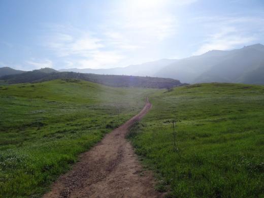
Satwiwa Loop Trail section that takes you diagonally through the meadow. Seen here when it is nice an green.

Satwiwa Loop Trail section that takes you diagonally through the meadow. Seen here when it is nice and green.

At the end of the meadow, continue straight up a fairly steep hill, where on the right hand side you'll see the Sycamore Canyon Overlook bench shown below.

RSVW_sycoverlook.JPG

bench on sycamore canyon overlook

Hike up the moderately steep and rocky path up the hill behind the bench and you'll reach another fork in the road. If you veer left at this juncture you'll be on the Hidden Valley Overlook Trail within Rancho Sierra Vista/Satwiwa. Stay to the right and you'll be entering the Boney Mountain Wilderness area within Point Mugu State Park.

Sign that shows you the Hidden Valley Overlook Trail is on the left.

Sign that shows you the Hidden Valley Overlook Trail is on the left.

Veering right into the State of California managed Pt Mugu State Park; as you can see, dogs are not allowed in the back country area of the park.

Veering right into the State of California managed Pt Mugu State Park; as you can see, dogs are not allowed in the back country area of the park.

This trail is referred to as Danielson Road, named after the last private owner of these lands. The path down into the canyon is seen below (taken from a higher point en route to the Danielson Monument).

View of the initial section of Danielson Road trail down into the canyon; this is the path you will be taking towards the waterfall.

View of the initial section of Danielson Road trail down into the canyon; this is the path you will be taking towards the waterfall.

Danielson Road is a bit on the steep side but I see folks young and old walking up and down this section all the time. Seen here in very dry conditions.

Danielson Road is a bit on the steep side but I see folks young and old walking up and down this section all the time. Seen here in very dry conditions.

RSVW_waterfalltrailsign.JPG

THIS IS THE OLD SIGN, WHEN IT WAS CALLED DANIELSON ROAD (PRIOR TO 2024)

NEW SIGN IN 2024 SHOWING THE “OLD CABIN TRAIL” INSTEAD OF DANIELSON ROAD.

After .4 mile, you will reach the bottom of the canyon and see the sign above, the final sign indicating you are on your way to the Waterfall Trail. Then you will cross a creek bed, which can have water in it after the rains. The photo taken below in January 2015 shows minimal moisture, making it easy to cross. Some years you may have to rock hop your way a bit over the creek.

RSVW_stream.JPG

Creek bed crossing on the way to the waterfall IN 2015

Creek Crossing in April 2024.

After you cross the creek, the remainder of the trail to the waterfall is single track. Be careful not to come in contact with poison oak often seen on the sides of the trails. For this reason, I would generally not recommend strollers be taken up here.

Soon you will reach the final fork in the road. Go straight and soon you will be at the waterfall. To the right, the Old Cabin Trail (formerly Danielson Road Trail) continues upward to the Danielson Monument.

RSVWaterfallFeb17.JPG

the waterfall in april 2024.

Twelve of My Favorite Things To Do in the City of Simi Valley

WelcomeToSimiValley.JPG

The City of Simi Valley was incorporated on October 10, 1969, less than 3 months after Neil Armstrong and Buzz Aldrin became the first humans to land on the Moon. The City covers 42 square miles and as of 2013 was home to just over 126,000 people. Simi Valley is neighbors with Moorpark, Thousand Oaks and the San Fernando Valley.

According to the City's website, the name of the Chumash Indian Village “Shimiji” is believed to be the origin of the City’s name and Ta’apu is the origin of the names of Tapo Street and Tapo Canyon.

But enough of that. Here are some of my favorite things to do in Simi Valley.

I love hiking the Long Canyon Trail, with its views of Wood Ranch, Bard Lake and the rest of Simi Valley (not to mention you can hike to Lang Ranch in Thousand Oaks from here).

The Simi Valley Cultural Arts Center is a 220 seat theater at 3050 Los Angeles Avenue that hosts musicals, concerts, exhibits, children's theater and other events year-round.  The theater is a landmark Gothic structure built in the 1920s that was named Ventura County Historical Landmark #67 in July 1981. Visit www.simi-arts.org to learn more.

Views from the Long Canyon Trail

Views from the Long Canyon Trail

The magnificent Ronald Reagan Presidential Library and Museum is a major draw to Simi Valley. This 243,000 sq ft museum at the top of 100 acres of land is a must see for its interactive displays, history, Air Force One and outstanding rotating exhibits. And the views, particularly on clear days, are quite memorable.

ReaganLib_AF1.JPG

Lazertag Axtreme opened in the Wood Ranch section of Simi Valley in 2013 and at over 5,000 sq ft is a great indoor, multi-level laser tag facility and arcade.

Grandma Prisbrey's Bottle Village is a historical and cultural landmark and is listed on the National Register of Historic Places. It is located on a residential lot that contains shrines, walkways, sculptures and buildings from recycled items and discards, built over a 25 year old period by Tressa "Grandma" Prisbrey. An eyesore to some, a one-of-a-kind treasure to others. Open periodically to the public as the site is restored.

Grandma Prisbrey's Bottle Village

Grandma Prisbrey's Bottle Village

The Veterans of Foreign Wars Post 10049 and Simi Valley Town Center host an impressive display at the Museum of Military History Posters and Memorabilia. There are hundreds of military posters and historical artifacts on display that have been graciously provided by local veterans and collectors.

Museum of Military History Posters and Memorabilia in Simi Valley

Museum of Military History Posters and Memorabilia in Simi Valley

There are no bowling alleys in the Conejo Valley, which means we have to drive elsewhere for our bowling fix! The closest bowling alley to the center of Thousand Oaks is Harley's Simi Bowl, about 10 miles away off of Highway 23 and Madera Road. This is a 24 lane alley that gets the job done.

HarleysSimiBowl_pic.jpg

The other bowling alley in Simi Valley is on the east end, about 20 miles from Thousand Oaks. Harley's Valley Bowl (formerly Brunswick Zone) has 40 lanes and a large arcade/game room area. Another great choice for fun in Simi Valley. Now why is it that Simi has 64 bowling lanes yet we still have none in the Conejo Valley? Sheesh.

The Mt. McCoy Trail is located on the west side of Simi Valley, just a short hop, skip and jump around the corner from the Reagan Library. You can't miss the hill because there's a large, white cross at the top. A bit over a mile of well-maintained switchbacks takes you to the top.

Views galore from Mt. McCoy Trail peak.

Views galore from Mt. McCoy Trail peak.

Simi Valley Days takes place in mid-September each year over a four day period. The event has a long history, going back to 1934. It is a community celebration with carnival rides, games, live music, vendors, food, a parade and much more. 

Visit a fully restored Southern Pacific Railroad depot circa 1903 with both freight and passenger trains rushing by day and night at the Santa Susana Depot Museum and Model Railroad. Open on weekends from 1-4 pm, the depot is also home to the Santa Susana Model Railroad Club’s large operating HO scale model railroad, in a layout that portrays Simi Valley during the mid 1950’s. This is a lot of fun to see. And outside, you and the kids will be treated to up close views of Amtrak and Metrolink passenger trains rolling by. Wave and they'll honk at you.

SantaSusanaDepot.jpg

The pristine Studio Movie Grill opened at the Simi Valley Town Center in October 2015. This 41,000 sq ft theater features 9 screens and over 950 seats. 

There is plenty more to see and do in Simi Valley that is not on this particular list. Check out: