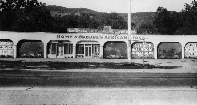
Hillcrest Brush Fire Historical Landmark Markers in the Conejo Open Space in Thousand Oaks

There are five historical landmark markers in the Hillcrest Open Space in Thousand Oaks in tribute to firefighter Angel Castro. On December 10, 1978, Castro was severely burned while fighting the Hillcrest Fire, which burned 100 acres in two hours on a windy day with erratic gusts up to 40 MPH. He was working as a "Dozer Swamper," hauling and unloading heavy equipment. As a result of his injuries, he recommended several modifications to operating procedures that VCFD implemented. Further down this path are four other markers with questions to help challenge and educate firefighters and civilians.

The Hillcrest Open Space Preserve trailhead is located on Hillcrest Drive, just west of Blue Mesa Street, about half a mile west of Westlake Boulevard.

LOCAL AREA TRAILS AND HIKES THROUGHOUT VENTURA COUNTY

The Hunt Olive Tree in Thousand Oaks is a Living Link to Conejo Valley History

Richard Orville Hunt and his wife Mary Jane purchased a large parcel of land in the Conejo Valley in 1876 in what is now Lynn Ranch. He called it Salto Ranch. Hunt also served as postmaster of the Newbury Park Post Office for 18 years and was well known in the local community. While his former land now is populated with family homes, one part of Hunt's ranch lives on.

HuntOliveTreeSprouts2013_2.JPG

For those of you who drive past the Sprouts Market at 600 West Hillcrest, perhaps you have noticed the historic landmark marker situated in front of the last remaining olive tree from Hunt's orchard. The Hunt Olive Tree was designated a Ventura County Historic Landmark in 1981, when the tree was over 100 years old. That would make this olive tree over 130 years old today.

HuntOliveTreeSprouts2013.JPG
HuntOliveTreeCCSign.jpg

For nostalgia buffs, to the right is a view of the Hunt Olive Tree marker back in the day that Circuit City was located here. It closed in late 2008. This tree was moved to its current home in 1993. I'm not sure why...perhaps to say hello to the thousands of residents who pass by each day. What a fine specimen this link to the past is. The Hunt Olive Tree is also Historical Landmark #4 in the City of Thousand Oaks.

So be sure to say hello to this tree that sits next to the Sprouts Farmers Market sign at Hillcrest and Lynn and do be nice to him (or her). She's older and wiser than all of us combined, having seen and lived through the growth of our local community.

Visit the City of Thousand Oaks website at www.toaks.org/departments/city-manager-s-office/public-information-office/history for more information on local historical landmarks and points of interest around town.

The Ventura County Portion of State Highway Route 1 is Named "Ventura County Vietnam Veterans Memorial Highway"

California State Route 1 runs along most of the coastline of California and at 656 miles is the longest state route in California. The section of SR 1 between I-5 in Dana Point and the US 101 near Oxnard is designated Pacific Coast Highway.

Sign at the indicating the north end of southbound PCH, where it connects to Las Posas Road.

Sign at the indicating the north end of southbound PCH, where it connects to Las Posas Road.

In 2002, the state assembly voted to designate the section of State Highway Route 1 in Ventura County as the “Ventura County Vietnam Veterans Memorial Highway” in gratitude and appreciation for the sacrifices California Vietnam veterans.

VC Vietnam Veterans Highway1.JPG

That same bill also designated the portion of State Highway Route 126 between the City of Santa Paula and State Highway Route 101 as the Korean War Veterans Memorial Highway.

U.S. 101 in Ventura County is Designated "The Screaming Eagles Highway"

Screaming Eagles Sign.JPG

As you drive U.S. Route 101 northbound in the Conejo Valley just past the Westlake Boulevard offramp, you’ll see a sign that says "The Screaming Eagles Hwy 101st Airborne Division."

The sign was authorized by Assembly Concurrent Resolution No. 54 (ACR-54) Screaming Eagles Highway: 101st Airborne Division, in 2003.

The 101st Airborne Division ("Screaming Eagles") is a specialized modular light infantry division of the U.S. Army trained for air assault operations. It was formed in World War I on July 23, 1918 and has been involved in every major U.S. war since then.

The 101st Airborne Division was instrumental in the success of the D-Day Invasion, the Operation Market Garden in Holland, in Bastogne for the Battle of the Bulge, in Vietnam for Operation Nevada Eagle, and in many other courageous missions worldwide. 

In recognition of the 101's significance for military personnel of the 101st Airborne Division, the Assembly designated the 44 mile section of the 101 in Ventura County as the Screaming Eagles Highway.

The sign was unveiled in September 2005. The same sign is placed on the southbound 101 just south of the Bates Road offramp on the Ventura/Santa Barbara County border.

Casita Valdez Mexican Restaurant Operated in Thousand Oaks From 1961 to 1979

(Image courtesy of Conejo Through the Lens, Thousand Oaks Library.)

Louie and Dee Valdez opened Casita Valdez out of their home at 159 E. Thousand Oaks Boulevard, Thousand Oaks, in 1961. It was expanded in 1963 by converting the garage into a dining area, then the adjacent home was acquired to further expand the popular Mexican eatery. It was remodeled as seen here in 1975. It operated until 1979, when it was sold to Henry Valdez (not related to Louie and Dee), owner of Enrique's Mexican Restaurant in Van Nuys. Enrique's Mexican Restaurant operated until 2009. Tipsy Goat opened here on March 17, 2011. And there you have the history of 159 E. Thousand Oaks Boulevard.

The Story of Jungleland in Thousand Oaks

The Thousand Oaks Civic Arts Plaza is located on historic land in many respects. The land was originally part of "Rancho El Conejo," a Spanish land grant. Egbert Starr Newbury purchased 2,259 acres of this land in 1874 and built a home here (more on Newbury and his local legacy at THIS LINK).

After a drought in 1876-1877 bankrupted the Newbury family, the land was foreclosed and sold to the Crowley family in 1887, who built a successful ranch on the land. In 1910, Frank Crowley's parents built him a five bedroom, two story home on the land that is located at 2522 Pleasant Way. The Crowley family lived on the ranch until 1922.

The "Crowley House" went through several ownership changes through the years but is now maintained by the Conejo Recreation and Park District and is considered a Ventura County Historical Landmark.

One of the subsequent owners of the Crowley House was Louis and Kathleen Goebel. In 1925, Goebel purchased former Newbury/Crowley land where the Thousand Oaks Civic Arts Plaza currently stands.  It cost him $50. Louis Goebel soon opened Goebel's Lion Farm, where he trained lions and rented them to movie studios.

"Home of Goebel's African Lions" circa 1929 (Courtesy of Conejo Through the Lens, Thousand Oaks Library)

"Home of Goebel's African Lions" circa 1929 (Courtesy of Conejo Through the Lens, Thousand Oaks Library)

As travelers passed through town, they wanted to see the animals. Goebel capitalized on this in 1929, when the site became "Goebel's Wild Animal Farm," a theme park that became very popular in the 1940s and 1950s. The 170 acre site housed all sorts of animals...elephants, tigers, giraffes, hippos, chimpanzees and more. Additionally, many TV shows and movies were filmed there, such as Tarzan, The Adventures of Robin Hood and Birth of a Nation.

Goebel's Wild Animal Farm was home to Leo the Lion, of MGM Pictures fame. Over the years, other animal celebrity residents included Mr. Ed, the talking horse, Bimbo, the elephant from Circus Boy and Tamba, the chimpanzee in Tarzan films and "Bedtime with Bonzo" starring Ronald Reagan and Diana Lynn.

Goebel sold Jungleland in 1946 and the park was renamed the "World Jungle Compound." Ten years later it was sold again to executives from 20th Century Fox and was renamed "Jungleland." After five years, the business slid and Goebel was able to purchase it back in 1961. 

In between Goebel's Lion Farm and Jungleland, from 1946 to 1955 the tourist destination was called the "World Jungle Compound" (Courtesy of CONEJO THROUGH THE LENS, THOUSAND OAKS LIBRARY.)

In between Goebel's Lion Farm and Jungleland, from 1946 to 1955 the tourist destination was called the "World Jungle Compound" (Courtesy of CONEJO THROUGH THE LENS, THOUSAND OAKS LIBRARY.)

Five elephants at Goebel's Lion Farm (from the Ethel Nixon Collection (via Conejo Through the Lens, Thousand Oaks Library.)

Five elephants at Goebel's Lion Farm (from the Ethel Nixon Collection (via Conejo Through the Lens, Thousand Oaks Library.)

At its peak popularity, the 170 acre Jungleland compound had all sorts of activities - shows by tiger trainer Mabel Stark, and others, elephant rides, tortoise rides, ducky boat rides, train rides, safari tram buses and even a sky tram. Animals included elephants, lions, tigers, hippos, camels, llamas, giraffes, orangutans, chimpanzees and a variety of others.

Jungleland closed in October 1969 after its popularity continued to drop - a combination of increased competition (Disneyland, Knotts Berry Farm, Universal Studios, etc.) and the fact that Highway 101 diverted drivers around the theme park. The park operated for 43 years and its 1,800 animal occupants were sold at auction. 

So...when you stroll through the grounds of the Civic Arts Plaza and The Lakes at Thousand Oaks, close your eyes and see if you can envision all the animal excitement that took place here just a few generations ago in the heart of Thousand Oaks.

Jungleland sign after the theme park closed in 1969. (Image courtesy of Conejo Through the Lens, Thousand Oaks Library.)

Jungleland sign after the theme park closed in 1969. (Image courtesy of Conejo Through the Lens, Thousand Oaks Library.)

Louis Goebel and Jungleland plaque outside the Civic Arts Plaza.

Louis Goebel and Jungleland plaque outside the Civic Arts Plaza.

More on Jungleland on the Stagecoach Inn Museum website at stagecoachinnmuseum.com/jungleland.

Some photos from around 1965 (from a private collection):

Alaska Airlines Flight 261 Sundial Memorial at Hueneme Beach in Port Hueneme

Just 25 miles west of Thousand Oaks is Hueneme Beach Park, a beautiful 50 acre park on the beach with a fishing pier, bike/walking paths, volleyball, picnic tables, BBQ pits, the Surfside Seafood snack bar and more.

24 hour fishing pier at Hueneme Beach Park

24 hour fishing pier at Hueneme Beach Park

One other feature at Hueneme Beach is the Alaska Airlines Flight 261 Sundial Memorial that commemorates the 88 passengers and crew who lost their lives aboard Alaska Airlines Flight 261 near Anacapa Island on January 31, 2000. The flight was en route from Puerto Vallarta, Mexico to San Francisco and Seattle.

The Memorial features a 36-foot diameter concrete plaza with a curving sand wall and seating area and a raised sundial in the center.

The Memorial features a 36-foot diameter concrete plaza with a curving sand wall and seating area and a raised sundial in the center.

The Memorial features a 36-foot diameter concrete plaza with a curving sand wall and seating area and a raised sundial in the center. The monument was designed by by well known Santa Barbara sculptor James “Bud” Bottoms. The sundial’s bronze dolphins and triangular blade (gnomon) cast a shadow on the 20-foot diameter dial face oriented to Pacific Standard Time. Names of each of the victims are inscribed on individual bronze plates mounted on the perimeter of the dial.

AlaskaAirMemorialHueneme.jpg

The crash site is located between the mainland at Port Hueneme and Anacapa Island, one of the smallest islands in the Channel Islands chain, 14 miles offshore. Families of the lost passengers and crew dedicated the sundial as both a memorial to their loved ones and a work of public art in gratitude to the residents of Port Hueneme for their compassion and tireless assistance in the recovery effort. This is a touching and lasting tribute to those who lost their lives on this flight.

Access the Sundial Memorial from Hueneme Beach parking lot B off Surfside Drive near the gazebo. More details at www.ci.port-hueneme.ca.us/index.aspx?nid=930.

BEACHES SPANNING FROM CARPINTERIA TO MALIBU