Several Dozen Things to See and Do in the City of Oxnard

OxnardSign.JPG

The City of Oxnard was incorporated on June 30, 1903. Covering an area of just over 39 miles, of which 70% is land, Oxnard is the most populous city in Ventura County, with nearly 208,000 residents in 2016.

Oxnard's namesake is Harry T. Oxnard, who opened a beet factory in 1899 and taught local farmers the ins and outs of growing sugar beets. The land for the factory was purchased from Thomas S. Rice (of Rice Avenue fame) and the first plant manager was Major J. A. Driffill, who later became mayor.

There's plenty to see and do in Oxnard, and we've summed up some of our favorite activities below.

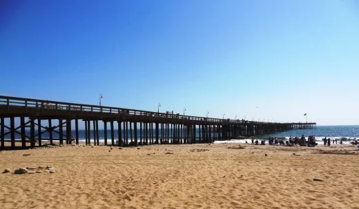
Great beaches in Oxnard include Mandalay Shores, Hollywood Beach and Silver Strand Beach, which are highlighted at THIS LINK.

Speaking of beaches, Oxnard Beach Park is a nice park with a pirate-themed, accessible playground area, large grassy area, restrooms and quick access to the beach.

The Channel Islands Maritime Museum located at the Channel Islands Harbor is home to world class maritime art, ship models and other maritime items. Open Thursday through Monday from noon to 4pm. Admission is free the 3rd Thursday of the month.

Channel Islands Harbor is a great place to beat the heat with the family, offering a variety of activities, such as fishing trips, boat cruises, eateries, water sports, shopping and special events year-round.

Oxnard Beach Park

Oxnard Beach Park

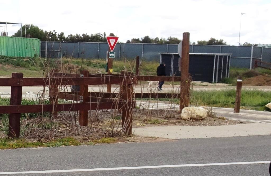
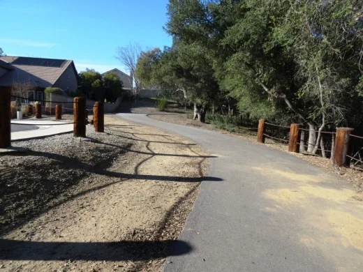
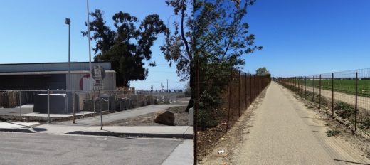
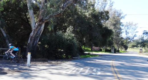
There's a nice bike path in Oxnard that takes you from Oxnard Beach Park to Channel Islands Harbor that we enjoy from time to time.

The Henry T. Oxnard Historic District is located on F and G Streets, between Palm and 5th Streets. The area was added to the National Register of Historic Places in 1999. Most of the 144 historic homes and buildings in the area were built before 1925 and includes Mission/Spanish revival, bungalow/craftsman and Colonial Revival architecture.

A great time to check out the Historic Oxnard District is during the two weeks preceding Christmas each year, when dozens and dozens of residents decorate their homes in lights and holiday decor for Christmas Tree Lane.

The Oxnard Performing Arts Center hosts concerts, musicals, speakers and other performances year-round. At over 1,600 seats, it is one of the largest venues in Ventura County and is a performance venue for the New West Symphony.

The Collection at RiverPark is an outdoor shopping center located on the northeast side of the 101 between the Oxnard and Vineyard exits. The 650,000 sq ft center includes a combination of entertainment, retail, restaurants, open space with fountains, parks and playgrounds and quality art. Activities at The Collection include Color Me Mine Ceramics Studio, Century RiverPark Movie Theater and Levity Live Comedy Club, Jump ‘n Jammin Children’s Entertainment Center, Red Door Escape Room and Bowlero.

Swing for the fences at Who's on First Batting Cages in Oxnard. What's on second? I don't know's on third. Who? First base.

Hollywood Beach

Hollywood Beach

River Ridge Golf Course is a public golf course offering two 18-hole courses as well as footgolf!

Skateboarders and in-line skaters are on a roll at the City of Oxnard Bedford Pinkard Skate Park near Channel Islands High School. Pinkard is a former City Council member who was a supporter of many youth and community programs.

The Elite Theatre Company, located at Fisherman's Wharf at Channel Islands Harbor, Fisherman's Wharf, is host to musicals, plays, comedies and more.

The Dallas Cowboys have held Summer Training Camp for a number of years at River Ridge Fields at Oxnard's Marriott Residence Inn. Practices and scrimmages taking place in August are open to the public and free of charge. Check for updates at www.dallascowboys.com/trainingcamp.

Guide to Finding Family Friendly Bike Paths In and Around Ventura County

As a casual cyclist with young kids I usually steer clear of riding on busy streets, particularly those that don't have any type of bike lane on them. Thankfully there are nearly 80 miles of bikeways in Thousand Oaks, including 3 miles of bike paths, 20 miles of bike lanes and 54 miles of marked bike routes.  

Bike routes are shared with vehicles

Bike routes are shared with vehicles

Class I Bike Paths are separate from auto traffic and thus are great for family friendly cycling. Class II Bike Lanes are striped, painted and shared lanes adjacent to automobile lanes. Class III Bike Routes are marked by green signs that signify sharing with autos.

We also love taking our bikes to other places in and around Ventura County to enjoy other sights and surroundings. So how about if we highlight Class I Bike Paths throughout Ventura County, stretching from Thousand Oaks to Ventura.

Conejo Valley

The Conejo Creek Bike Path is a 1.2 mile path in the heart of Thousand Oaks that connects Gainsborough Road on the south to Conejo Creek Park and the Thousand Oaks Library. This is a nice, flat path, good for kids.

Another access point to the Conejo Creek Bike Path on La Granada Drive.

Another access point to the Conejo Creek Bike Path on La Granada Drive.

There is another Thousand Oaks bike path, the .5 mile Greenmeadow Drive connector bike path accessible on the west at Greenmeadow and Yellowstone, on the south side of Los Robles Greens. This is not a particularly interesting path but it does enable cyclists and walkers a path around the golf course to the Los Robles trailhead and Moorpark Road from Newbury Park. A bit hilly, too.

Entrance to Greenmeadow Avenue connector bike path in Thousand Oaks

Entrance to Greenmeadow Avenue connector bike path in Thousand Oaks

There is also the .8 mile bike path on the north side of The Oaks mall as well as the .5 mile Read Road Connector path accessible off of Olsen Road just east of the 23 freeway.

Sign at the Read Road connector path on Olsen Road east of 23 Freeway.

Sign at the Read Road connector path on Olsen Road east of 23 Freeway.

Medea Creek Natural Park has hiking, biking and fitness trails that stretch from Calle Rio Vista and Oaks Hills Drive in Oak Park on the north, then south past Medea Creek Lane and Conifer Street to a cul de sac entrance to the park at the west terminus of Tamarind Street. About a mile to mile and a half of paths, including paved and dirt paths.

Nicely paved path at Medea Creek Natural Park in Oak Park

Nicely paved path at Medea Creek Natural Park in Oak Park

Ventura

My personal favorite bike path in Ventura County is the Omer Rains Trail that runs the entire length of San Buenaventura State Beach.

Senator Omer Rains Ventura Oceanfront Bikeway Sign on Main Street next to Ventura Beach RV Resort

Senator Omer Rains Ventura Oceanfront Bikeway Sign on Main Street next to Ventura Beach RV Resort

We park the car at Marina Park in Ventura and ride a short distance north on Pierpont Blvd to the bike path entrance. This oceanfront path takes you past the Ventura Pier, through the Promenade area, adjacent to the Ventura County Fairgrounds, Emma Wood State Beach and beyond. Or you can get to the path from anywhere along the Ventura Promenade area.

Bike path along San Buenaventura State Beach.

Bike path along San Buenaventura State Beach.

Omer Rains Bike Path near Ventura Beach RV Resort on Main St.

Omer Rains Bike Path near Ventura Beach RV Resort on Main St.

Nice, newer paved section of Ventura beachfront bike path near Surfers Point.

Nice, newer paved section of Ventura beachfront bike path near Surfers Point.

The Ventura River Trail is a 6.3 mile asphalt pedestrian and bike path that follows the old Southern Pacific Railroad right-of-way from Main Street in Ventura to Foster Park inland towards Ojai. You can easily connect from the Omer Rains Trail to the Ventura River Trail up to the Ojai Valley Trail for quite a long, nearly automobile-free ride.

The Ventura Harbor Bike Path takes you 1.2 miles from Market St and Arundell Ave in midtown Ventura southwest through farmland to E. Harbor Boulevard and Schooner Drive, near Four Points by Sheraton.

Bike path from midtown Ventura to the Harbor is not the most exciting path but it is a convenient way to ride to Ventura Harbor, Marina Park and adjacent areas.

Bike path from midtown Ventura to the Harbor is not the most exciting path but it is a convenient way to ride to Ventura Harbor, Marina Park and adjacent areas.

The La Conchita Bike Path between Rincon Point at the Ventura/Santa Barbara County Line adjacent to Highway 101 past La Conchita to Mobil Pier Road in Ventura was completed in September 2014. This path has leapfrogged into my own personal favorite in Ventura County because of its spectacular beach views. This is about 4 miles of bike path in the Oil Piers Beach to Mussel Shoals to La Conchita Beach to Rincon Point beach areas.

Bike paths rarely get better than this stretch along the southbound 101 and the Pacific Ocean in Ventura.

Bike paths rarely get better than this stretch along the southbound 101 and the Pacific Ocean in Ventura.

There's another short stretch of bike path at the east end of Navigator Drive that goes west, then south, around the Ventura West Marina.

Entrance to short bike path adjacent to Ventura West Marina.

Entrance to short bike path adjacent to Ventura West Marina.

There is a two mile biking and hiking on the east side of the lake at the Lake Casitas Recreation Area, 11311 Santa Ana Road, Ventura. The path starts at picnic area #1 and follows the east shoreline of the lake for a four mile round trip ride. The path is paved in the recreational area and becomes a dirt road outside of that. More information at www.casitaswater.org/recreation/amenities/bike-trail.

Ojai

The Ojai Valley Trail is a 9 to 10 mile trail that parallels Highway 33 from Foster Park on the outskirts of west Ventura, to Soule Park in Ojai. It connects to the Ventura River Trail.

The Ojai Trail runs parallel to Ventura Ave/Ojai Ave.

The Ojai Trail runs parallel to Ventura Ave/Ojai Ave.

Simi Valley

The Arroyo Simi Bike Path is a two lane bike path in Simi Valley that runs from Madera Road, just south of Easy Street on the west, ending at Tapo Street on the east. Over seven miles.

Arroyo Simi Bike Path/Trail in Simi Valley.

Arroyo Simi Bike Path/Trail in Simi Valley.

Camarillo

We enjoy the newer, flat roughly 2 mile Calleguas Creek bike path from Pleasant Valley Fields up to the corner of Flynn and Upland Roads in Camarillo. Quick access from the Conejo Valley and a nice, relatively easy path good for all ages.

Look at how nice and flat this bike path adjacent to Calleguas Creek is!

Look at how nice and flat this bike path adjacent to Calleguas Creek is!

Other Areas

There's an online bike map available on the Ventura County Transportation Commission website at www.goventura.org where you can find other Class I, II and II bike paths around the county. Here are some of them.

The Santa Paula Bike Trail takes you roughly 3 miles on the east near W. Main St and Peck Rd to (roughly) Dike Road on the west

The Fillmore Bike Path runs from south of Highway 126 (Telegraph Road) up past Shiell Park.

In Moorpark there's a .5 mile path at Country Trail Park, around the neighborhood to the west, back to Mountain Trail Street.

There's a bike path that starts at the ocean side of Oxnard Beach Park and takes you south all the way to Hollywood Beach and Channel Islands Harbor. Cross Harbor Boulevard and make your way into Channel Islands Harbor, where you can ride all the way to the south end of the harbor.

Bike path near Oxnard Beach Park and Channel Islands Harbor.

Bike path near Oxnard Beach Park and Channel Islands Harbor.

In Port Hueneme there's a bike path that starts off of Bard Rd, west of South J St, through Richard Bard Running Springs Park and takes you southwest all the way to Hueneme Beach.

If you're willing to venture a bit further away from Ventura County, the Marvin Braude Coastal Bike Path stretches over 20 miles, from Will Rogers State Park in Pacific Palisades to Torrance. Flat, adjacent to the ocean, and so many things to do along the way!

Marvin Braude Coastal Bike Path in Pacific Palisades

Marvin Braude Coastal Bike Path in Pacific Palisades

That should be enough to get you started! Looking for local cycling clubs? Find some of them at this link.

Compilation of Great Trails and Hikes In and Around Ventura County

TrailSign1.JPG

Looking for a good hike around Ventura County and nearby areas? We've highlighted a number of our favorite hikes in the Do Something section of Conejo Valley Guide.

HIKE TO A CONEJO VALLEY BENCH WITH A VIEW

HIKE TO AUTOMOTIVE RELICS IN THE CONEJO VALLEY OPEN SPACE

SEVEN FLAT, STROLLER FRIENDLY TRAILS IN THE CONEJO VALLEY

DOG-FRIENDLY TRAILS IN THE SANTA MONICA MOUNTAINS

Reminder: Please refrain from using the trails during rain events and afterwards, until they have dried. Doing otherwise causes damage to the trails.

Lone Oak at Rancho Sierra Vista/Satwiwa

Lone Oak at Rancho Sierra Vista/Satwiwa

Rancho Sierra Vista/Satwiwa in Newbury Park

Fossil Trail Loop in the Boney Mountain Wilderness

Oakbrook Vista Trail in Thousand Oaks

Rancho Potrero Open Space in Newbury Park

Wildwood Park in Thousand Oaks

Lynnmere Trail in Thousand Oaks (south of Wildwood Park)

Conejo Canyons Open Space (Western Plateau)

Tarantula Hill Hike in Thousand Oaks

Arroyo Conejo Trail in Thousand Oaks

Sunset Hills Trail in Thousand Oaks

Conejo Ridge Open Space in Thousand Oaks

North Ranch Open Space in Thousand Oaks/Westlake Village

Wishbone Trail in the North Ranch Open Space - Westlake Village

Hillcrest Open Space Preserve in Thousand Oaks

Powerline Trail in Newbury Park to Conejo Mountain

Lake Eleanor Open Space Hike in Westlake Village

Conejo Valley Botanic Garden in Thousand Oaks

Triunfo Creek Park in Westlake Village

Potrero Ridge Trail in Newbury Park

Marview Drive Trail in Thousand Oaks

Pentachaeta Trail and Westlake Vista Trail in Westlake Village

Rabbit Hill (Knoll Open Space) in Newbury Park

Hike to the Cross in the Hills Above Cal Lutheran in Thousand Oaks

Lynnmere Open Space views to the west.

Lynnmere Open Space views to the west.

Views from the Ray Miller Trail in Malibu.

Danielson Road trail in the Boney Mountain Wilderness.

Danielson Road trail in the Boney Mountain Wilderness.

Views of Simi Valley from the peak of Mt. McCoy in Simi Valley.

Views of Simi Valley from the peak of Mt. McCoy in Simi Valley.

Sunset Hills Trail in Thousand Oaks.

Sunset Hills Trail in Thousand Oaks.

Tree encampment along Los Padres Trail in Thousand Oaks.

Tree encampment along Los Padres Trail in Thousand Oaks.

Seven Flat, Stroller and Family Friendly Hikes in the Conejo Valley

There is a ring of about 15,000 acres of open space with 140 miles of trails for public use surrounding the Conejo Valley. All too often on the Conejo Valley Guide Facebook Page we hear requests for which trails are "stroller friendly" and/or suitable for young children. Here is a sampling of some of the more popular ones in the area.

Wildwood Park to many is the single greatest spot for family hikes and stroller-friendly trails. With 14 trails covering 17 miles, including the popular hike to Paradise Falls and the teepee as well as some wide, relatively flat sections along the Mesa Trail towards Lizard Rock.

It takes a bit of driving via the Norwegian Grade and Santa Rosa Road to get there, but the Conejo Canyons Open Space in the Western Plateau section of the Conejo Open Space leads to several miles of nice, flat, well-maintained family-friendly trails leading to tree-canopied picnic areas. The Hill Canyon Trail and Hawk Canyon Trail are very easy to navigate.

Shaded picnic area off the Hawk Canyon Trail from the Conejo Canyons Bridge.

Shaded picnic area off the Hawk Canyon Trail from the Conejo Canyons Bridge.

The one mile Spring Canyon Trail is a mostly flat trail that runs from Lynn Oaks Park, 359 Capitan Street, Newbury Park to the Los Robles Trail.  There are some moderate hills but with the park nearby, this makes for a fun little excursion with the little ones. (No restrooms, however.)

The main access point to the Los Robles Trail at the southern endpoint of Moorpark Road at Greenmeadow Ave starts out with a reasonably flat section that is a nice, easy family stroll.

Speaking of the Los Robles Trail, another great little hike to take with the kids is the Oak Creek Canyon Loop Trail. The first 4/10th of a mile of the trail, accessible off of Greenmeadow Avenue in Thousand Oaks, is the Oak Creek Canyon Whole Access Interpretive Trail. This is a nice, shady, flat trail with benches and picnic benches along the path. The remainder of the loop is not quite as stroller friendly, with a couple moderately steep sections that can be navigated on foot.

Picnic trails and shade abound at the Oak Creek Canyon Interpretative Trail.

Picnic trails and shade abound at the Oak Creek Canyon Interpretative Trail.

The Rancho Sierra Vista/Satwiwa area managed by the National Park Service in Newbury Park has several miles of trails to explore, most of which are flat and stroller-friendly. The Satwiwa Loop Trail takes you around the area and the Satwiwa Native American Indian Culture Center makes for a fun stop with the family when open on weekends.

The Chumash home, or “‘Ap,” in the background. The one pictured has since been replaced.

The Chumash home, or “‘Ap,” in the background. The one pictured has since been replaced.

Cheeseboro/Palo Comado Canyons offer great family hiking opportunities. While there's definitely hills surrounding these canyons, try the Cheeseboro Canyon Trail, the 4 to 5 mile main artery into the park. Flat and kid/stroller friendly it is. Also try the Doubletree Trailhead connector to the Palo Comado Trail. Flat, fun and scenic.

The Los Padres Trail in Thousand Oaks is a short trail, half of which is pretty flat and tree lined, if you’re looking for a short excursion with a toddler. A seasonal creek makes it even more interesting as you may hear froggies in the spring.

PaloComadoSign.JPG

Although the trails in the Lang Ranch/Woodridge Open Space in Thousand Oaks are NOT FLAT and indeed quite HILLY, they are worth checking out with the kids because they wide and have some interesting sandstone rock formations. If you are really strong, strollers are possible here, but do know that you will encounter some hills like the hill shown in the image below.

This hill in the Lang Ranch/Woodridge Open Space at the Autumn Ridge Trail is a bit daunting but worth the climb.

This hill in the Lang Ranch/Woodridge Open Space at the Autumn Ridge Trail is a bit daunting but worth the climb.

We're going to throw a bonus trail into the mix. The several miles of hiking trails in the Oakbrook Regional Park Archaeological Area in Thousand Oaks is an outstanding place for a flat, picturesque and oak-tree canopied place for a short hike with the kids.

For a more comprehensive compilation of trails in the Conejo Valley and throughout Ventura County, visit THIS LINK.

Eleven of My Favorite Things to Do In and Around the City of Ventura

HistoricVenturaSign.jpg

Incorporated in 1866, the City of Ventura is the county seat of Ventura County. The official name of Ventura is the city of San Buenaventura. Mission San Buenaventura was founded by Franciscan priest Junipero Serra on March 31, 1782 and was named after Saint Bonaventure. Enough with the history lesson...here are some of my favorite things to do in this beautiful city!

You can't miss the 1,600 foot long Ventura Pier, with its panoramic views, fishing and ocean breezes. There's a cool little playground area in the sand just west of the pier, bicycle rentals nearby, miles of beachfront bike path and Surfers' Point. San Buenaventura State Beach stretches from the Ventura Pier down south past the homes of the Ventura Keys. Eateries on the pier include Eric Ericsson’s Fish Co., MadeWest Brewing Company Taproom and Beach House Tacos.

VenturaPierBeach.JPG

Ventura Harbor Village is home to 33 acres of harborside activities, shopping and restaurants. There's an arcade with an antique carousel, boat rides, kayaking and sailing and quick access to family-friendly Harbor Cove Beach and Surfer's Knoll Beach. Also within a short walking distance is the Robert J. Lagomarsino Visitor Center, an inspirational and interactive source of information about the Channel Islands National Park. Bring the kids!

Ventura Harbor Village is a popular destination for tourists and locals alike.

Ventura Harbor Village is a popular destination for tourists and locals alike.

For some of the most spectacular views of Ventura, stop by Grant Park / Serra Cross Park. You can drive up there, or park above the historic Ventura City Hall building and walk to Grant Park via the Ventura Botanical Gardens Demonstration Trail. This nice one mile trail will give you a nice little workout, with views along the way.

A view from the Ventura Botanical Gardens Demonstration Trail near Grant Park in 2020.

Golf N' Stuff is a family favorite, especially when it's really hot in the Conejo Valley and you're looking for an outdoor alternative to the beach.  The kids never tire of the two 18-hole mini golf courses, bumper boats, large, nicely appointed arcade, go karts and bumper cars.

Mini golf fun at Golf N' Stuff Ventura.

Mini golf fun at Golf N' Stuff Ventura.

Another popular family choice is oceanfront Marina Park in the Ventura Keys, a decent sized park with plenty of grassy area, a newer playground and path to adjacent picnic and viewing area Soter Point. We enjoy riding bikes from the park to the Ventura Beach Path.

Marina Park Beach

Marina Park Beach

In Downtown Ventura, the Museum of Ventura County hosts a collection of over 30,000 pieces of fine art and historical items and a changing lineup of exhibits displaying items of local relevance. The Museum's Research Library houses over 150,000 resources related to the history of Ventura County. And the Museum regularly hosts public events geared towards all ages as well as free admission the first Sunday of each month.

The city closed off five blocks of Main Street in Downtown Ventura to create “Main Street Moves.” in 2020. This allowed many businesses to thrive with outdoor dining during the pandemic, but it also caught on as a great opportunity to roam the streets of Downtown Ventura in a leisurely way, without automobile traffic. City Council voted to extend Main Street Moves on a year-round basis in November 2024. Updates at www.cityofventura.ca.gov/2165/Main-Street-Moves.

It doesn’t feel like it is in Ventura, but Lake Casitas Recreation Area, technically in Ventura (though it feels more like it is in Oak View), is a wonderland of outdoor fun - boating/kayaking on the lake (no swimming though…it is a water source), camping, disc golf, picnicking, bicycling, exploring and more.

Kayaking at Lake Casitas.

Something new! Moby’s on Main opened at 369 E. Main Street in Ventura, in late May 2024. Moby’s is Ventura’s first family-friendly arcade and bar, offering a collection of vintage arcade games, pinball machines, classic Thrifty ice cream, snacks and more. www.mobysonmain.com

Oakbrook Regional Park Archaeological Area in Thousand Oaks is City Historical Landmark #5

Oakbrook Regional Park Archaeological Area is located at 3290 Lang Ranch Parkway in Thousand Oaks, south of the intersection of Avenida de los Arboles and Westlake Boulevard.

This 428 acre park is a designated historical landmark by the City of Thousand Oaks and County of Ventura. The Chumash inhabited this area going back as far as 12,000 years ago through the late 1800's. 

The park grounds are open to the public daily from 7 a.m. to 10 p.m.  There are flat hiking trails and a Chumash village reproduction available to explore. The oak trees provide a beautiful canopy for hikers. It is a peaceful place worth exploring. Note that dogs are prohibited from the property.

Located on the property is the Chumash Indian Museum, which contains a large collection of Chumash artifacts. The museum is open on Saturdays and Sundays from 10 a.m. to 4 p.m.

More information on Oakbrook Regional Park at www.crpd.org/park/oakbrook-regional-park.

Hiking and Exploring in Rancho Sierra Vista/Satwiwa in Newbury Park

Entrance to Rancho Sierra VistaSatwiwa at Lynn Road and Via Goleta in Newbury Park

Located on the western edge of the Santa Monica Mountains National Recreation Area, Rancho Sierra Vista/Satwiwa is accessible in Newbury Park at the intersection of Lynn Road and Via Goleta. This area spans from Potrero Road on the north and connects to Point Mugu State Park on the south.

Ranching in the area dates back to the early 1800s, when Spanish soldiers were granted 48,672 acres of land, "Rancho El Conejo," which through the years was subdivided and sold to other landowners. One of these ranchers was Carl Beal, who in 1937 named the area Rancho Sierra Vista "Mountain View Ranch." The last private landowner in the area was Richard Danielson, whose family farmed and ranched the area for 32 years. Danielson donated 5,585 acres of the ranch to the State of California, which became part of Point Mugu State Park, and sold 850 acres, including the horse ranch, to the National Park Service in 1980.

Sign at Danielson Monument accessible via Danielson Road/Old Boney Trail.

Sign at Danielson Monument accessible via Danielson Road/Old Boney Trail.

The Satwiwa Native American Indian Natural Area is a bike/horse free area within Rancho Sierra Vista/Satwiwa of roughly 60 acres. Located on the northwest corner of this area, just a short walk from visitor parking, is the Satwiwa Native American Culture Center.

The Culture Center is staffed from 9 a.m. to 4 p.m. most weekends with a park ranger or other staff. It is a small building that also hosts a variety of educational Chumash and wildlife items. NPS BROCHURE AND TRAIL MAP

Learn more about RSV at www.nps.gov/samo/planyourvisit/rsvsatwiwa.htm.

SatwiwaSign.JPG

The area is a popular destination for hikers with a variety of well maintained trails. Note, however, that bicycles and horses are not allowed in the "Satwiwa Natural Area" section (see map below).

Map excerpt courtesy of National Park Service.

Map excerpt courtesy of National Park Service.

The Satwiwa Loop Trail is an easy, 2 mile trail that starts at the Culture Center through grasslands, past the old windmill and back around, with several extensions for those looking to do a little more.

SatwiwaLoopTrail_sign.jpg

There's the Lower Loop Trail and the Upper Loop Trail that is a bit of a zig-zaggy trail with wooden footings placed by volunteers to help hikers navigate. The Upper Loop Trail runs past the "Old Windmill" pictured below.

Satwiwa Lower Loop sign at intersection of Danielson Road trail.

Satwiwa Lower Loop sign at intersection of Danielson Road trail.

The old windmill at the northeast corner of the Satwiwa Loop Trail (Upper Loop). (Windmill was knocked down by high winds in December 2016 and is still down as of MAY 2024).

You can also park at the Wendy and Potrero trailhead and walk to the Culture Center via the Wendy Trail, about a mile each way.

Wendy Trail trailhead at the intersection of Wendy and Potrero in Newbury Park

Wendy Trail trailhead at the intersection of Wendy and Potrero in Newbury Park

It is pretty dry in here most of the year but after the winter/spring rains, the green stages a comeback.

It is pretty dry in here most of the year but after the winter/spring rains, the green stages a comeback.

Another trail to explore is the 1 mile Ranch Overlook Trail that takes you from just west of the Satwiwa Native American Indian Culture Center, up a hill (where you can indeed look down toward the old ranch area, parking area and restrooms) to the main entrance and to the Palomino Trail in the Rancho Potrero Open Space.

Ranch Overlook Trail

Ranch Overlook Trail

One of my favorite trails in Rancho Sierra Vista/Satwiwa is the Hidden Valley Overlook Trail. This challenging, fairly steep trail branches off from the Satwiwa Loop Trail on the southeast, past the bench at the Upper Sycamore Canyon Overlook, via the Boney Mountain Trail/Danielson Road.

The popular bench at Upper Sycamore Canyon Overlook. Photo taken April 4, 2014, approximately 11 months after the devasting Springs Fire of 2013.

The popular bench at Upper Sycamore Canyon Overlook. Photo taken April 4, 2014, approximately 11 months after the devasting Springs Fire of 2013.

Roughly 700 feet past the Upper Sycamore Canyon bench is a juncture where you can either veer right into Point Mugu State Park and the Boney Mountain Wilderness, where you can walk down, over a stream (or a dry stream bed as the case may be), towards the popular "waterfall" (which in recent years has been not much more than a trickle) and the Danielson Monument. CLICK HERE for details.

If you veer left at the juncture, you'll see the Hidden Valley Overlook trail sign.

HiddenValleyOverlook_sign.jpg

The trail is steep and rocky and reaches an end point in about half a mile. If you are up to the challenge, you will be rewarded with sweeping views of Newbury Park, the Channel Islands, Sycamore Canyon and Boney Mountain.

Views from halfway up the Hidden Valley Overlook Trail towards the Satwiwa Native American Indian Natural Area

Views from halfway up the Hidden Valley Overlook Trail towards the Satwiwa Native American Indian Natural Area

At the end of the trail is the Hidden Valley overlook, where you will be able to peek into the not-so-hidden-anymore Hidden Valley and its peaceful ranches. As a final reward for your effort, it's all downhill the way back. Be sure to wear solid hiking shoes as the trails are a bit technical.

Peek at Hidden Valley at the end of the Hidden Valley Overlook Trail.

Peek at Hidden Valley at the end of the Hidden Valley Overlook Trail.

View of Santa Cruz Island, one of the Channel Islands, from Hidden Valley Overlook trail

View of Santa Cruz Island, one of the Channel Islands, from Hidden Valley Overlook trail

To learn more, visit the Anthony C. Beilenson Visitor Center at 26876 Mulholland Highway, Calabasas or visit www.nps.gov/samo or call 805.370.2301.

Dogs are allowed in Rancho Sierra Vista/Satwiwa as long as they are on a leash no longer than 6 feet. But please, pick up after your pet. Dogs are not allowed in the Point Mugu State Park / Boney Mountain Wilderness back country trails, though they are allowed on paved roads, such as the Big Sycamore Canyon Trail road.