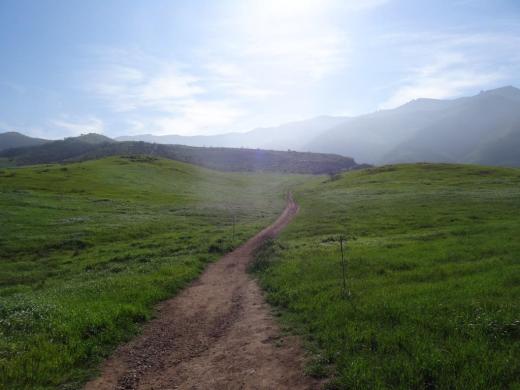
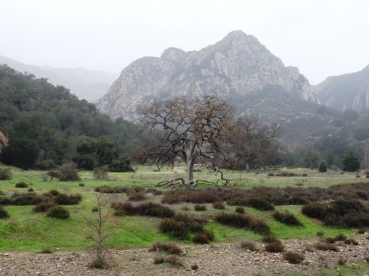
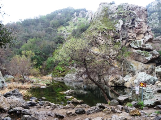
Hiking to the Waterfall in Pt Mugu State Park from Rancho Sierra Vista/Satwiwa

One of the most popular hikes in the Rancho Sierra Vista/Satwiwa open space in Newbury Park is to a small waterfall in the adjacent Boney Mountain Wilderness. The hike is about 3 1/2 miles round-trip from the Satwiwa Native American Indian Culture Center and is a moderate hike that can be done by all ages.

Keep in mind that in drought years, there’s sometimes not more than a trickle flowing down this waterfall, while in rainier years like 2023-2024, the waterfall is quite active. In either case, it’s a fun hike to do.

You have two primary options for where to start the hike. You can drive into the Rancho Sierra Vista park entrance on Via Goleta in Newbury Park and park in a lot that is a brief walk to the Culture Center, or you can park at the Wendy Drive and Potrero Road trailhead and add an another two miles, round trip, to your adventure.

The entrance to Rancho Sierra Vista/Satwiwa at Via Goleta, 1 mile west of Reino Road.

The entrance to Rancho Sierra Vista/Satwiwa at Via Goleta, 1 mile west of Reino Road.

The trailhead where Wendy Road ends at Potrero Road in Newbury Park

The trailhead where Wendy Road ends at Potrero Road in Newbury Park

The Satwiwa Native American Indian Culture Center is a small building open from 9am to 5pm on weekends where you can learn about native Chumash items and local wildlife.

The Satwiwa Native American Indian Culture Center is a small building open from 9am to 4pm on weekends (as of April 2024) where you can learn about native Chumash items and local wildlife.

Next to the Culture Center, you'll see multiple paths, all of which can get you to your destination, but the most direct path is the Satwiwa Loop Trail seen on the left, which crosses through a meadow that can be quite green and beautiful in late Winter/early Spring and dry and brown the rest of the year. An alternate route is on the right of the picture above - the Big Sycamore Canyon Trail (paved road) to the Boney Mountain Trail, where you'll take a left.

Satwiwa Loop Trail section that takes you diagonally through the meadow. Seen here when it is nice an green.

Satwiwa Loop Trail section that takes you diagonally through the meadow. Seen here when it is nice and green.

At the end of the meadow, continue straight up a fairly steep hill, where on the right hand side you'll see the Sycamore Canyon Overlook bench shown below.

RSVW_sycoverlook.JPG

bench on sycamore canyon overlook

Hike up the moderately steep and rocky path up the hill behind the bench and you'll reach another fork in the road. If you veer left at this juncture you'll be on the Hidden Valley Overlook Trail within Rancho Sierra Vista/Satwiwa. Stay to the right and you'll be entering the Boney Mountain Wilderness area within Point Mugu State Park.

Sign that shows you the Hidden Valley Overlook Trail is on the left.

Sign that shows you the Hidden Valley Overlook Trail is on the left.

Veering right into the State of California managed Pt Mugu State Park; as you can see, dogs are not allowed in the back country area of the park.

Veering right into the State of California managed Pt Mugu State Park; as you can see, dogs are not allowed in the back country area of the park.

This trail is referred to as Danielson Road, named after the last private owner of these lands. The path down into the canyon is seen below (taken from a higher point en route to the Danielson Monument).

View of the initial section of Danielson Road trail down into the canyon; this is the path you will be taking towards the waterfall.

View of the initial section of Danielson Road trail down into the canyon; this is the path you will be taking towards the waterfall.

Danielson Road is a bit on the steep side but I see folks young and old walking up and down this section all the time. Seen here in very dry conditions.

Danielson Road is a bit on the steep side but I see folks young and old walking up and down this section all the time. Seen here in very dry conditions.

RSVW_waterfalltrailsign.JPG

THIS IS THE OLD SIGN, WHEN IT WAS CALLED DANIELSON ROAD (PRIOR TO 2024)

NEW SIGN IN 2024 SHOWING THE “OLD CABIN TRAIL” INSTEAD OF DANIELSON ROAD.

After .4 mile, you will reach the bottom of the canyon and see the sign above, the final sign indicating you are on your way to the Waterfall Trail. Then you will cross a creek bed, which can have water in it after the rains. The photo taken below in January 2015 shows minimal moisture, making it easy to cross. Some years you may have to rock hop your way a bit over the creek.

RSVW_stream.JPG

Creek bed crossing on the way to the waterfall IN 2015

Creek Crossing in April 2024.

After you cross the creek, the remainder of the trail to the waterfall is single track. Be careful not to come in contact with poison oak often seen on the sides of the trails. For this reason, I would generally not recommend strollers be taken up here.

Soon you will reach the final fork in the road. Go straight and soon you will be at the waterfall. To the right, the Old Cabin Trail (formerly Danielson Road Trail) continues upward to the Danielson Monument.

RSVWaterfallFeb17.JPG

the waterfall in april 2024.

Areas in the Santa Monica Mountains Recreation Area Allowing Dogs on Leash

Pooch on leash

Pooch on leash

The Santa Monica Mountains National Recreation Area is the largest urban national park in the United States at over 150,000 acres, extending from the Hollywood Bowl on the east to Point Mugu at its western end; including the beaches of Santa Monica and Malibu as well as the canyons and peaks extending north to Simi Valley.

Dogs are allowed in a number of areas within the Santa Monica Mountains, as long as they are on leashes that are no more than 6 feet in length. Here is a listing of areas where dogs are allowed:

National Park Service: Arroyo Sequit (has been closed since the Woolsey Fire in 2018), Castro Crest, Cheeseboro/Palo Comado Canyons, Circle X Ranch, Deer Creek Canyon, Paramount Ranch, Peter Strauss Ranch, Rancho Sierra Vista/Satwiwa, Rocky Oaks, Solstice Canyon and Zuma/Trancas Canyons

Santa Monica Mountains Conservancy: Calabasas Peak, Dixie Canyon, Escondido Canyon, Franklin Canyon, Fryman Canyon, Marvin Braude Mulholland Gateway Park, Red Rock Canyon Park, San Vicente Mountain Park, Temescal Gateway Park, Wilacre Park

City of Malibu: Charmlee Wilderness Park, Malibu Bluffs

California State Parks: Pets are NOT allowed on backcountry trails of Topanga, Malibu Creek, Leo Carrillo and Point Mugu State Park, including the Boney Mountain Wilderness.

Canines are not allowed in the backcountry trails of Point Mugu State Park, including the Boney Mountain Wilderness.

Canines are not allowed in the backcountry trails of Point Mugu State Park, including the Boney Mountain Wilderness.

Dogs on leash are allowed at County Line Beach, Leo Carrillo State Park (on beach north of lifeguard tower 3 and campground only), Point Mugu State Park (on beach and campground only in Sycamore Cove and Thornhill Broome Beach), Will Rogers State Historic Park (day-use areas and loop road only)

L.A. City Recreation and Park District: Coldwater Canyon Park, Laurel Canyon Park, Runyon Canyon Park, Temescal Canyon Park

While you're out on the trails with your pooch, remember to pick up after your dog and bring plenty of water and food for you and Fido.

For more information, visit the Anthony C. Beilenson Interagency Visitor Center in Calabasas or www.nps.gov/samo.

Outside of the Santa Monica Mountains, trails in the Conejo Valley, Simi Hills and other local area locations are generally dog-friendly as long as your furry friend is on a leash. 

Dozens and dozens and dozens of local area trails and hikes

DOG PARKS IN AND AROUND VENTURA COUNTY

VISITING STATE PARKS WITH YOUR DOG

Palo Comado Canyon Trail in Agoura Hills

Palo Comado Canyon is located adjacent to Cheeseboro Canyon in the National Park Service maintained Santa Monica Mountains in Agoura. Palo Comado is part of the 2,308 acre Jordan Ranch owned by comedian Bob Hope that was acquired for $16.7 million in 1993.

The Palo Comado Canyon Trail stretches from the Modelo Trail in Cheeseboro Canyon on the south to the China Flat area in Oak Park to the north, about six miles one way.

View of the Cheeseboro Canyon trailhead and parking are from the Modelo Spur Trail.

View of the Cheeseboro Canyon trailhead and parking are from the Modelo Spur Trail.

There are stretches of the trail that are flat, wide and good for family hikes and outings. This section of the trail is primarily in the area accessible via the Smoketree Avenue (east of Conifer St in Oak Park) and Doubletree Road (east of Clear Haven Dr in Oak Park) residential connectors.

The Palo Comado Trail on the south end connects with the Cheeseboro Canyon Trail in addition to the moderately steep Modelo Trail.

From the main Cheeseboro Canyon Trail, this juncture leads you to the south entry point to the Palo Comado Trail.

From the main Cheeseboro Canyon Trail, this juncture leads you to the south entry point to the Palo Comado Trail.

The Modelo Trail on the south end of the Palo Comado Canyon Trail is a bit steep, with awesome views.

The Modelo Trail on the south end of the Palo Comado Canyon Trail is a bit steep, with awesome views.

The southern section of the Palo Comado Trail has rolling hills with some beautiful views, but is a bit on steep side. The northern section of the trail, about a mile or so above the Doubletree trailhead, is also a moderately grueling climb, from 1,200 feet to 2,140 feet elevation at the China Flat area. In my personal experiences on these sections of the trail, mountain bikers are the vast majority. But don't let that stop you if you're up for a long, mostly quiet, hike!

The southern end of the Palo Comado Trail has rolling, moderately steep hills.

The southern end of the Palo Comado Trail has rolling, moderately steep hills.

Learn more about Cheeseboro/Palo Comado Canyon are at THIS LINK.

Powerline Trail to Edison Road to Conejo Mountain Peak in Newbury Park

View of Boney Mountain range from midway up the Powerline Trail in Newbury Park.

View of Boney Mountain range from midway up the Powerline Trail in Newbury Park.

While you're driving down the Conejo Grade from the Conejo Valley towards Camarillo, you may wonder what that mountain is south of the 101.  This would be the 1,814 foot tall Conejo Mountain.

So how do you get up there? 

There are no "official" marked trails to the peak of Conejo Mountain, but there are unofficial ways to get up there. One way that I'm aware of us via the Powerline Trail to Edison Road Trail in the Dos Vientos section of Newbury Park. 

Get to the Powerline Trail trailhead located on Via Ricardo, west of Via Pisa. Park on the street. Or for added trail mileage, park at Dos Vientos Community Park and take the short (1/2 mile) Park View Trail until it ends at Via Ricardo, where you'll see a crosswalk to the Powerline Trail on the other side.

Follow the Powerline Trail on a single to double tract trail until it reaches the much wider Edison Conejo Mountain Road, marked by sets of power line transmission towers.

It is amazing how quiet it can get back here. This trail is a bit on the long, steep side and the mountain can get quite brown and barren. But the rock formations are pretty cool, and get more interesting the higher you climb. And the views are outstanding, from Boney Mountain to the south to the Channel Islands and Oxnard Plain to the west and Thousand Oaks to the east.

You will be passing by this anxiety-causing sign on the way up. Not to worry. Just a warning.

You will be passing by this anxiety-causing sign on the way up. Not to worry. Just a warning.

Now, pay attention, To find the path to the top of Conejo Mountain, count the pairs of transmission towers that you pass. The unmarked path is just above the 4th set of transmission towers, which is roughly two miles from the trailhead.

When I went, there was fairly large arrow formed with rocks that pointed in the direction of the path. Although it is not an official trail, you can kind of make out the path that has been cleared by hikers over the years. And there are some sections where it appears the path has been aligned by rocks.

In any case, although it looks difficult, it actually isn't that bad, as long as you take your time and watch your step. When you reach the top, you will have a clear birds eye view of the 101 on the other side.of the mountain.

When it greens up after the winter storms, it sure looks a lot prettier up here.

When it greens up after the winter storms, it sure looks a lot prettier up here.

A clear view of Highway 101 from the peak of Conejo Mountain.

A clear view of Highway 101 from the peak of Conejo Mountain.

Clear, unimpeded views of Anacapa and Santa Cruz Islands from up here.

Clear, unimpeded views of Anacapa and Santa Cruz Islands from up here.

Hike to the Rock Pool at Malibu Creek State Park in Agoura Hills

One of the most popular destinations in Malibu Creek State Park is the Rock Pool, a picturesque place that is easily accessible for all ages.

MalibuCreek_RockPool1.JPG

As seen in the photo above, it can be stunning to see after solid rains but can also dry up. One fun way to get to the Rock Pool is via the Grassland Trail, accessible on Mulholland Highway just west of Las Virgenes Road, where street parking is available.

GrasslandTrail_sign.JPG

Take the Grassland trail, with moderate hills, .7 miles to the Crags Road main fire road/trail in Malibu Creek State Park, and turn right. Alternatively, you can park in the Park's lower parking lot, pay $12 for a bit more secure parking, and take the main trail into the park.

The scenery along the Grassland Trail can be quite beautiful, particularly after the rainy season.

The scenery along the Grassland Trail can be quite beautiful, particularly after the rainy season.

MalibuCreekSP_020815.JPG
MalibuCreek_CragsRoadSign.JPG

Soon you'll see the sign where you can see the Visitor Center is on the left. That's the direction you'll be taking to get to the Rock Pool. Veering to the right gets you to another popular site at the Park, the old M*A*S*H television series set.

You'll see a bridge over the creek (seen below after the winter rains) that takes you to the Visitor Center (open weekends noon to 4pm). The Rock Pool is the trail on the right (west) before reaching the bridge. Look carefully and you may see the little sign that says "Rock Pool."

Malibu Creek free flowing after some decent winter rainstorms

Malibu Creek free flowing after some decent winter rainstorms

Well known Rock Wall used by rock climbers seen in the original Planet of the Apes (1968)

Well known Rock Wall used by rock climbers seen in the original Planet of the Apes (1968)

You'll walk through a shaded area with picnic benches through to a Rock Wall that is popular with local rock climbers. The video above shows scenes from the movie Planet of the Apes (1968) shot in Malibu Creek State Park. From there, the Rock Pool is a short walk further.

MalibuCreek_RockPool.JPG

California State Parks, which manages the Park, warns visitors not to jump or dive into the Rock Pool as it is dangerous. But it is certainly fun to explore and is quite a beautiful area.

RockPool_MalibuCreek.JPG

All told, getting to the Rock Pool is only about 3 miles round trip and worth it. I would put this hike on par with hiking to Paradise Falls in Thousand Oaks' Wildwood Park in terms of ease of access and family enjoyment. Learn more about Malibu Creek State Park at this link.

Scenes Around the Conejo Valley Before and After the Winter Rainstorms of 2022-2023

Here's a compilation of "before and after" scenes from various places in the Conejo Valley - Thousand Oaks, Newbury Park and Westlake Village after this past season of rainstorms. All of these local area trail can be found at THIS LINK.

The Corriganville Movie Ranch Site in Simi Valley is a Ventura County Historical Landmark

The Corriganville Movie Ranch Site in Simi Valley was designated a historical point of interest by the Ventura County Cultural Heritage Board in January 1982, then subsequently was redesignated as a historical landmark in August 1995.

Corriganville was a 1,500 acre piece of land in Simi Valley purchased by western film star Ray “Crash” Corrigan in 1937. The site was a working movie ranch for nearly three decades, and was used in the making of roughly 3,500 western films and television series such as Fort Apache, The Lone Ranger, and The Adventures of Rin Tin Tin. Actors like John Wayne, Gene Autry, Johnny Weissmuller, Tex Ritter, Joel McCrea, Dale Evans and so many others filmed movies here.

Corriganville today...the ranch burned down in the 1970s, leaving just these cement slabs and exterior walls.

Corriganville today...the ranch burned down in the 1970s, leaving just these cement slabs and exterior walls.

In 1949, the ranch opened to the public as “Corriganville,” a western themed amusement park. The ranch was later purchased by Bob Hope in 1965, deeming the ranch its alternative name, Hopetown. The ranch burned down in the 1970s and all that is left are the cement slabs and exterior rock walls of the barn. 

View of Corriganville Park from a trail on the east side of the park. The trail takes you up to 118 Freeway and a wildlife corridor tunnel that takes you under the freeway into Rocky Peak Park.

View of Corriganville Park from a trail on the east side of the park. The trail takes you up to 118 Freeway and a wildlife corridor tunnel that takes you under the freeway into Rocky Peak Park.

In 1988, 190 acres of the original ranch was purchased by the City of Simi Valley and is now owned and managed by the Rancho Simi Recreation and Park District. Corriganville Park is located at 1601 Kuehner Drive, Simi Valley and is open to the public for hiking, walking and exploring. For a detailed compilation of historical aspects of the site, visit www.corriganville.net.

A photo of the Corriganville Movie Ranch when it was an active movie set. Learn more about Corriganville and see a model of what it looked like in the 1960s at the nearby Santa Susana Depot Museum.

A photo of the Corriganville Movie Ranch when it was an active movie set. Learn more about Corriganville and see a model of what it looked like in the 1960s at the nearby Santa Susana Depot Museum.