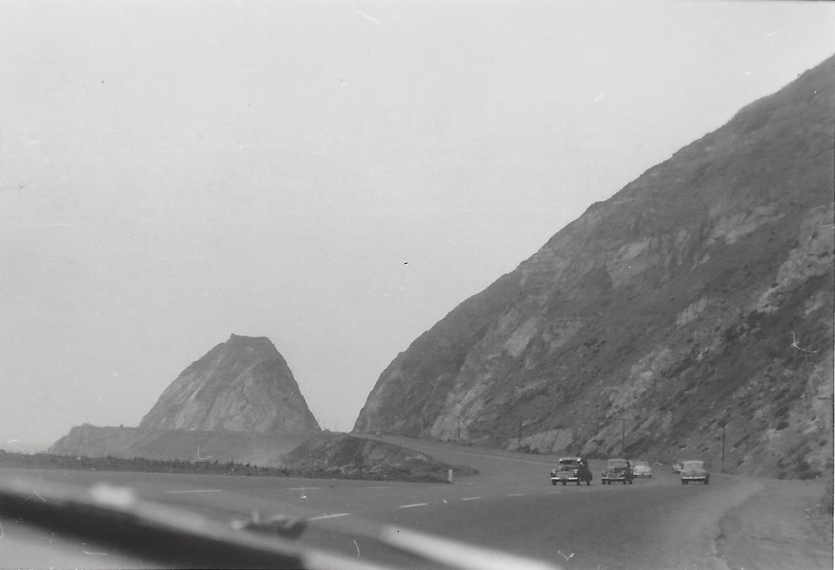
Northbound PCH Just South of Mugu Rock: 1950 and 2019

Mugu Rock came into existence in 1940 when a 200 foot cut was made into the mountain. Today it is an iconic scene that is often seen in auto commercials.

Taken on July 2, 1950, this is a view of Mugu Rock from the shoulder of northbound Pacific Coast Highway (SR 1). From a private collection. And below it is the same view, remarkably similar, 69 years later, on April 20, 2019. Thankfully, some things never change.

Mugu Rock 7.2.50.jpg
Mugu Rock 4.20.19.JPG

Building Pacific Coast Highway Around Point Mugu in 1923-1924

Point Mugu before and after creation of a narrow road around it in 1924.

Point Mugu before and after creation of a narrow road around it in 1924.

According to the California Highway Commission in the October 1924 issue of “California Highways,” perhaps the most dangerous and difficult piece of construction work on the California state highway system at that time was the 3800 feet of grading AROUND Point Mugu.

For those driving Pacific Coast Highway in Ventura County past Mugu Rock, there are clear signs of this old route that took automobiles on a precarious route around Point Mugu.

Peaking through the fence towards the old road around Mugu Rock.

Peaking through the fence towards the old road around Mugu Rock.

The new and still existing route was created by blasting a massive hole through Point Mugu to create Mugu Rock in 1937 to 1940.

The work to complete this section of the Oxnard to San Juan Capistrano PCH route was authorized by a bond issue in 1919.

The project averaged 60 workers who moved 108,000 cubic yards or rock at a total cost of $108,500 (heck, that would be the cost of a pool addition and new kitchen remodel today). The cut around Point Mugu ranged from 40 feet on the ocean side to 115 feet on the high side in creating the narrow, short-lived roadway.

The California Highway Commission ended its article by stating “…along this piece of rugged coast line the Old Pacific is recognized as an arch enemy to whom we must trust as little as possible of our costly highway.”

Mugu Rock at Point Mugu

Point Mugu is an unincorporated part of Ventura County that is derived from the Chumash word Muwu, or beach. Other than the Naval Base, probably the most well known fixture in Point Mugu is the Mugu Rock. Mugu Rock is a large rock formation that was formed when Pacific Coast Highway was built and cut through the mountain that now resides on the other side of PCH. Before PCH was built, a road went around the rock, where a chain link fence has been placed to keep people away from this hazardous area adjacent to the Pacific Ocean.  PCH was cut through Point Mugu from October 1937 to February 1940, according to this interesting KCET article.

MuguRock_pch.JPG

Mugu Rock is located just a few miles near the northwest tip of PCH before it veers north towards Oxnard. It is about a 10 mile drive from the Camarillo Premium Outlets and about 20 miles from the heart of Thousand Oaks taking either the 101/Lewis Road route or the slightly slower, curvy and interesting Potrero Road route.

Professional landscape and wildlife photographer Greg Clure of Newbury Park has shared a couple neat images facing Mugu Rock from the south. Visit Greg's website at www.gregclurephotography.com for more of his outstanding work.

ClureMuguRock2.jpg
ClureMuguRock1.jpg

And here is some not so professional video footage of Mugu Rock from the north.

Mugu Rock Then and Now

Mugu Rock is a large rock formation formed when a 200 foot deep cut was made into the rocky ridge from October 1937 to February 1940. Prior to the modern day PCH at Mugu Rock (at the time called U.S. 101 Alternate (State Route 60), drivers went around a 275 foot radius curve that is now fenced off.

The photos in the video above from the October 1940 edition of California Highways and Public Works show what it looked like before, during and after the cut was made, compared to what it looks like today.

Hike to the Teepee, Paradise Falls and Little Cave at Wildwood Park in Thousand Oaks

One hiking experience that everyone in the Conejo Valley and neighboring areas has to experience is Wildwood Park. With 14 trails covering 17 miles in the nearly 1,800 acre park managed by the Conejo Open Space Conservation Agency, there is plenty to see and do in Wildwood Park.

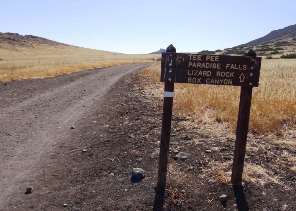
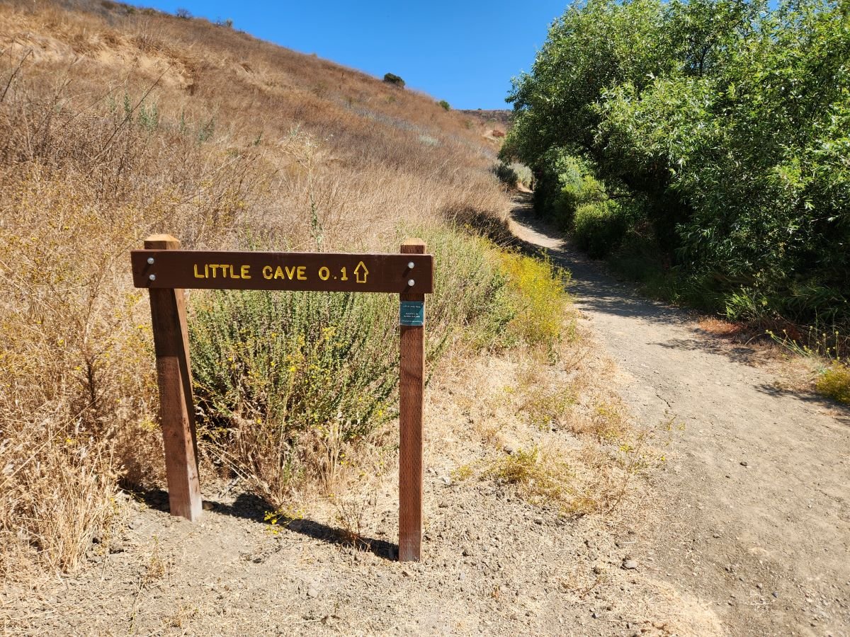
One particularly fun and fairly easy family hike at Wildwood takes you from the main parking lot at the west end of Avenida de los Arboles to the Teepee, Paradise Falls and Little Cave (formerly Indian Cave**). Take the Mesa Trail about a 3rd of a mile until you see the sign below, then take a left.

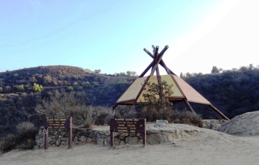
Another third of a mile and you're at the teepee, where you'll find another clearly marked sign pointing you in the direction of Paradise Falls.

Another third of a mile and you're at the teepee, where you'll find another clearly marked sign pointing you in the direction of Paradise Falls.

WildwoodTeepee3.JPG

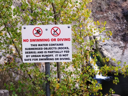
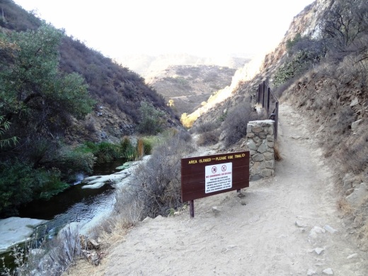
Hike down some switchbacks and stairs and you'll see be at the beautiful Paradise Falls. Always a fun place to take the kids, though we're warned not to go into the water, which is largely urban runoff.

ParadiseFalls2.JPG
ParadiseFalls4.jpg

But it is sure popular and enjoyable to sit back and enjoy this year-round waterfall that is so nicely hidden yet so close to hustle and bustle of suburban Thousand Oaks.

ParadiseFalls11.3.13.JPG

The Little Cave is roughly half a mile east of Paradise Falls and can be accessed from the trail directly above the falls or by hiking back up to the teepee and going the other direction.

Trail adjacent to Paradise Falls that takes you towards the Indian Cave.

Trail adjacent to Paradise Falls that takes you towards little Cave.

A quarter of a mile or so and you'll see the sign below.

Little Cave (Formerly Indian Cave) sign

Here's the sign indicating you are near the Indian Cave in Wildwood Park.

Formerly called indian cave

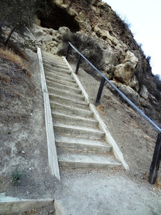
Another 100 yards or so and you've reached the staircase that will take you up to the Cave.

Large enough to actually hang out in, though the last time we walked in there were signs of rodents.

Large enough to actually hang out in, though the last time we walked in there were signs of rodents.

IndianCave5.JPG

You can literally climb through the cave to an exit at the top and hike your way up to a connector trail that will lead you back towards the parking lot. My kids love this and so do I!

** The change in name was approved by the Conejo Open Space Conservation Agency (COSCA) in May 2022. COSCA received a request to change the Indian Creek Trail name earlier that year. On its own, the work "Indian" refers to individuals from India, rather than Native Americans, and thus did not accurately reflect the origin of the people to whom it refers.

The Indian Cave and Indian Cave Trail were renamed Little Cave as it was unclear if the cave was naturally formed and/or historically used by Native Americans.

The Indian Creek Trail in Wildwood Park was renamed Two Springs Trail as two natural springs contribute to the stream flow in this portion of the channel.

Koi Ponds In and Around Ventura County and Surrounding Areas

On a recent visit to The Commons at Calabasas we were treated to a beautiful pond full of koi and turtles cohabitating. Koi comes from the Japanese word nishikigoi, which means "brocaded carp." Koi is basically domesticated, ornamental carp. In Japanese, the word koi sounds like another word that mean affection or love.

Where to find koi in Ventura County and surrounding areas? Here's what we know:

There is a koi pond at The Promenade at Westlake, next to Marmalade Cafe.

Friendly looking koi looking for handouts at The Lakes at Thousand Oaks.

Friendly looking koi looking for handouts at The Lakes at Thousand Oaks.

The bottom level pond at The Lakes at Thousand Oaks has lots of koi, frolicking around with the ducks, even during the winter when the Holiday Ice Rink is in use.

Green Thumb Nursery on Victoria Avenue in Ventura has a small koi pond container in the back that is fun to observe with the kids.

The pristine Gardens of the World on Thousand Oaks Boulevard has a Japanese Garden that contains a beautiful koi pond.

Koi pond at The Gardens of the World in Thousand Oaks

Koi pond at The Gardens of the World in Thousand Oaks

The Santa Barbara Zoo has a large koi pond area with some very healthy looking koi, swimming among the lily pads.

Last I checked there were a lot of koi amongst the hundreds of ducks at Conejo Creek Park in Thousand Oaks.

The Simi Valley Town Center has a koi pond on the west side of the mall where you can get up close and personal with them.

Koi pond at west end near Studio Movie Grill.

Koi pond at west end near Studio Movie Grill.

As noted at the beginning of the article The Commons at Calabasas has quite a lovely koi and turtle pond.

The turtles are quite prominent at The Commons at Calabasas. Don't touch them!

The turtles are quite prominent at The Commons at Calabasas. Don't touch them!

When in Santa Barbara, be sure to stop by Alice Keck Park Memorial Gardens, a beautiful botanic garden with over 75 tree and plant species, a large koi pond also home to ducks and turtles, picnic areas and more. Quite a serene place.

Only 25 miles from the Conejo Valley is the Lake Shrine Meditation Gardens in Pacific Palisades. This 10 acre spiritual sanctuary hosts a spring-fed lake lined with gardens and home to koi, ducks and beautiful swans.

The Hunt Olive Tree in Thousand Oaks is a Living Link to Conejo Valley History

Richard Orville Hunt and his wife Mary Jane purchased a large parcel of land in the Conejo Valley in 1876 in what is now Lynn Ranch. He called it Salto Ranch. Hunt also served as postmaster of the Newbury Park Post Office for 18 years and was well known in the local community. While his former land now is populated with family homes, one part of Hunt's ranch lives on.

HuntOliveTreeSprouts2013_2.JPG

For those of you who drive past the Sprouts Market at 600 West Hillcrest, perhaps you have noticed the historic landmark marker situated in front of the last remaining olive tree from Hunt's orchard. The Hunt Olive Tree was designated a Ventura County Historic Landmark in 1981, when the tree was over 100 years old. That would make this olive tree over 130 years old today.

HuntOliveTreeSprouts2013.JPG
HuntOliveTreeCCSign.jpg

For nostalgia buffs, to the right is a view of the Hunt Olive Tree marker back in the day that Circuit City was located here. It closed in late 2008. This tree was moved to its current home in 1993. I'm not sure why...perhaps to say hello to the thousands of residents who pass by each day. What a fine specimen this link to the past is. The Hunt Olive Tree is also Historical Landmark #4 in the City of Thousand Oaks.

So be sure to say hello to this tree that sits next to the Sprouts Farmers Market sign at Hillcrest and Lynn and do be nice to him (or her). She's older and wiser than all of us combined, having seen and lived through the growth of our local community.

Visit the City of Thousand Oaks website at www.toaks.org/departments/city-manager-s-office/public-information-office/history for more information on local historical landmarks and points of interest around town.