How to Be Coyote Aware in the Conejo Valley and Greater Ventura County

Coyote1.jpg

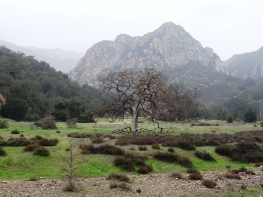
Living in the Conejo Valley, surrounded by thousands of acres of open space, most of us come into contact with coyotes from time to time. Coyotes are a vital component of rural and urban communities, deserving of respect for their adaptability, resilience and intelligence. Below are some tips on coyote awareness, courtesy of Project Coyote.

Facts:

  • Coyotes are members of the dog family; they are curious, adaptable, and learn quickly.

  • Coyotes often mate for life, are devoted parents, and are highly communicative (barks, yips, howls).

  • Coyotes weigh 18-35 pounds in the West.

  • Coyotes may be more protective of dens/territories during pup rearing (April-Aug).

  • Coyotes eat large numbers of rodents and rabbits, as well as fruit, vegetation, insects and carrion. They help keep ecosystems vital, healthy and clean.

  • Coyotes are naturally wary of people but can habituate to our presence and the reliable food sources that we provide.

Safety:

  • DON’T FEED COYOTES. Their life and your safety depend on coyotes remaining wild and naturally wary of people.

  • Remove attractants; pick up trash, secure garbage, and feed pets inside. Don’t leave food or pets outside at night.

  • Walk dogs on leashes, especially during pup rearing season (April-Aug). Pick up your small dog if you see a coyote and don’t let pets roam.

  • If approached, don’t run. Wave arms, make noise and walk toward the coyote until he retreats. Be “Big, Bad and Loud.”

  • Avoid areas where coyotes may be denning or feeding/hiding pups.

  • Appreciate coyotes from a distance. Share this information with family and friends.

Coyote4.jpg
Coyote2.jpg

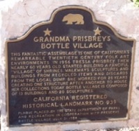
Historical and Cultural Landmark Grandma Prisbrey's Bottle Village in Simi Valley

BottleVillage1.JPG

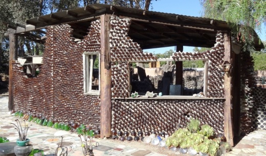
Grandma Prisbrey's Bottle Village in Simi Valley is a California Historical Landmark, Ventura County Cultural Landmark and is listed on the National Register of Historic Places.

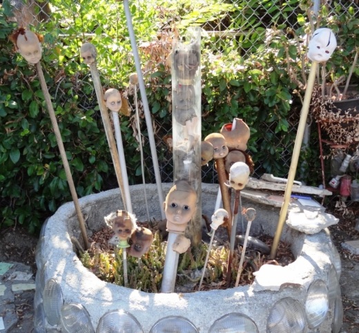
Bottle Village is a .3 acre lot located at 4595 Cochran Street that contains shrines, walkways, sculptures and buildings made from recycled items and discards from local landfills. All of these structures were built by hand over a 25 year old period by Tressa "Grandma" Prisbrey, beginning at age 60 in 1956 until 1972. Thirteen buildings and 22 sculptures in total.

BottleVillage8.JPG

A non-profit organization, Preserve Bottle Village (PBV), was formed in 1979. The 1994 Northridge Earthquake caused extensive damage to the Bottle Village site. PBV has embarked on a campaign to develop a master plan for the restoration of significant site components. Learn how you can help at bottlevillage.weebly.com.

BottleVillage4.JPG

Grandma Prisbrey sold the property in 1972 to care for an ailing son, but came back several years later to continue building and to give tours.  She died in 1988 at the age of 92.

BottleVillage9.JPG
BottleVillage11.JPG
BottleVillage7.JPG
BottleVillage5.JPG

1983 Was the Last Year You Could Watch Drive-In Movies in the Conejo Valley

The Thousand Oaks Drive-In, located behind the current site of the Kohl's Department Store in Newbury Park at 1960 Newbury Road, was closed in 1983. This picture, courtesy of the Thousand Oaks Library Special Collections, was taken by local photographer Scott Harrison on October 11, 1983, shortly after the Drive-In was closed that year.

Thousand Oaks Library Special Collections, News Chronicle Collection. Photo by Scott Harrison.

Thousand Oaks Library Special Collections, News Chronicle Collection. Photo by Scott Harrison.

As you can tell from the sign in the picture, the last two films shown at the Drive-In were "Risky Business" and "Private School." The theater was torn down and eventually Kohl's opened in March 2004.

According to an August 4, 1997 Ventura County Star article, the Thousand Oaks Drive-In opened the first week of August 1967.  Seeing this picture certainly brings back childhood memories for me. There are over 150 other movie screens in the Conejo Valley and Ventura County today, but nothing compares to watching a movie while sitting in the comfort (arguably) of your own car!

Grand opening of the Thousand Oaks Drive-In Theatre in August 1967

Powerline Trail to Edison Road to Conejo Mountain Peak in Newbury Park

View of Boney Mountain range from midway up the Powerline Trail in Newbury Park.

View of Boney Mountain range from midway up the Powerline Trail in Newbury Park.

While you're driving down the Conejo Grade from the Conejo Valley towards Camarillo, you may wonder what that mountain is south of the 101.  This would be the 1,814 foot tall Conejo Mountain.

So how do you get up there? 

There are no "official" marked trails to the peak of Conejo Mountain, but there are unofficial ways to get up there. One way that I'm aware of us via the Powerline Trail to Edison Road Trail in the Dos Vientos section of Newbury Park. 

Get to the Powerline Trail trailhead located on Via Ricardo, west of Via Pisa. Park on the street. Or for added trail mileage, park at Dos Vientos Community Park and take the short (1/2 mile) Park View Trail until it ends at Via Ricardo, where you'll see a crosswalk to the Powerline Trail on the other side.

Follow the Powerline Trail on a single to double tract trail until it reaches the much wider Edison Conejo Mountain Road, marked by sets of power line transmission towers.

It is amazing how quiet it can get back here. This trail is a bit on the long, steep side and the mountain can get quite brown and barren. But the rock formations are pretty cool, and get more interesting the higher you climb. And the views are outstanding, from Boney Mountain to the south to the Channel Islands and Oxnard Plain to the west and Thousand Oaks to the east.

You will be passing by this anxiety-causing sign on the way up. Not to worry. Just a warning.

You will be passing by this anxiety-causing sign on the way up. Not to worry. Just a warning.

Now, pay attention, To find the path to the top of Conejo Mountain, count the pairs of transmission towers that you pass. The unmarked path is just above the 4th set of transmission towers, which is roughly two miles from the trailhead.

When I went, there was fairly large arrow formed with rocks that pointed in the direction of the path. Although it is not an official trail, you can kind of make out the path that has been cleared by hikers over the years. And there are some sections where it appears the path has been aligned by rocks.

In any case, although it looks difficult, it actually isn't that bad, as long as you take your time and watch your step. When you reach the top, you will have a clear birds eye view of the 101 on the other side.of the mountain.

When it greens up after the winter storms, it sure looks a lot prettier up here.

When it greens up after the winter storms, it sure looks a lot prettier up here.

A clear view of Highway 101 from the peak of Conejo Mountain.

A clear view of Highway 101 from the peak of Conejo Mountain.

Clear, unimpeded views of Anacapa and Santa Cruz Islands from up here.

Clear, unimpeded views of Anacapa and Santa Cruz Islands from up here.

Hike to the Rock Pool at Malibu Creek State Park in Agoura Hills

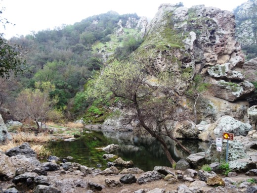
One of the most popular destinations in Malibu Creek State Park is the Rock Pool, a picturesque place that is easily accessible for all ages.

MalibuCreek_RockPool1.JPG

As seen in the photo above, it can be stunning to see after solid rains but can also dry up. One fun way to get to the Rock Pool is via the Grassland Trail, accessible on Mulholland Highway just west of Las Virgenes Road, where street parking is available.

GrasslandTrail_sign.JPG

Take the Grassland trail, with moderate hills, .7 miles to the Crags Road main fire road/trail in Malibu Creek State Park, and turn right. Alternatively, you can park in the Park's lower parking lot, pay $12 for a bit more secure parking, and take the main trail into the park.

The scenery along the Grassland Trail can be quite beautiful, particularly after the rainy season.

The scenery along the Grassland Trail can be quite beautiful, particularly after the rainy season.

MalibuCreekSP_020815.JPG
MalibuCreek_CragsRoadSign.JPG

Soon you'll see the sign where you can see the Visitor Center is on the left. That's the direction you'll be taking to get to the Rock Pool. Veering to the right gets you to another popular site at the Park, the old M*A*S*H television series set.

You'll see a bridge over the creek (seen below after the winter rains) that takes you to the Visitor Center (open weekends noon to 4pm). The Rock Pool is the trail on the right (west) before reaching the bridge. Look carefully and you may see the little sign that says "Rock Pool."

Malibu Creek free flowing after some decent winter rainstorms

Malibu Creek free flowing after some decent winter rainstorms

Well known Rock Wall used by rock climbers seen in the original Planet of the Apes (1968)

Well known Rock Wall used by rock climbers seen in the original Planet of the Apes (1968)

You'll walk through a shaded area with picnic benches through to a Rock Wall that is popular with local rock climbers. The video above shows scenes from the movie Planet of the Apes (1968) shot in Malibu Creek State Park. From there, the Rock Pool is a short walk further.

MalibuCreek_RockPool.JPG

California State Parks, which manages the Park, warns visitors not to jump or dive into the Rock Pool as it is dangerous. But it is certainly fun to explore and is quite a beautiful area.

RockPool_MalibuCreek.JPG

All told, getting to the Rock Pool is only about 3 miles round trip and worth it. I would put this hike on par with hiking to Paradise Falls in Thousand Oaks' Wildwood Park in terms of ease of access and family enjoyment. Learn more about Malibu Creek State Park at this link.

The Homeplace of Original Conejo Valley Settler Nils Olsen in 1913

This historic photo and information was generously provided by Gerry Olsen, grandson of Nils Olsen, one of the original settlers in the Conejo Valley in the 1890s.

Nils Olsen was born over 150 years ago (June 16, 1859) in Norway. After a stint in the Norwegian Army, he decided in 1884 that he wanted to move to the United States. So he started saving his money. In late January 1886 he bid farewell to his family. He arrived New York on February 20, 1886 via ship...it took about 16 days to get from Bergen, Norway to New York via Liverpool, England and Ireland (cost was roughly $58).

Built in 1905, this is the home of original Conejo Valley settler Nils Olsen in 1913.

Built in 1905, this is the home of original Conejo Valley settler Nils Olsen in 1913.

Two days after arriving in New York, Nils was off to San Francisco, where he arrived nine days later.  Then later that month (March 1886) he took the train and stagecoach to Santa Barbara, where for four years he worked as a stone mason. In 1889, Nils met George Edwards, whose family owned 20,000 acres in the Conejo Valley and who was selling parcels.

In 1890, Nils and four other Norwegians, Ole Nelson, Lars Pederson, George Hanson and Ole Anderson purchased 650 acres from Edwards. Apparently the land cost about $3/acre for flatlands and $2/acre for hillsides. They settled and grew barley and wheat for the next 20 years.  This area was known as the Norwegian Colony.

Anderson sold his land to Hanson by 1900 and moved back to Norway. Nelson sold his land to Pederson in 1902. Hanson's wife (he died at age 39 in 1901) sold her land to Olsen in 1902-1903. That left just the Olsens and Pedersons.

Olsen's first home was southeast of the corner of Olsen and Moorpark roads. In 1905, he and his family moved into the new three bedroom home and barn pictured above. The photo was taken from the hill behind where the Church of the LDS on Moorpark Road currently resides. The home was located on, but of course, OLSEN Road near the corner of Olsen and Mountclef (adjacent to Cal Lutheran University).

Outdoor castle scenes of Wuthering Heights were filmed on the Olsen property in 1938. Nils passed away on December 14, 1941 at the age of 82.  In 1954, the home pictured above was torn down to make room for a more modern home.

There is so much more history to tell about these Norwegian settlers who bravely settled on the land we now reside.  Here I am stressing out about pulling weeds and mowing the lawn. These hearty Norwegians will forever be remembered in the Conejo Valley.

Dos Vientos Ranch Twenty Five Years Ago Compared to Today in Newbury Park

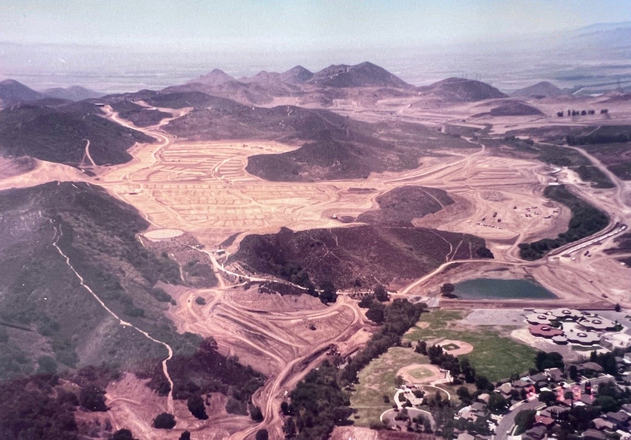
Dos Vientos Ranch in August 1997

Dennis Bronk of Newbury Park sent over this old photo of the Dos Vientos Ranch (or Two Winds Ranch) development in its early stages in August 1997. That's Cypress Elementary near the bottom right side of the photo. The body of water east of the school is Conejo Mountain Creek Detention Basin No. 1. The photo below is the view today.

Keep in mind that in the late 1800s/early 1900s there was almost no residential development throughout the Conejo Valley. The Dos Vientos development was the last of the large developments we will ever see in the Conejo Valley.

A view of Dos Vientos Ranch looking towards the Oxnard Plain in the 1950s.